Ljubelj - Bielschitza/Svačica (upper path)
Starting point: Ljubelj (1058 m)
| Latitude/Longitude: | 46,4324°N 14,2602°E |
| |
Route name: upper path
Walking time: 4 h 20 min
Difficulty: partly demanding marked way
Elevation gain: 895 m
Elevation difference along the route: 1060 m
Map: Karavanke - osrednji del 1:50.000
Recommended equipment (summer):
Recommended equipment (winter): ice axe, crampons
Views: 10.549
 | 2 people like this post |
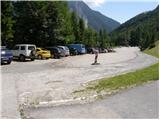
Access to starting point:
From the highway Ljubljana - Jesenice, we take the Ljubelj exit and follow the road ahead to the border crossing. Just a few meters before the border crossing, signs for Zelenica direct us to the left, and after some 10 meters of additional driving, the road brings us to the parking lot below the ski center Zelenica.
Route description:
From the parking lot, we head onto the marked footpath in the direction of Zelenica, Vrtača and Stol. The path first leads along a moderately steep cart track, which ascends through the forest, then turns slightly to the right and brings us out of the forest onto the ski slope track. We continue the ascent on the ski slope, from which beautiful views open up onto the walls and screes of Begunjščica, and on the right side we see the ridge of Ljubeljšica. The path, which continues on a rough road, brings us only a little higher to the Koča Vrtača hut, where the chairlift Zelenica I ends and the chairlift Zelenica II starts. Here the transport-rescue road turns sharply to the right, and we continue straight in the direction of Zelenica and continue on a path that is at first still gentle, then more steep, which ascends along the ski slope track. Higher, we ascend through a sparse belt of dwarf pines, then return to the road. We continue on the rough road, then, when the road turns to the left, we continue right onto a steep footpath, which returns to the road just below the upper station of the single chairlift Zelenica II. From here, a short descent follows, and the path brings us to the Dom na Zelenici hut.
Just before the hut, a path leading to Begunjščica and Roblekov dom branches off to the left, and behind the hut we continue left and begin to ascend beside the children's ski lift Ciciban. Somewhere in the middle of the ski lift, we arrive at a smaller junction, where we continue right across the ski slope (straight to Koča pri izviru Završnice, Srednji vrh and Stol - lower path). On the other side of the Ciciban ski slope, the path goes into a narrow belt of forest, after which we arrive at the next ski lift. We also just cross this ski slope, then beside a smaller boulder we look for the continuation of the marked path leading toward Vrtača and Stol. In continuation, the path leads us along the slopes below the ridge Na Možeh, then descends a little and brings us to the place where an unmarked path to the valley of Suhega ruševja and Palec branches off to the right (at the junction there is a smaller cairn). After the junction, the path gradually transitions onto the slopes of Vrtača, across which it mostly ascends transversely. Higher, an unmarked path from the Koča pri izviru Završnice also joins us from the left, and we continue straight to the nearby marked junction.
At the junction, a path to Vrtača and toward Stol and Svačica via Vatelca or Skleda branches off slightly to the right, and we continue straight along the lower path, which crosses a belt of dwarf pines and raspberry bushes. After a few minutes of further walking, we arrive at the next junction, where we can descend left downward in a few minutes to the saddle Šija, from which the lower path to Stol leads; to the right, a poorer track toward Vrtača branches off (the latter joins the previously mentioned marked path a little higher), and we again continue straight, this time across occasionally steeper grassy slopes interrupted by some less steep gullies. The crossing of the grassy slopes soon ends, and the path brings us to a steep gully, through which we begin to descend along a path that is locally eroded and slippery in some places. When the gully ends, the path transitions onto scree, across which it descends transversely below the cliffs to the cirque V Kožnah. Here the path begins to ascend again, and the lower path and the path from Završnica join us from the left.
We continue straight, and the path further leads us past several larger boulders. A shorter, somewhat steeper ascent follows, and we arrive at a junction where a path toward Celovška koča and Svačica branches off to the right.
We continue in the mentioned direction (slightly left to Stol), where we quickly arrive at extensive screes below the Orlic ridge. We cross the screes in a northeasterly direction, then arrive at a smaller gully, where we turn left. Further, we ascend up the gully, through which a steep and somewhat damaged path in parts leads us. The gully ends quickly, and the path levels out on grassy slopes beside the sinkhole Vatelca or Skleda. Here a path to Vrtača branches off to the right, or the path via Vatelca or Skleda joins us, and we continue straight to the nearby saddle Belščica, where there is a marked junction.
From the mentioned junction, beside which there are Austrian hiking signposts, we continue right (straight down to Celovška koča / Klagenfurter Hütte) in the direction of Svačica (on the sign Bielschitza). The path ahead first crosses slopes to the right, then brings us onto the ridge of Svačica. Here we continue slightly left, and continue further along the initially still gentle ridge. Some 10 meters higher, the path, which continues along the ridge, begins to ascend very steeply. Further, we steeply ascend along the ridge, which is somewhat precipitous in places, but since we have a belt of dwarf pines on the right side all the time, the ascent does not present greater difficulties. Higher, the ridge narrows, and from the right side a somewhat less steep unmarked path also joins us. A shorter gentle ascent follows along the locally exposed ridge, and the path brings us to the panoramic and precipitous summit.

Photos:
 1
1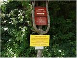 2
2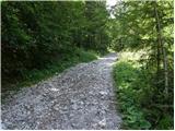 3
3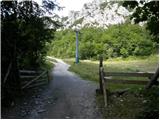 4
4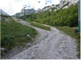 5
5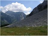 6
6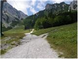 7
7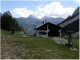 8
8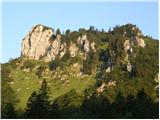 9
9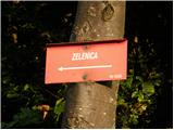 10
10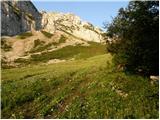 11
11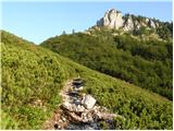 12
12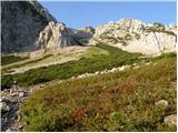 13
13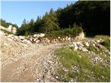 14
14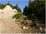 15
15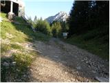 16
16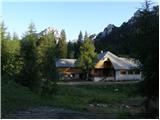 17
17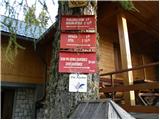 18
18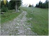 19
19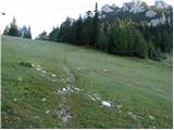 20
20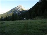 21
21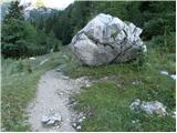 22
22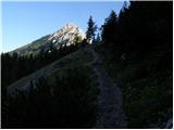 23
23 24
24 25
25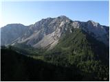 26
26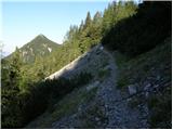 27
27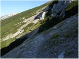 28
28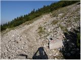 29
29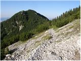 30
30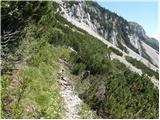 31
31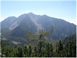 32
32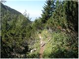 33
33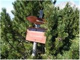 34
34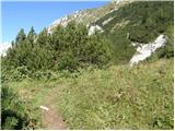 35
35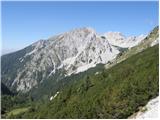 36
36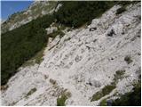 37
37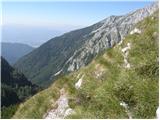 38
38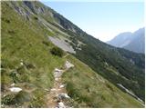 39
39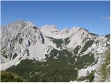 40
40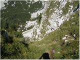 41
41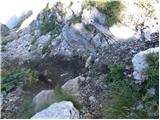 42
42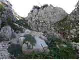 43
43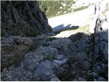 44
44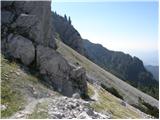 45
45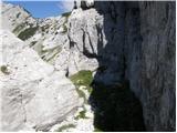 46
46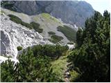 47
47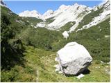 48
48 49
49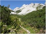 50
50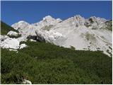 51
51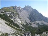 52
52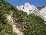 53
53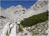 54
54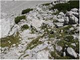 55
55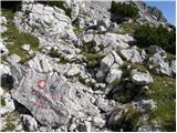 56
56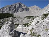 57
57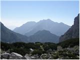 58
58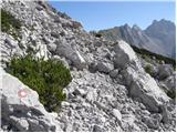 59
59 60
60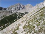 61
61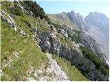 62
62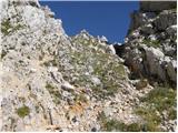 63
63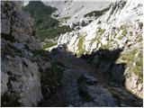 64
64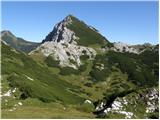 65
65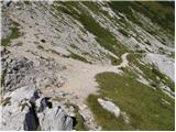 66
66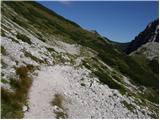 67
67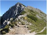 68
68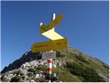 69
69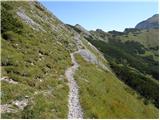 70
70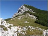 71
71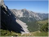 72
72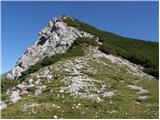 73
73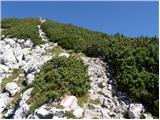 74
74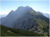 75
75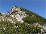 76
76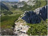 77
77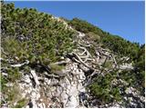 78
78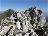 79
79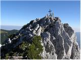 80
80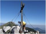 81
81 82
82
Discussion about the trip Ljubelj - Bielschitza/Svačica (upper path)
|
| robter15. 07. 2011 |
For stamp enthusiasts, there's a stamp in the logbook box next to the book
|
|
|
|
| Kriška29. 08. 2012 |
Regarding the approach to the summit, something is unclear to me: regardless of which path (the ridge one or the one ascending through scrub in the middle of the slope), the last picture where there are still a few meters to the cross on top is the same. Neither approach description shows the two paths merging before that. Can someone who has already hiked this path or the path describer explain?
|
|
|
|
| klm29. 08. 2012 |
Both little paths merge right before the summit rocky ridge. Then along the narrow ridge notch to the slender summit, as visible in the picture.
|
|
|
|
| VanSims29. 08. 2012 |
Specifically: all paths from Austria and Slovenia lead to the Belščica saddle. From there it is another 15 min to the summit. Just before the summit there is a short exposed ridge.
There are no other marked paths to the summit.
|
|
|
|
| Kriška30. 08. 2012 |
Thanks "klm", I haven't seen this information (trail junction) anywhere.
VanSims, you're probably right, as it seems to me that the path running in the middle of the slope is not marked.
|
|
|
|
| ben30. 08. 2012 |
@Kriška: it's probably not marked, but it's much more knee-friendly on the descent. 
LP B
|
|
|
|
| Kriška30. 08. 2012 |
@Ben, your comment is also extremely useful for me - my knees have been protesting quite a bit for several years on very steep descents. 
|
|
|
|
| Jst_Me20. 08. 2014 |
Very nice little hill, which is actually 1958 m high. At least according to the sign at the top and the stamp.
|
|
|
|
| klm21. 08. 2014 |
I think: this is the Austrians' measurement, the Slovenian one is however as stated above. Anyway, this isn't the only deviation in elevation between the countries. In the chain of Karawanks peaks there are plenty such with different elevations...
|
|
|
To post a comment you must log in:
If you do not yet have a username, you must first
register.