Dolina Kot - Požgana Mlinarica
Starting point: Dolina Kot (950 m)
| Latitude/Longitude: | 46,4157°N 13,8977°E |
| |
Walking time: 4 h
Difficulty: difficult unmarked way
Elevation gain: 918 m
Elevation difference along the route: 1050 m
Map: Triglav 1:25.000
Recommended equipment (summer): helmet
Recommended equipment (winter): helmet, ice axe, crampons
Views: 10.170
 | 2 people like this post |
Access to starting point:
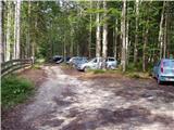
We leave the Gorenjska motorway at the Hrušica exit and continue following the road towards Kranjska Gora. Just a little before the village of Dovje, a road branches off to the left from the main road leading to Mojstrana (Vrata, Kot and Krma). We continue along the road in the direction of the village of Radovna and the Krma and Kot valleys. The relatively steep road then takes us past the TNP sign, after which the road soon levels out and brings us to an intersection where a gravel road branches off to the right into the Kot valley (straight ahead Radovna and Krma). We then follow this occasionally somewhat poorer road to the parking lot, where we also notice the hiking trail signs.
Route description:
From the parking lot we continue along the wide cart track (poorer road), which after a few minutes of easy walking brings us to the turning point (parking here is not recommended). Here the marked path to Staničev dom slightly descends and crosses a torrent, but we continue slightly to the right along the cart track which gently ascends on the right side of the torrent (left bank). After approximately 3 minutes of walking from the turning point, an unmarked hunting path branches off to the right from the cart track, along which we continue the ascent. The path, which initially ascends gently, quickly brings us to a stream, along which we ascend for a short time before crossing it. On the other side of the stream the path ascends relatively steeply in numerous switchbacks and after some time brings us out of the forest onto quite overgrown grassy slopes. The path from which views open primarily to Macesnovec, Luknja peč and Rjavina higher up again enters the forest. When the trail brings us to an indistinct side ridge we can climb in a few steps to a nice viewpoint from which a view opens to the peaks above the Kot and Krma valleys.
On the indistinct ridge the path turns left (not along the ridge) and brings us in a traversing ascent to a smaller grassy scree slope surrounded by numerous larches. The path then re-enters the forest, higher up turns right and after a somewhat longer traversing ascent brings us to the main ridge, where we continue sharply left (slightly right to Požar).
The path continues along the steep and relatively narrow forest-covered ridge where there is an increased risk of slipping especially when wet. The path which until now is not too demanding then brings us to the forepeak of Rušnata Mlinarica where less experienced hikers can also end the trip (the peak is recognizable by a large cairn).
We continue along the ridge which is increasingly overgrown with dwarf pine but the passages are nice as the dwarf pine has been cut. A bit further the path brings us to a shorter steep step where there is a torn steel cable and we have to climb steeply upwards for five meters with the help of the dwarf pine. The path which runs along a relatively steep slope and occasionally narrow ridge then brings us through numerous forepeaks and gullies to the bare and panoramic summit of Rušnata Mlinarica.
Although the path is not marked it is not particularly difficult orientation-wise but in fog it is difficult to know which is the right peak. Technical difficulties on the path occasionally reach the 1st degree of climbing. Due to the crumbly rock especially in the upper part it is good to have a helmet. On the ridge there is a great risk of slipping when wet.
From Rušnata Mlinarica we continue further along the narrow and in places exposed ridge. The difficulty does not lessen in the continuation and on the path there follow some more steep ascents and exposed traversings. We mostly avoid difficulties on the left side of the ridge. Such a path leads us all the way to the panoramic summit of Požgana Mlinarica.
Starting point - branch from the marked path 0:05, branch from the marked path - junction on the ridge 1:45, junction on the ridge - Rušnata Mlinarica 1:10, Rušnata Mlinarica - Požgana Mlinarica 1:00.

Photos:
 1
1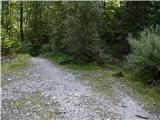 2
2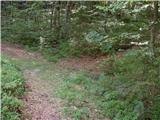 3
3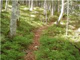 4
4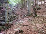 5
5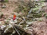 6
6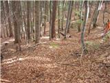 7
7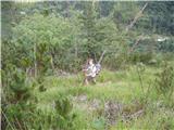 8
8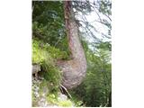 9
9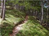 10
10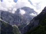 11
11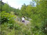 12
12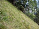 13
13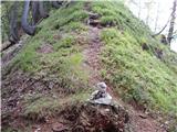 14
14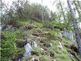 15
15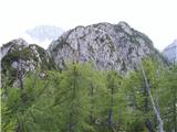 16
16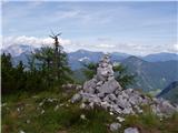 17
17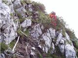 18
18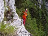 19
19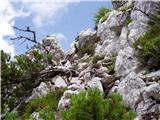 20
20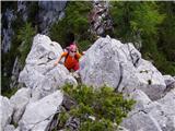 21
21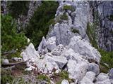 22
22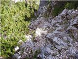 23
23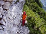 24
24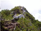 25
25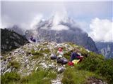 26
26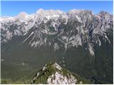 27
27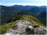 28
28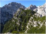 29
29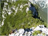 30
30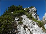 31
31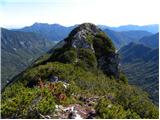 32
32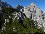 33
33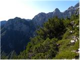 34
34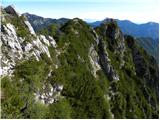 35
35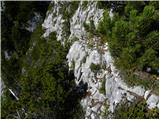 36
36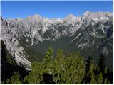 37
37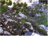 38
38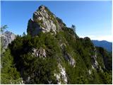 39
39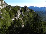 40
40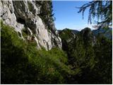 41
41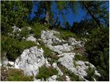 42
42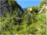 43
43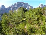 44
44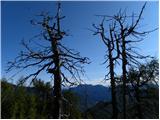 45
45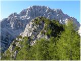 46
46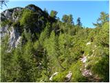 47
47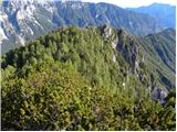 48
48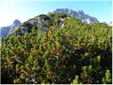 49
49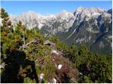 50
50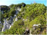 51
51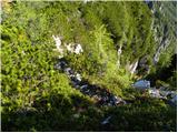 52
52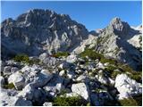 53
53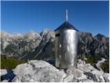 54
54
Discussion about the trip Dolina Kot - Požgana Mlinarica
|
| SilvestrO25. 06. 2012 |
The descent is the same as the upper description..., ascending from Kot along the marked path towards Staničev dom ... all the time studying where that right ledge is ,... when in the middle of the wall I spot a large mark  , no problem..., into the folds to the right and...,... according to the upper description back to Kot. The tour was of exploratory nature... , no problem..., into the folds to the right and...,... according to the upper description back to Kot. The tour was of exploratory nature... 
|
|
|
|
| ljubitelj gora24. 10. 2013 |
This week in the middle of the day I set out for Rušnata and Požgana Mlinarica, starting in Kot after a few minutes of walking on the right side right before the stream bed I spot a cairn, there I go right up along the stream bed and after a few minutes of walking I notice on the right side a cairn and path. I follow this well-visible path to the ridge just before the ridge I quickly spot a chamois that flees and since the slope there was steep I start running too, after a few seconds I turn around and see behind me a 10kg rock flying down, good thing I wasn't taking photos and was paying attention to the surroundings. On the ridge I go left upward from there a nice path begins, which is exposed here and there even without climbing the bushes helped me, the path was also partially wet, so I was more careful. At the top of Požgana Mlinarica there was plenty of space, because I had once heard of a path coming from the other side up (V Gubah) there I go a bit further in the direction of Vrbanova špica but decide to go back along the ridge, the ridge isn't that short, as there are ascents and descents but still it was a nice ascent and also descent. More photos here: https://plus.google.com/photos/114400986607884783562/albums/5937616667830255425
|
|
|
|
| foxy25. 10. 2013 |
LG, I have to compliment you, very nice photos....haven't been to Mlinarica yet, but I went in the other direction, through Požar all the way to Črna gora....nice, undemanding and very scenic ridge
|
|
|
|
| Jernej96811. 08. 2025 07:53:15 |
Yesterday my son and I walked this path in the opposite direction, as we ascended Požgana Mlinarica from the valley Za Cmirom. The described path is quite demanding, time-consuming and difficult. Time-consuming mainly because the ridge is very jagged and overgrown with brush on top, and the path mostly runs right along the top of the ridge. The brush has already overgrown the path quite a bit, which also hinders progress. At steep descents, the brush is of course helpful. We also briefly lost the path at two places, but found it again quickly. There was quite a bit of easy climbing too, but these are short sections, however unsecured. For the ridge section of the path from Požgana Mlinarica to the junction in Kot, we took 3 hours.
|
|
|
To post a comment you must log in:
If you do not yet have a username, you must first
register.