Mače - Bašeljski vrh (via valley of Suha and via Kališče)
Starting point: Mače (600 m)
| Lat/Lon: | 46,3131°N 14,4187°E |
| |
Name of path: via valley of Suha and via Kališče
Time of walking: 3 h 15 min
Difficulty: easy unmarked way
Altitude difference: 1144 m
Altitude difference po putu: 1144 m
Map: Karavanke - osrednji del 1:50.000
Recommended equipment (summer):
Recommended equipment (winter): ice axe, crampons
Views: 3.508
 | 2 people like this post |
Access to the starting point:
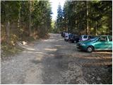
a) From the motorway Ljubljana - Jesenice, take the exit Kranj - East, then continue driving in the direction of Jezersko. When you reach Preddvor, leave the main road and turn left towards the centre of the town, and from there follow the signs for Mače. When you arrive in Mače, continue right at the marked crossroads (left Bašelj, straight ahead St Nicholas Church (the church is not accessible by car)) and follow the narrow road above the village, where there is a large marked parking lot.
b) From the motorway Jesenice - Ljubljana, take the exit Kranj - West and continue left at the first junction. Continue through the underpass under the motorway and then to the roundabout, from where you continue in the direction of Golnik. The road continues through Mlaka pri Kranju, and at the end of the village we turn right in the direction of Srakovlje. We then drive through Srakovlje, Spodnja Bela, Srednja Bela to Zgornja Bela, where we turn right towards Preddvor. At Preddvor we see signs for Mače, which direct us left past the primary school onto the road that climbs up to Maca. When you arrive at Mače, continue right at the marked crossroads (left Bašelj, straight ahead St Nicholas Church (the church is not accessible by car)) and follow the narrow road above the village, where there is a large marked parking lot.
Path description:
From the parking lot, continue in the direction of Kališča and follow the forest road, which is closed to public traffic. The road, which climbs relatively steeply, leads us after a good 20-minute walk to a marked crossroads, where the normal route to Kališče branches off to the left, and we continue to the right and continue along the deteriorating forest road. Just a little higher we reach the bottom station of the cargo cableway leading to Kališče, and the road gradually turns into a wide cart track after that.
Follow the marked cart track for a while, then, when it splits in two, continue along the wider unmarked cart track on the left (at the crossroads there is cairn). The ascent continues along the above-mentioned cart track, which climbs steeply along a strip of uncultivated slope. At a higher altitude, the cart track ends and we continue on a well-traced but rather steep path which turns into dense forest at a higher altitude. There is a climb of about 20 minutes and we join the marked path, which we follow to the left.
Continue in the direction of Kališča along the path, which lays down transiently and then gradually starts to climb steeper. The path continues for some time climbing through the dense forest, then leads us to the foot of the rocky cliffs and only slightly higher on the ridge, where only a few metres off the path we see a small cottage. Here the path turns right and climbs steeply over a short rocky jump. The path lays down here and joins the normal path leading to Kališče just a few metres further on.
Continue in the direction of Kišče and ascend along a moderately steep path, which will take you to the Mountain Home at Kišče in 5 minutes' walking.
After Dom na Kališču, you will see a mountain direction sign with a number of possibilities to continue the route. Continue along the gently sloping and scenic ridge path in the direction of Storžič, Bašeljski vrh. . . , which continues northwards. After a few minutes of easy walking with beautiful views as far as Julian Alps, we arrive at a crossroads where we continue right (straight Storžič) towards Bašeljski vrh. The way ahead climbs steeply through the dwarf pines zone and, with fine views of the neighbouring Mali Grintovec, leads us to the dwarf pines ridge of Bašeljski vrh, where we arrive at the next well-marked crossroads in the next few minutes. At the crossroads, the path to Mali Grintovec and Srednji vrh branches off to the right, and we continue straight ahead, looking at Storžič as we continue our ascent. The path along and along the ridge covered with dwarf pines is joined shortly below the summit by the path from Jekarica and Bašeljski Preval. Continue right here and, after a slightly narrower ridge, within a minute's further walking you will reach Bašeljski vrh, which offers a beautiful view of the mountains above Jezersko, and the view extends as far as Košuta, Obirje and Lavanttal Alps in Austria.

Pictures:
 1
1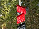 2
2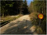 3
3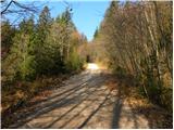 4
4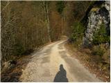 5
5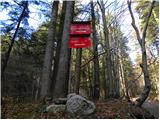 6
6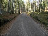 7
7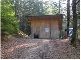 8
8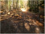 9
9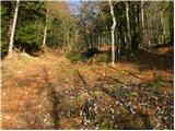 10
10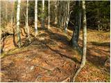 11
11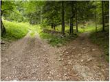 12
12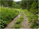 13
13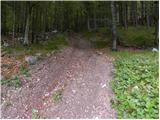 14
14 15
15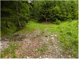 16
16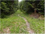 17
17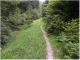 18
18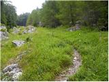 19
19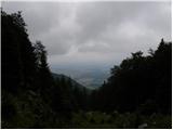 20
20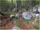 21
21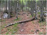 22
22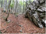 23
23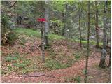 24
24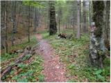 25
25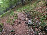 26
26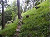 27
27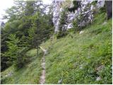 28
28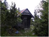 29
29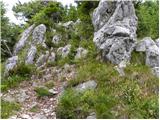 30
30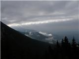 31
31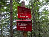 32
32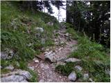 33
33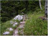 34
34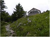 35
35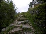 36
36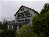 37
37 38
38 39
39 40
40 41
41 42
42 43
43 44
44 45
45 46
46 47
47 48
48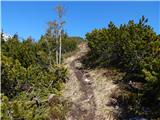 49
49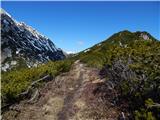 50
50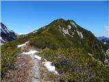 51
51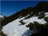 52
52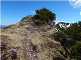 53
53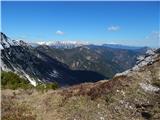 54
54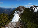 55
55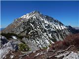 56
56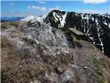 57
57 58
58
Discussion about the trail Mače - Bašeljski vrh (via valley of Suha and via Kališče)
|
| tomko14. 05. 2014 |
prosil bi avtorja ,če se mi lahko oglasi na ZS
lp
tomko
|
|
|