Planina pod Golico - Kahlkogel/Golica (via Ovčarska koča - eastern way)
Starting point: Planina pod Golico (980 m)
| Lat/Lon: | 46,4624°N 14,0488°E |
| |
Name of path: via Ovčarska koča - eastern way
Time of walking: 2 h 45 min
Difficulty: easy unmarked way
Altitude difference: 855 m
Altitude difference po putu: 855 m
Map: Karavanke - osrednji del 1:50.000
Recommended equipment (summer):
Recommended equipment (winter): ice axe, crampons
Views: 19.265
 | 1 person likes this post |
Access to the starting point:
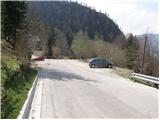
From the motorway Ljubljana - Jesenice take the exit Lipce (also Hrušica) and follow the road in the direction of Jesenice, where the signs for Planina pod Golico direct us to the ascending road (the exit is marked and is located at the health centre in Jesenice). The relatively steep road soon leads us to the above-mentioned village, where in May, in the surrounding meadows, you can admire the bloming of daffodils. Park in one of the car parks at the foot of the Španov vrh ski centre.
Path description:
From the parking lot, continue along the asphalted road, which after a few minutes' walk leads to a marked crossroads, where you continue left downhill towards Rožce (straight Kahlkogel, right Španov vrh). Continue along the road, which leads past the Church of the Holy Cross to an unmarked crossroads (at the cross), where you continue to the right. A marked trail soon branches off to the left from the road to Rožco, and we continue straight on past a few houses.
The road along the White Stream climbs steeply for a short time, then leads to a dilapidated house, where we continue right along the relatively steep cart track (left over the Rožca bridge).
The steep cart track, which passes through a dense forest, soon gives way, and after a few minutes of further walking it leads to a crossroads, where we continue along the right ascending cart track (between the two tracks there is a smaller cairn on a stump).
The track soon leaves the forest on a short rocky and scenic slope and then returns to the forest, where it continues until it reaches a forest road. Cross the road and then climb the avalanche-prone slope straight up (this part of the path was completely destroyed by the avalanche).
Keep to the left as you climb up the avalanche slope, as after about 50 m you will see a track continuing through the forest.
After a few steps through the forest, you will come to a small clearing, at the edge of which stands a small wooden hut. Continue along the wide path that crosses the lane of the forest, which soon leads to the lower part of the mountain pasture, where you come to a small crossroads. Continue to the right, cross the grazing fence and climb a few steps to the Golica shepherd's hut.
From the shepherd's hut, continue along a pleasant path which soon leads to the fence at the top of mountain pasture. Cross the fence and continue the ascent along the increasingly narrow grassy slope (the path is not very visible in this part), which in a few minutes leads to an unmarked side ridge, where you can see a small wooden sign with a faded inscription 'Koča na Golici' (the hut on Golica). The ascent continues along a well-traced path that climbs transversely to the east. At a higher elevation, join the marked trail with Jekljevo sedlo, which you follow to the right. After a few minutes of crossing relatively steep slopes, the path leads to the hut on Golica.
From the hut, the ascent continues northwards along initially steep and then steep grassy slopes. After a good 20 minutes of ascent, the steepness eases and the path turns left. There is a further 15 minutes or so of walking along the increasingly scenic summit ridge of Golica.

Pictures:
 1
1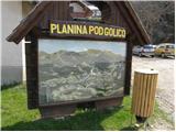 2
2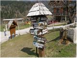 3
3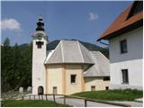 4
4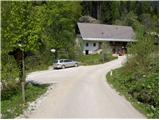 5
5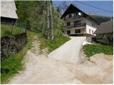 6
6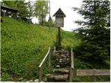 7
7 8
8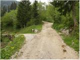 9
9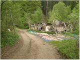 10
10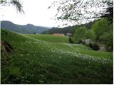 11
11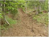 12
12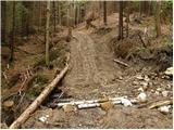 13
13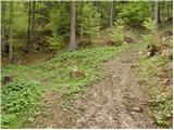 14
14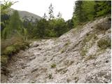 15
15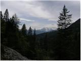 16
16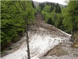 17
17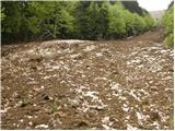 18
18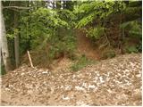 19
19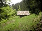 20
20 21
21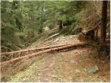 22
22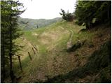 23
23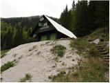 24
24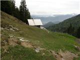 25
25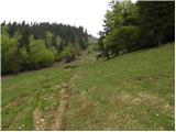 26
26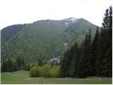 27
27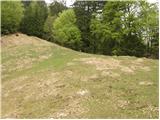 28
28 29
29 30
30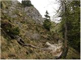 31
31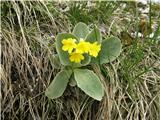 32
32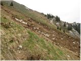 33
33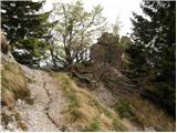 34
34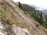 35
35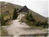 36
36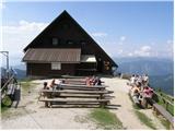 37
37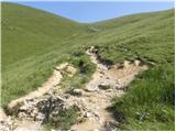 38
38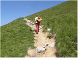 39
39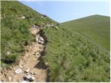 40
40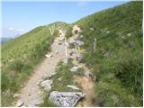 41
41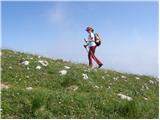 42
42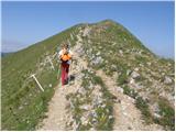 43
43 44
44
Discussion about the trail Planina pod Golico - Kahlkogel/Golica (via Ovčarska koča - eastern way)
|
| Franc6012. 11. 2021 21:33:21 |
Za spremembo sva izbrala ta pristop. Malo sva se zgubljala, nekajkrat bila v dvomih. To pa predvsem zaradi sprememb, ki so nastale zaradi vlak in gozdne ceste. Zato nekaj dopolnitev sicer dobremu opisu.
- začetni kolovoz je na novo skopan, utrjen in zelo zvožen. Za gozdarje je označen z roza črtami in znaki. Odpelje pa nas daleč v desno - če mu seveda sledimo. Z njega je treba zaviti na opisan kolovoz, ki pa ga je težko opaziti. Novi ga namreč odreže in zakrije. Treba je biti pozoren, da na levi strani nad sabo najdemo pravo nadaljevanje. Po ozkem prehodu med skalama zavijemo desno navzgor ali pa to naredimo že pred ožino.
- razpotje z manjšim možicem na štoru je bolj zaraščeno kot na sliki (14)- smrečice in praprot.
- ko se prebijemo na gozdno cesto (zaradi nasipa malo stran od prvotne poti), je ne prečimo, ampak enostavno gremo po njej. Poleti seveda ni plazovine, nekaj časa je celo betonirana. Mala koča (slika 20) je sedaj nova, napis pa nam pove, da je tam volovska planina...
Velja poskusiti ! Za razliko od običajne steze verjetno ne boste srečali nikogar.
|
|
|