Starting point: Bakonybel (344 m)
Time of walking: 2 h 15 min
Difficulty: easy marked way
Altitude difference: 365 m
Altitude difference po putu: 361 m
Map:
Recommended equipment (summer):
Recommended equipment (winter):
Views: 1.996
 | 1 person likes this post |
Access to the starting point:
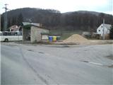
First we drive to Lendava, then we continue to Hungary, where we take the Tornyszentmiklos - Nagykanizsa - Budapest motorway. Leave the motorway at the Enying / Balatonfüred exit and then drive to Veszprem. From Veszprem, follow the signs for Györ, and we will head towards the village of Zirc, where we will see signs for the village of Bakonybel. At the end of Bakonybel, you will see a bus stop, which is the official start of the road to Köris Hegy (if you start here, you will have to walk 8 km on an asphalt road through the gorge). You can drive the 8 km and then park at the crossroads, where one road continues east towards Borzavar village, and the other road climbs up in serpentines to the radar station at the top.
Path description:
From the junction about 8 km above the bus stop, follow the tarmac road towards the radar station. Walk along the road for the first few metres, then turn right onto the often quite muddy cart track, which continues through a clearing. The path first takes you past a bench where you can rest, but the track quickly starts to climb steeply through scrub (blue markings are on a few trees that have not fallen down), and higher up through the forest. The path then becomes rockier and climbs steeply for some time. Higher up, the path flattens out and after a while leads to a crossroads where the path from Borzavar joins from the right.
From the crossroads onwards, the path is still relatively steep for some time, and then begins again to climb quite steeply towards the summit.
At the top, you can rest on one of several benches, or you can climb up to the wooden lookout tower "Vajda Peter Kilato", which offers a beautiful view of northern Hungary, Slovakia, and, to the south, the Bakonya hills to the south, where the view is obstructed by the hills.
There is also a radar station at the top, which is reached by a road along which we parked. You can descend down the road, from which you can take one bend and get a beautiful view, which, with good visibility, reaches all the way to the Alps.

Pictures:
 1
1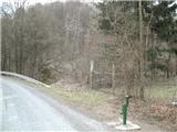 2
2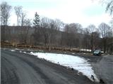 3
3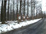 4
4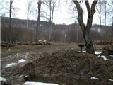 5
5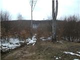 6
6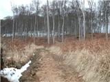 7
7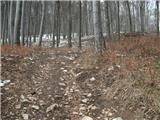 8
8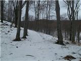 9
9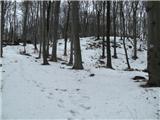 10
10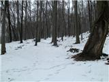 11
11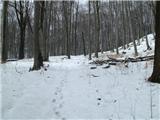 12
12 13
13 14
14 15
15 16
16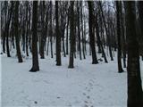 17
17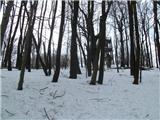 18
18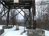 19
19
Discussion about the trail Bakonybel - Köris Hegy