Brezje pri Tržiču - Dobrča (via koča na Dobrči)
Starting point: Brezje pri Tržiču (677 m)
| Lat/Lon: | 46,3589°N 14,2787°E |
| |
Name of path: via koča na Dobrči
Time of walking: 3 h
Difficulty: easy marked way
Altitude difference: 957 m
Altitude difference po putu: 1000 m
Map: Karavanke - osrednji del 1:50.000
Recommended equipment (summer):
Recommended equipment (winter):
Views: 28.313
 | 2 people like this post |
Access to the starting point:
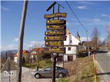
From the Ljubljana - Jesenice motorway, take the Ljubelj exit and follow the road towards Tržič. Just before the petrol station at Tržič, turn right (towards Tržič) and then immediately left (towards Begunje) and drive on to the village Brezje pri Tržiču, where you park in the parking lot near the church.
Path description:
From the parking lot, continue along the road towards Begunj, but only as far as where it starts to descend. Here, the road to Bistriška planina branches off to the right (there are also mountain signs for Dobrča at the crossroads), but we walk along it for only a few minutes, then turn left at the crossroads in the direction of Dobrča (the right road leads to Bistriška planina).
From the crossroads, continue along the slightly worse road for about 1 minute, then the markings lead you right onto a footpath that continues along the fence. Climb moderately along the fence for a while and then, after about 20 minutes' walk from the starting point, arrive at the wide but steep cart track. Follow cart track up to a slightly thinner forest, where the markings point sharp right upwards. Continue climbing steeply through the forest and after 15 minutes of further walking you will reach an abandoned animal trough. Here the path turns to the left and climbs steeply below the undistinguished peak of Vaško. A little further on, you reach a small hamlet between the aforementioned peak on the right and the slopes of Dobrča on the left.
There is a short climb and the path leads to a place where you cross a nearby forest road (the road is crossed right where it ends). Continue for some time along a wide and forested ridge, which you follow all the way to the paragliding airstrip, which is located on the southern slopes of Dobrča (the southern slopes of Dobrča).
Here, a wide path branches off to the right and continues towards Lešanská and Bistriška planina, while we continue straight ahead, initially walking along the edge of the forest. We quickly return to the forest and then climb quite steeply in the keys. At about 1400 metres above sea level we reach cart track, which we only cross, and then, just a little higher up, we arrive at a marked crossroads, where the path from Lešanska planina joins from the right, the path continues in a straight direction towards the summit of Dobrča, and we continue to the left in the direction of Koča na Dobrči. There is a short descent and the path returns to the aforementioned cart track (the track we have just crossed), which we follow for only a short time, as the markings then lead us slightly to the left. Continue westwards across the slopes of Dobrča without any significant change in altitude, and then emerge from the forest onto the mountain pasture viewpoint of Podgorsko.
From mountain pasture, from which you can already see the hut on Dobrča, descend gently at first and then climb up to the nearby mountain hut.
Near the Hut on Dobrča, the signs for the summit of Dobrča direct you to a forest road, along which you begin to descend gently northwards. After a short descent, we see direction signs pointing us right to Podgorsko mountain pasture, whose huts we pass on the right. Next, we climb over a grassy slope with a view, and then the path passes into initially sparse, but higher up, increasingly dense forest. When the slope subsides, two paths join from the right, and in both cases we continue straight ahead. The path ahead climbs steeper again and after a few minutes of further walking leads us to the top of Dobrča.

We can extend the trip to the following destinations: Šentanski vrh
Pictures:
 1
1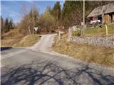 2
2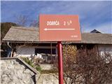 3
3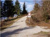 4
4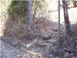 5
5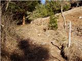 6
6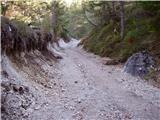 7
7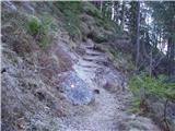 8
8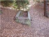 9
9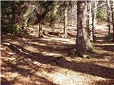 10
10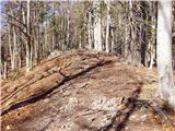 11
11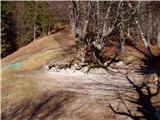 12
12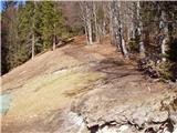 13
13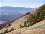 14
14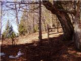 15
15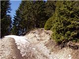 16
16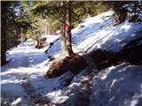 17
17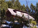 18
18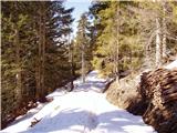 19
19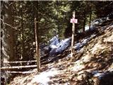 20
20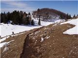 21
21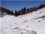 22
22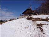 23
23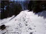 24
24 25
25 26
26 27
27 28
28 29
29 30
30 31
31
Discussion about the trail Brezje pri Tržiču - Dobrča (via koča na Dobrči)
|
| andrej jerina27. 09. 2008 |
Danes sva s sinom Joštom opravila omenjeno pot. Opis poti je zelo lepo napisan. Na vrhu je kar močno pihalo, bilo je tudi oblačno, tako da kakšnih razgledov ni bilo, vsekakor pa je bila lepa kondicijska tura. Pot sva podaljšala še do Šentanskega vrha, kjer naju je pozdravilo rahlo naletavanje snega. LP Andrej in Jošt
|
|
|
|
| majamaja9. 04. 2009 |
Vprašanje za redne obiskovalce Dobrče (jaz načrtujem prvi obisk  ) ... koliko je kaj trenutno snega na poti, ali zelo otežuje hojo (se udira itd.) Vnaprej hvala tistemu, ki mi bo odgovoril! lp Maja
|
|
|
|
| anč9. 04. 2009 |
V soboto sem bila na Dobrči. Sneg se začne cca.100 metrov pred kočo,južen in se vdira. Drugače pa super.
|
|
|
|
| lan9. 04. 2009 |
Na DObrči sem bil včeraj, snega je kar pobralo od sobote, tako da ga je (če greste od Hibja vam vem povedat)le še pod kočo v zadnji bližnjici v gozdu tu pa tam malo, pa še to ga bo gotovo pobralo do sobote. Priporočam obisk, zelo lep razgled.
|
|
|
|
| urskaa17. 05. 2009 |
Na Dobrči smo bili danes, krasen izlet, pot zelo lepa, nenaporna za hodit, krasen razgled, veliko rožic, zelo priporočam-SUPER!!!
|
|
|
|
| Brinova_Sara14. 08. 2009 |
Živjo! Samo eno vprašanje - je pot v redu označena, ali je treba vklopiti kake "posebne navigacijske sisteme"? Hvala Sara
|
|
|
|
| Bojan_A14. 08. 2009 |
Pot je dobro označena. Mogoče se pot še najmanj vidi s Koče na Dobrči čez travnik na vrh Dobrče. Po gozdu pa pot prepredajo gorsko-tekaške bljižnice.
Pravkar pa so jo tudi rahlo popravili.
|
|
|
|
| Bojan_A14. 08. 2009 |
Parkirati pa ni treba pri Sv. Neži, ampak se da na križišču ceste proti Bistriški planini.
V Koči na Dobrči je po novem vpisna knjiga za gorske tekače in kolesarje -"Kampeljce".
Kar se tiče treninga gorskega teka je ta gora odlična, ker premore skoraj jurja višincev. Sestop je hiter zaradi dobre poti. Pa še gora je zelo varna in jo jo je mogoče obiskati praktično v vsakem vremenu.
Priporočam tekačem in planincem začetnikom.
Da pa se tudi po lovskih poteh izogniti avtocesti na vrh in uživati v gorskem cvetju, ki ga je tu ogromno.
|
|
|
|
| wolphgang10. 10. 2011 |
mi zna kdo povedat kaj pomeni na spletni strani pzs-ja, podatek, da je koča na dobrči odprta? a to pomeni vsak dan ali kako? hvala
|
|
|
|
| robter10. 10. 2011 |
wolphgang, poglej na spletni strani www.dobrca.net tam imaš kontakt in vprašaj oskrbnika
|
|
|