Carbonin - Monte Fumo / Rauhkofel (Northern route)
Starting point: Carbonin (1444 m)
| Lat/Lon: | 46,62046°N 12,21895°E |
| |
Name of path: Northern route
Time of walking: 2 h 30 min
Difficulty: very difficult marked way
Altitude difference: 670 m
Altitude difference po putu: 680 m
Map: Tabacco 03 1:25.000
Recommended equipment (summer): helmet
Recommended equipment (winter): helmet, ice axe, crampons
Views: 2.088
 | 1 person likes this post |
Access to the starting point:
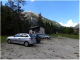
Access from Gorenjska: Take the Border crossing Rateče road to Trbiž / Tarvisio, where you take the motorway towards Udine. Leave the motorway at the exit for Tolmezzo and follow the road to the above-mentioned place. From Tolmezzo, continue in the direction of Ampezzo and the Passo della Mauria mountain pass. The road then begins to descend and leads into the Cadore valley, where you continue to the right (Belluno and Cortina d'Ampezzo on the left) in the direction of Auronzo. After a few more kilometres, you will come to the next major crossroads, where you turn right towards Misurina (left Tre Croci Pass). From here, follow the road down to a major crossroads (right Dobbiaco and Austria, left Cortina d'Ampezzo). Shortly before this crossroads, you will see a large parking lot on the left side of the road.
From the Primorska side. Continue on the Italian motorway towards Padua, but only as far as the motorway junction where you continue towards Veneto and Belluno. Near Belluno the motorway ends and we continue towards Cortina d'Ampezzo and Auronzo. As the road enters the Cadore valley, we come to a large junction where the road towards Cortina d'Ampezzo goes left and the road towards Auronzo goes right. Here we continue to the right towards Auronzo. Continue as described above.
Path description:
From the parking lot, continue along the main road for about 200 metres towards Misurina. Two dirt roads will then branch off to the right. Take the second road after the Cortina signs.
Walk along this road, which is popular with cyclists, for some time. Two narrower roads will join from the right and the road will soon lead to a wooden fence where cart track branches off to the left. Alongside cart track you will also see some old markings on the trees.
Right at the start of cart track you will see a narrow path on the left by the fence. Take this path, which starts to climb quite steeply (there is another path straight ahead on cart track to Monte Fumo / Rauhkofel).
The ascending path is marked, but it is still rather poorly trodden. In the initial part you will cross a fence a few times, then climb through dwarf pines on a rather steep slope. The view at the bottom is particularly nice towards the north, where we can see the summit of Pico di Vallandro and Croda Rossa. The path continues past some WWI military tunnels and climbs very steeply several times. The path also crosses a few exposed slopes. As the path is poorly trodden, some caution is needed when crossing it. At higher altitudes, the wire is also helpful for such crossings. The path then runs for some time along the western side of the mountain where it crosses steep slopes in a slight ascent.
Just below the summit the path leads us to a crossroads where we turn left upwards, and right leads the path to the south side of the mountain and then along the western slopes into the valley.
From the crossroads, the path first climbs slightly steeper and then follows a slightly flatter path along the dwarf pines to the summit lookout.
The trail described is relatively poorly maintained, so some caution is needed in a few places.

Pictures:
 1
1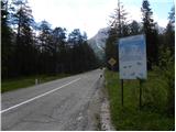 2
2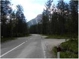 3
3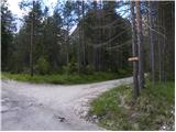 4
4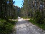 5
5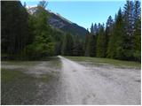 6
6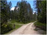 7
7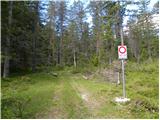 8
8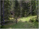 9
9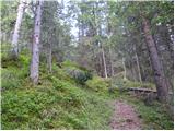 10
10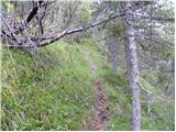 11
11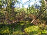 12
12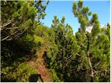 13
13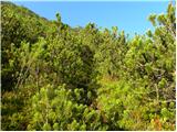 14
14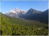 15
15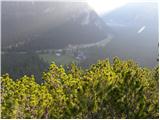 16
16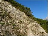 17
17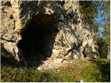 18
18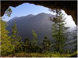 19
19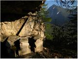 20
20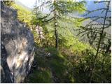 21
21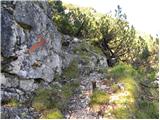 22
22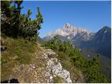 23
23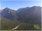 24
24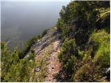 25
25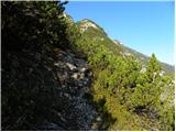 26
26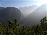 27
27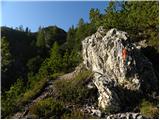 28
28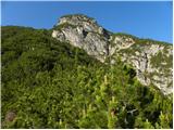 29
29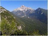 30
30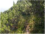 31
31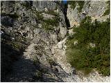 32
32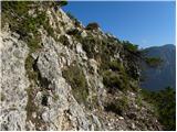 33
33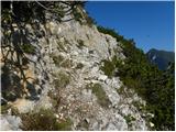 34
34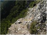 35
35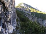 36
36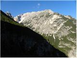 37
37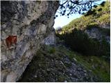 38
38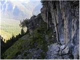 39
39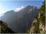 40
40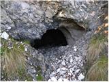 41
41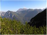 42
42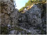 43
43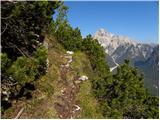 44
44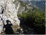 45
45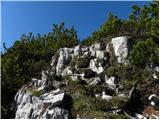 46
46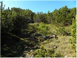 47
47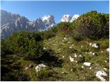 48
48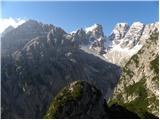 49
49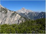 50
50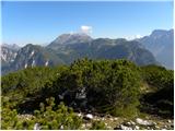 51
51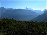 52
52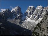 53
53
Discussion about the trail Carbonin - Monte Fumo / Rauhkofel (Northern route)