Cave del Predil - Kraljevska špica/Monte Re
Starting point: Cave del Predil (1023 m)
| Lat/Lon: | 46,4427°N 13,5648°E |
| |
Time of walking: 2 h 30 min
Difficulty: partly demanding marked way
Altitude difference: 889 m
Altitude difference po putu: 900 m
Map: Julijske Alpe - zahodni del 1:50.000
Recommended equipment (summer):
Recommended equipment (winter): ice axe, crampons
Views: 36.575
 | 2 people like this post |
Access to the starting point:
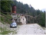
From Kranjska Gora, take the Rateče border crossing to Trbiž / Tarvisio. In Trbiz, turn left towards Bovec and follow the road to Rabelj / Cave del Predil. Here, leave the main road and turn right. At the church, turn right again and cross a narrow prefabricated bridge. After the bridge, continue left and the road begins to climb slowly. Follow the dirt road all the way to the end, where you park near an abandoned mine building.
From Bovec, cross the Predel border crossing and continue towards Trbiz, but only as far as Rabelj / Cave del Predil. Cross the bridge at the right-hand bend, and just after the bridge, leave the main road and turn left. At the church, turn left again and cross a narrow prefabricated bridge. After the bridge, continue left and the road starts to climb slowly. Follow the dirt road all the way to the end, where you park near an abandoned mine building.
Path description:
At the end of the road, head into the wods on the footpath after the Monte Re signs. The path climbs for a while in the keys, then leads to a crossroads. A sign on a tree points upwards to the left and the path becomes steeper and steeper. The path here follows an indistinct ridge, mostly alongside wire fences and pipes. More and more often, we also get beautiful views of the surrounding area (Rabeljske špice, Rabeljsko jezero, Viš. . . ). When we come out of the forest, the steepness eases for a short time, and then the path turns left and starts to climb up the grassy slope. This path then soon leads us to the Little King's Spit.
From the top of the hill where the cross stands, we then descend slightly and the path leads us back into the forest. Again we start climbing steeper and steeper and eventually the forest turns into dwarf pines. In a few places the path is so steep that we have to use our hands to help us. From dwarf pines we occasionally get beautiful views, especially towards the Vistula, but later also towards Kamnitý Lovec and Mangart. In the last part of the route there is a climb up a ridge covered with dwarf pines, and at the top we get a wonderful view on all sides.

Pictures:
 1
1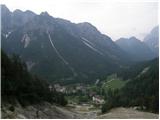 2
2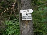 3
3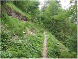 4
4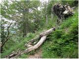 5
5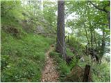 6
6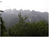 7
7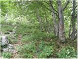 8
8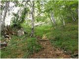 9
9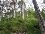 10
10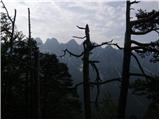 11
11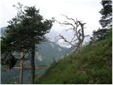 12
12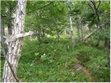 13
13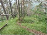 14
14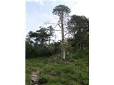 15
15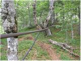 16
16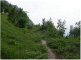 17
17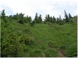 18
18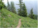 19
19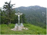 20
20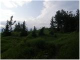 21
21 22
22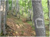 23
23 24
24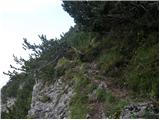 25
25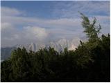 26
26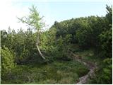 27
27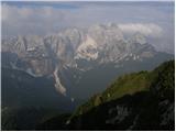 28
28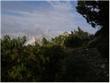 29
29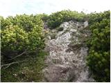 30
30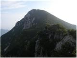 31
31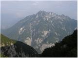 32
32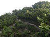 33
33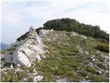 34
34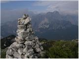 35
35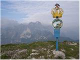 36
36
Discussion about the trail Cave del Predil - Kraljevska špica/Monte Re
|
| klavdipo19. 05. 2011 |
Prosim za informacijo, ali je na tem vrhu tudi žig?
|
|
|
|
| stankos21. 08. 2011 |
Gora vredna obiska.Pot nekoliko strma,a na cilju poplačana z čudovitimi razgledi.Gora malo obiskana,srečala le par planincev.
|
|
|
|
| sla29. 10. 2015 |
Ali kdo ve, če je kakšna pot iz sedla, ki se po italijansko imenuje Sella delle Cave, na vrh Kraljevske špice?
|
|
|
|
| sla29. 10. 2015 |
Se bo že posušila  Markirana ni, je kak možic?
|
|
|
|
| IgorZlodej29. 10. 2015 |
Ko sem poleti šel čez sedlo v Mrzlo vodo je bilo že do sedla precej podrtega drevja, lahko, da so v tem času kaj očistili, več bi vedel Alessio. Kako je naprej pa ne vem, še nisem hodil  . Na karti Tabacco je vrisana.
|
|
|
|
| ločanka2. 06. 2019 |
Lahko rečem samo: prečudovito!
Pri opisu bi pa popravila podnapise na slikah 7 in 11: niso Rabeljske špice, ampak mejni greben nad Predelom v smeri proti Mangartu
|
|
|
|
| golica10. 08. 2020 |
pregledala sem slike od Magdag.Pot je označena kot delno zahtevna. Kje bi bilo za popazit pri hoji.Po slikah ni videti (razen prave strmine) kaj izpostavljenega.?
|
|
|
|
| velkavrh11. 08. 2020 |
Pot ni zahtevna.Strmia sicer je , ni pa nič prepadnega .Samo suho mora bit.Kar korajžno!
|
|
|
|
| Majdag11. 08. 2020 |
golica, nič razen hude strmine ni na tej poti. Na grebenček, malo pred začetkom zadnjega dela proti vrhu je le v snegu treba bolj pazljivo prehoditi. Srečno, lepo je na vrhu.
|
|
|
|
| golica11. 08. 2020 |
hvala za oba odgovora.To sem "želela slišati" bomo v začetku septembra z družbo tole obiskali.
|
|
|
|
| mikkeni29. 04. 2022 03:50:50 |
Se dosti snega oz sneznih zaplat?
|
|
|
|
| J.P.24. 05. 2022 20:00:58 |
Cela pot je popolnoma kopna. Zelo lepi in posebni konci..od vrha do vasi in njene okolice.
|
|
|
|
| gamsek120. 05. 2023 17:27:32 |
Ali je še vedno možno/dovoljeno z avtom priti čisto do konca makadamske ceste?
|
|
|
|
| 2061alessio20. 05. 2023 19:44:10 |
ja kar naprej do konca (poglej slika 1) prosim ce greš sporocimi ce je pot v redu , prehodna in markacije .
|
|
|
|
| capraibex20. 05. 2023 22:22:22 |
Cesta je normalno prevozna
|
|
|
|
| sla5. 11. 2023 13:02:06 |
Cesta je zelo zdrta od deževja - za avte z nizkim podvozjem neprevozna. Malo pred zadnjim ovinkom čeznjo leži podrto drevo. Sama pot na vrh brez posebnosti.
Preverila sem tudi dostop s sedla Selle della Cave - do kote na približno 1500 m je lahko prehoden gozd, potem pa se začne res strmo skrotje, kjer sem raje obrnila.
|
|
|
|
| Enka24. 08. 2025 13:00:34 |
Je kdo hodil kaj tod mimo, v kakšnem stanju je cesta do izhodišča?
|
|
|
|
| narava24. 08. 2025 20:58:50 |
Ravno danes. Makadamska cesta je v slabem stanju. Kar nekaj je jarkov, eden precej neugoden, a z dovolj visokim podvozjem gre. Vendar pa skoraj vsi štartajo v naselju, danes je bil naš avto edini parkiran višje. Zadnjih 200 m pred zapuščeno rudniško zgradbo je obvestilo o prepovedi oz. vožnji na lastno odgovornost, saj se zid ob cesti podira. Sicer smo se do nje vseeno zapeljale, a v izogib morebitni kazni raje obrnile in parkirale na zadnji serpentini.
|
|
|
|
| Enka26. 08. 2025 12:03:05 |
Narava, hvala za odgovor, je prišel zelo prav. Smo parkirale lepo pri cerkvi v Rablju in se tistih dobrih 1,5 km in 130 višincev po cesti ravno fajn ogrele za strmino, ki nas je čakala. Parkiranje za tablo o prepovedi dejansko ni priporočljivo. Včeraj so tam spravljali les iz gozda in sta se Avstrijca, ki sta parkirala čisto na koncu pri rudniški zgradbi, kar fino načakala . Pot je strma. Ampak res strma. Že skozi gozd do Male Kraljevske špice se človek pošteno zadiha. Sledi nekaj res prijetne in mehke poti po gozdu, potem pa gre samo še zelo strmo navzgor. V tem delu je na poti tudi grušč, skale pa so tudi kar zlizane, tako da je pri sestopu malo za popazit. V suhem sicer ni težav, v mokrem pa ne bi rinila gor. Na vrhu je ves trud poplačan, saj je prijetno prostoren in silovito razgleden. Za gor ostat .
|
|
|