Collina - Cima Ombladet (path 141)
Starting point: Collina (1255 m)
| Lat/Lon: | 46,58689°N 12,84349°E |
| |
Name of path: path 141
Time of walking: 3 h 20 min
Difficulty: partly demanding marked way
Altitude difference: 1000 m
Altitude difference po putu: 1050 m
Map: Tabacco 01 1:25.000
Recommended equipment (summer):
Recommended equipment (winter): ice axe, crampons
Views: 1.150
 | 2 people like this post |
Access to the starting point:
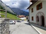
From Trbiz/Tarvisio, take the motorway to Udine/Vidmo. Leave the motorway at the Tolmezzo exit. At Tolmezzo, you also leave the road leading to the Passo di Croce Carnico / Plockenpass and head towards Villa Santina. In Villa Santina, at the roundabout, go straight ahead following the signs for Ovaro, Sappada. Follow this road until Forni Avoltri, where turn right after the Collina signs. Follow the asphalted road to Collina. In Collina, follow the upper road on the left towards the centre of the village. The road then leads you through the beautifully landscaped village centre, paved with cobblestones. Immediately afterwards, turn left up the narrow Via del Leone. At the first crossroads, turn left again and continue for another 10 metres to a parking area by a steel cable.
Path description:
From the parking lot, continue along the road past the last houses, then the road becomes cart track. Then follow the above-mentioned cart track for some time, crossing the view slopes by the pastures, and just before the right-hand bend you reach a crossroads.
You will see a bench on the left, and we head right up the less well-trodden, slightly overgrown cart track, where we are also directed by a wooden signpost with the inscription Forcella Ombladet 141. The cart track climbs past a small building with a transmitter, and then the cart track leads into the forest. Here cart track becomes a path which then climbs for some time through the forest. The path through the forest is still quite beautiful, but when you cross a few clearings a little higher up, you will quickly notice that the path is very poorly frequented and quite overgrown. As you walk through the woods, follow the mostly damaged signposts marked "Forcella Ombladet" and the wooden signs marked "141".
The higher you get out of the forest and onto grassy terrain, the path starts to disappear. The path runs northwards parallel to the valley of the Rio Collinetta, which is on our left, far below us. We continue to climb up the grassy slopes for some time on the difficult-to-follow track, and the views of the surrounding peaks and the aforementioned valley of the Rio Collinetta begin to open up. At about 1700m, a red signpost marked '141' directs you to the right towards mountain pasture Casera Chiampei. Here you walk along overgrown grassy slopes, with a few wooden stakes with markers to help you find your way. Continue past some ruins to mountain pasture, then you will see a sign ahead of you pointing to the left again.
Cross the grassy slopes and the track becomes a little more visible from time to time. Here we also get a better view of the Forcella Ombladet. The relatively level path continues northwards and leads to a torrent bed below a steeper rocky slope. Then we start to climb steeply up the valley along the stream bed. The relatively steep path, which runs mainly on grassy terrain, then leads to the Forcella Ombladet notch, where there is also a marked crossroads.
To the right is the trail to the Monte Volaia summit, straight down is the trail to Pierabech, and we continue left on trail 169 to the summit of Cima Ombladet.
From the crossroads, continue along the ridge and after a short climb, the path leads to the south side of the ridge on the left. Continue for some time then cross the grassy slopes to the west. Later, the slopes become a little steeper and some caution is needed when crossing, especially in the wet. The trail then descends slightly to a small notch, and then ascends again, crossing steep slopes on the left side of the ridge. The slope becomes a shade less steep and an unmarked path joins from the left. The path then turns slightly to the right and climbs up the grassy slope to a marked crossroads.
Here, the path from Sigilletto joins us from the left, but it is much better trodden than our path. At the crossroads, continue to the right and follow the grassy ridge with a view to the summit.

Pictures:
 1
1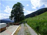 2
2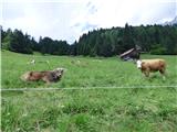 3
3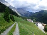 4
4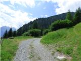 5
5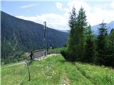 6
6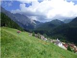 7
7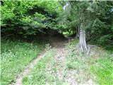 8
8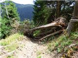 9
9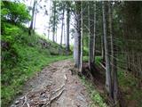 10
10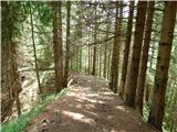 11
11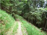 12
12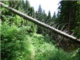 13
13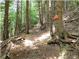 14
14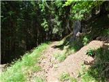 15
15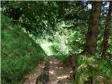 16
16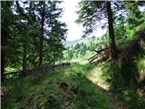 17
17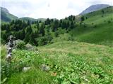 18
18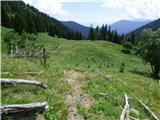 19
19 20
20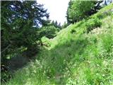 21
21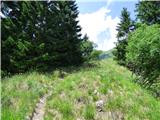 22
22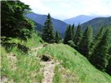 23
23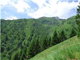 24
24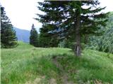 25
25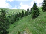 26
26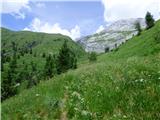 27
27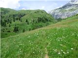 28
28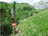 29
29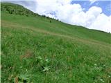 30
30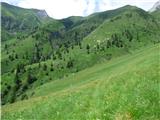 31
31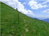 32
32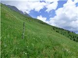 33
33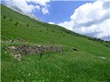 34
34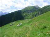 35
35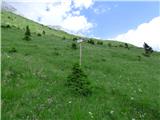 36
36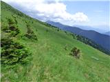 37
37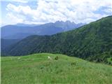 38
38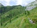 39
39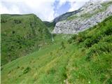 40
40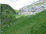 41
41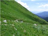 42
42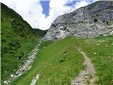 43
43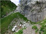 44
44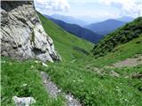 45
45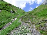 46
46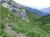 47
47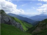 48
48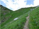 49
49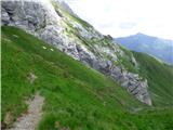 50
50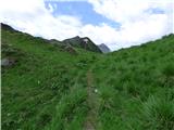 51
51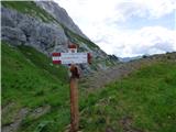 52
52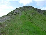 53
53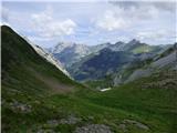 54
54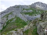 55
55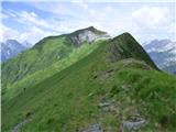 56
56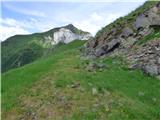 57
57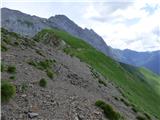 58
58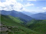 59
59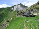 60
60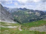 61
61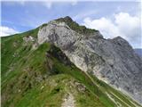 62
62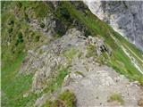 63
63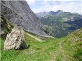 64
64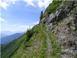 65
65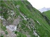 66
66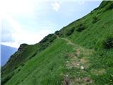 67
67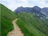 68
68 69
69 70
70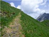 71
71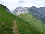 72
72 73
73 74
74 75
75 76
76 77
77 78
78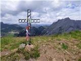 79
79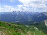 80
80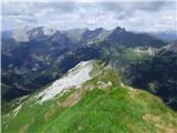 81
81 82
82
Discussion about the trail Collina - Cima Ombladet (path 141)
|
| mirank14. 09. 2025 13:43:59 |
Sl 34-letos je planina polna ovac. Na mestu ruševin je improvizirana lopa in ob njej počitniška prikolica katero je lahko pripeljal le helikopter. V njej bivata pastirja-na naše začudenje, črnca 
|
|
|