Dom pod Storžičem - Stegovnik (western way)
Starting point: Dom pod Storžičem (1123 m)
| Lat/Lon: | 46,3586°N 14,3906°E |
| |
Name of path: western way
Time of walking: 4 h
Difficulty: partly demanding marked way
Altitude difference: 569 m
Altitude difference po putu: 800 m
Map: Karavanke - osrednji del 1:50.000
Recommended equipment (summer): helmet
Recommended equipment (winter): helmet, ice axe, crampons
Views: 13.485
 | 1 person likes this post |
Access to the starting point:
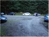
From the Ljubljana - Jesenice motorway, take the Ljubelj exit. Follow the road through Tržič and on the other side of Tržič turn right towards Lom pod Storžičem. Follow this road towards the signs for the Lodge under Storžič. Park in the parking lot a few metres in front of the mountain hut.
Path description:
From the parking lot in front of the lodge, take the road to the left in the direction of Javorniško sedlo and mountain pasture Javornik. After about 20 minutes' walk, the road turns into cart track. Here you can continue along the marked footpath, which is rather abandoned, or you can follow the cart track. I recommend walking along the cart track as it is also easier to navigate, even though it is not marked. Follow Cart track, which climbs quite steeply, through the forest to Javorniško sedlo, where there is a crossroads. To the left mountain pasture Javornik, to the right Stegovnik and Mačensko sedlo. Take the left dirt track towards mountain pasture Javornik (not in the direction of Stegovnik, a possible circular route of approximately the same length). Cart track continues on a gentle ascent, crossing the slopes of Javornik and after 20 minutes' walk leading to mountain pasture.
At mountain pasture we enter a forest road, which we then follow in a gentle downhill, first to the north, while the dirt road makes a bend mainly to the east. After about 15 minutes of walking along the road, you will reach a large meadow, where there is also a crossroads. Leave the road here and continue in the direction Stegovnik along the path that crosses the meadow. On the other side of the meadow, the path enters the woods and continues along cart track, which is gently descending for the most part. After a while the track turns into a footpath, now ascending and then descending again. After a while, the path from which we have only a few views (mainly of the ridge of Košuta) leads us to a pleasant bench. The path continues through the forest, which is occasionally interrupted by a clearing overgrown with tall grass. A little further on, we come to a small crossroads, where the Jezersko trail joins us from the right (and the eastern trail - the possibility of returning to the exit). Continue straight ahead and in a few further steps the path leads to the window in Stegovnik.
With the help of a rope climb up to the first window in the middle of which a passage opens to the left via a ladder down. The window then narrows (watch your head) and the path leads to the other side of the side ridge. On the other side of the window, the path starts to climb steeply and leads us to the Stegovnik ridge in the keys. There is a 10-minute walk along the scenic ridge. In the snow, the ridge is dangerous for slipping.
You can descend via the eastern route.

Pictures:
 1
1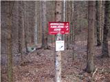 2
2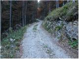 3
3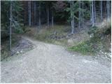 4
4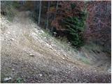 5
5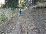 6
6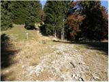 7
7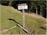 8
8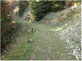 9
9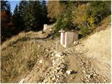 10
10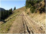 11
11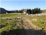 12
12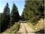 13
13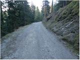 14
14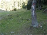 15
15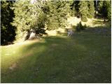 16
16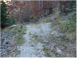 17
17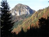 18
18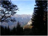 19
19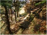 20
20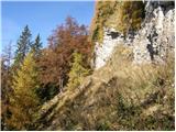 21
21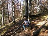 22
22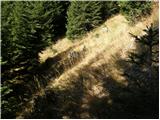 23
23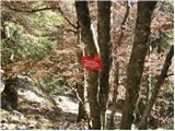 24
24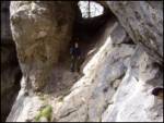 25
25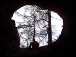 26
26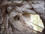 27
27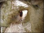 28
28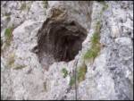 29
29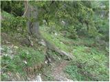 30
30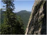 31
31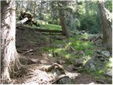 32
32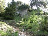 33
33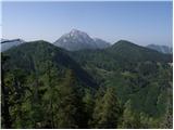 34
34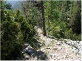 35
35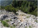 36
36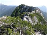 37
37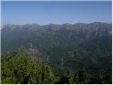 38
38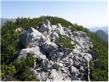 39
39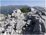 40
40
Discussion about the trail Dom pod Storžičem - Stegovnik (western way)
|
| Tadej22. 10. 2008 |
Pot skozi okno je zelo slikovita in vredna ogleda. Tudi zgornji del pot je zanimiv, saj je greben zelo razgleden.
|
|
|
|
| asde14. 03. 2011 |
Zdravo,
v soboto, 12.03.2011 sva se odpravila na Stegovnik. Začetek poti Dom pod Storžičem, čez Javorniško sedlo, naprej pod M. Javornik.
Snega v senčnih legah do 30cm, drugod 5-10cm.
Sam Stegovnik je povsem kopen, vendar poti na vrh nisva našla, markacije so očitno na tleh, pokrite s snegom. Pot je sicer zelo težko sledljiva, malce kritike za PD Tržič in markaciste.
|
|
|
|
| Zasavčan14. 03. 2011 |
Ali kdo ve kašna je pot skozi žrelo???
|
|
|
|
| Zasavčan15. 03. 2011 |
To vem,ampak razmere,če je kdo v kratkem tu skozi šel
|
|
|
|
| robter13. 06. 2011 |
Danes opravil krožno turo z Doma pod Storžičem, do Javorniškega prevala in nato po zahodni poti proti Stegovniku. Spotoma obiskal Ženiklovec. Pri drevesu, kjer je potrebno prečiti travnik nisem bil dovolj pozoren in sem nadaljeval po cesti, vendar sem po cca 10 minutah brez markacij ugotovil, da je nekaj narobe in se vrnil.
Pot je drugače solidno označena.
Na Javorniški preval sem se vrnil po vzhodni poti, kjer je v travah potrebno biti pazljiv na markacije, saj je pot na posameznih odsekih težko sledljiva.
|
|
|
|
| VanSims4. 05. 2020 |
Res je, vzhodna pot (vsaj v povratku) je mestoma (še vedno) dokaj slabo označena in je treba biti kar malo detektiva. Tudi zgornji opis je nekoliko pomanjkljiv ali pa že zasztarel in potreben obnove.
|
|
|