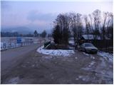
Starting point: Dovže (522 m)
| Lat/Lon: | 46,4526°N 15,1545°E |
| |
Time of walking: 3 h 45 min
Difficulty: easy marked way
Altitude difference: 1021 m
Altitude difference po putu: 1050 m
Map: Pohorje 1:50.000
Recommended equipment (summer):
Recommended equipment (winter): crampons
Views: 8.109
 | 1 person likes this post |
Access to the starting point:
a) From the motorway Ljubljana - Maribor, take the exit Žalec and then continue in the direction of Velenje. At the main roundabout in Velenje, turn right (towards Dravograd and Slovenj Gradec) and follow the main road to Mislinja and a little further to where the road to the village of Dovže turns right. Park in a suitable place at the crossroads.
b) From Koroška, take the first exit to Slovenj Gradec, then continue to Velenje. A little after Turiška vas, you will come to a crossroads where the road to Dovže turns left. Turn left here and after a few metres park in a suitable parking space at the junction.
Path description:
At the starting point, you will see signs for Grmovškov dom, which direct you to the asphalt road, which will take you to Spodnje and then to Zgornje Dovž in a few minutes. From the Church of St Ulrich in Dovže, continue along the main road for about 100 m, and then the signs will direct you to the left onto a side road, which will take you almost to the fire station. Before the fire station, turn right and then immediately after the small bridge, turn left onto cart track (direction Pungart), which climbs steeply alongside a small stream. After a few metres leave cart track as the signs for Grmovškov dom direct you right into the forest, through which you climb steeply to the nearby dirt road, which you follow to the right. Walk along the road for only a short distance, as soon after the left-hand bend the markings lead us into the forest again, through which we then climb moderately. The path continues out of the forest onto the slopes of a grassy hillside, which we quickly climb to a nearby farm.
Above the farm, or behind the neatly arranged chapel, step onto the road, which you follow in a gentle ascent to the right. Continue along the road for some time, but it leads us higher to the next farm (the Pušel farm).
From the farm, continue along the road to the first left-hand bend, and here the markings lead us left into the forest, through which we climb moderately along the old tractor track logging trail. Soon we rejoin the road, and we reach it just at a small crossroads. We continue on the ascending road, which passes a local sign (cross) on the left, but we quickly leave it as the markings direct us slightly right on the old cart track. The path quickly returns to the road, but we soon leave it. Continue following the signs, which lead us along the old cart track, which climbs moderately along the forested ridge of Razborca. Higher up, the path leads us out of the forest onto a grassy ridge, which we quickly walk along to the nearby NOB monument.
Behind the monument, the path descends slightly and leads us to the nearby forest road, along which we walk for only a short time, as the markings then direct us slightly to the right to the ascending cart track, which continues to climb moderately along the forested ridge. The way forward takes us along and along the ridge for some time, and we follow the markings carefully at the crossroads so that we do not stray from the right path. A little higher up, we step onto the asphalt road leading from Slovenj Gradec to the Kope ski resort. Follow the road to the right, and it quickly leads us past Luke's home to a large parking lot and above it Grmovškov dom at Kope. From Grmovškov dom, walk to the nearby saddle, and from there turn right onto the path that climbs gently along the children's ski slope (when the ski slope is in operation, you must climb along the edge of the ski slope). Above the ski slope, the trail changes to the cart track, which continues to climb, partly through the forest and partly across open meadows. The path then leaves the forest for a while and climbs gently over an extensive and quite scenic grassy slope to the Zajec cafeteria.
Above the cafeteria, we cross a short lane of forest, and the path behind it leads us to the top of a grassy slope, after which we walk in a few minutes to the highest peak of Pohorje.

We can extend the trip to the following destinations: Ribniška koča
Pictures:
 1
1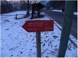 2
2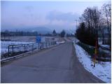 3
3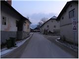 4
4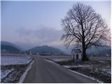 5
5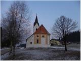 6
6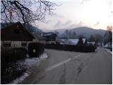 7
7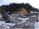 8
8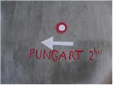 9
9 10
10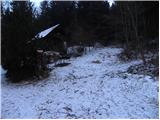 11
11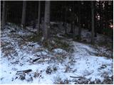 12
12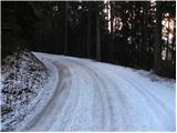 13
13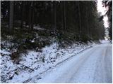 14
14 15
15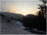 16
16 17
17 18
18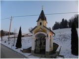 19
19 20
20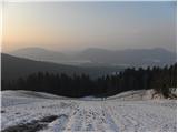 21
21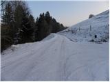 22
22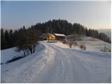 23
23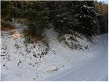 24
24 25
25 26
26 27
27 28
28 29
29 30
30 31
31 32
32 33
33 34
34 35
35 36
36 37
37 38
38 39
39 40
40 41
41 42
42 43
43 44
44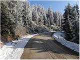 45
45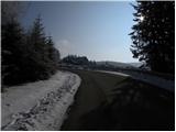 46
46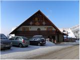 47
47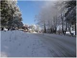 48
48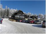 49
49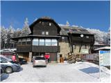 50
50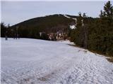 51
51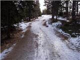 52
52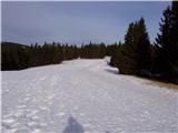 53
53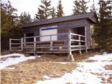 54
54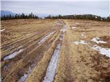 55
55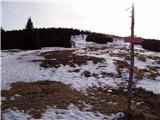 56
56 57
57
Discussion about the trail Dovže - Črni vrh