Drežniške Ravne - Lopatnik
Starting point: Drežniške Ravne (750 m)
| Lat/Lon: | 46,2729°N 13,6147°E |
| |
Time of walking: 3 h
Difficulty: easy marked way
Altitude difference: 1262 m
Altitude difference po putu: 1262 m
Map: Julijske Alpe - zahodni del 1:50.000
Recommended equipment (summer):
Recommended equipment (winter): ice axe, crampons
Views: 23.721
 | 5 people like this post |
Access to the starting point:
From Tolmin or Bovec, drive to Kobarid. From the Kobarid bypass, follow the signs for Drežnica and Vrsno. Continue over the famous Napoleon Bridge over the Soča River and turn left immediately after the bridge in the route Drežnica. Right Vrsno and mountain pasture Kitchen. The dual carriageway climbs in serpentines for about 5 km towards Drežnica. As the road levels out, we pass the memorial to the fallen in the Home Front, which is on our left. There is a panoramic sign at the monument where you can see our destination and the neighbouring peaks from Krno to Krasje Peak. We continue driving to the village of Drežnica. At the beginning of the village, turn left and follow the slightly narrower road towards Drežnice Ravne. A large information board and signs await you at the crossroads in Drežniške Ravne. Continue right up towards the mountains of Zapleč and Zaprikraj and Krasje Vrch. At the next crossroads turn right again towards the Zapleč and Zaprikraj mountains. The road narrows a little more and in a few steep bends leads to a water trough where the asphalt ends. Here we park in a small parking lot. From Drežnica to Drežniška Ravenas is about 2 km, and to the parking lot at the water trough is about 1. 5 km.
From the water trough you can take the dirt road to mountain pasture Zapleč, thus shortening the climb by 1 hour. However, the road is not always in the best condition, especially for cars with lower chassis.
Path description:
From the parking lot above Drežniške Ravne, continue along the dirt road for a few metres to the signposts where you turn right in the route mountain pasture Zapleč, Vrata and Krn. Our destination Lopatnik rises above the Vrata saddle on our right, and across the road on our left is Krasji vrh. The track leads us across a meadow to a wood where it widens into a narrower cart track which climbs moderately to gently through the wood. Higher up, the path crosses a less good dirt road, which is followed for a few steps to the right, and then a signpost for the Curk waterfall and mountain pasture points upwards to the left. From here the path climbs slightly more steeply up the grassy cart track between hazel and other lower trees. Higher up, the path dips a little and leads us through a fence into a small wood, which quickly thins out. We continue with a gentle ascent over grassy slopes, from which a fine view opens up on our right of Krnčica, Lopatnik and the saddle of Vrata and the other peaks above the mountains of Zapleč and Zaprikraj. Krasji vrh rises on our left, with Matajur behind us. The trail crosses a worse road, with a water trough by the side of the road. Follow the signs for Vrata and Krn, which point us up over the pastures. The more or less visible track climbs along an overgrown torrent bed. Here and there you will see some old markings, but orientation is not a problem. After climbing over the pasture, you reach the next wider cart track, which branches off the road for mountain pasture Zapleč and Zaprikraj. Cross cart track and continue climbing across the pasture to mountain pasture Zapleč. If you find faded markings, follow them, otherwise climb along the left-hand edge of the pasture. A marked path, overgrown in places, and cow tracks lead under the edge of the road to mountain pasture Zapleč. Above us on our left we will see a gate in the paddock through which we enter the road. Ahead of us is a TNP sign and some space for parking cars. The road continues towards mountain pasture Zaprikraj.
Go through the gate of the barrier that closes the road in front of mountain pasture Zapleč and then immediately turn right. On the stone in front of the gate of the enclosure you will see a marker for the Gate. It is about a 2 hour climb to the finish, which is straight ahead.
The beautifully marked route follows a mulatier, which climbs gently in countless switchbacks. Most of the path is grassed. In the lower part, the grass is very high in midsummer and can completely obscure the mulatier. All the crossroads are well marked, but in the grass the markings may be less visible. In the lower part of the trail, you can quickly be fooled into turning too fast or continuing too far to the left towards Vršič, so it takes some attention.
With every metre of ascent, we get better views of mountain pasture Zapleč and Zaprikraj and Krasji vrh rising above them. The view reaches the Kanin mountain range, with Stol and Matajur behind us.
Higher up, the path becomes rockier and a little steeper. Our goal seems to be getting further away with every metre we walk, even though it is still ahead of us. About 10 minutes below the saddle between Lopatnik and Krnčica, the marked mulatier climbs crosswise to the right towards Krnčica and Krno. A little further on, the path to Vrata branches off to the left, which is followed for a few steps, and then climbed over a rocky-grassy slope to the saddle between Krnčica and Lopatnik , from where the summit of Lopatnik is reached in a few minutes.
We can extend our hike along the marked trail to Krnčica or Krno, or along the unmarked trail to Monte Guarda and on along the trackless path to Krnčice.
From Lopatnik we descend along a trackless ridge to the saddle of Vrata and from here we follow the mulatier in the direction of arrival to mountain pasture Zapleč, or we can continue along the unmarked ridge path to Vrh Ruš and Vršič, from where we descend along the mulatier to mountain pasture Zaprikraj. Unfortunately, the ridge tends to get foggy and cloudy in the morning, and in poor visibility it is not recommended to continue along the ridge.
With the mountain pasture Zapleč you can also go by road to the starting point instead of crossing the pastures. After about 1 km, you will come to a large bend where the sign for the Peace Trail directs you into the forest. Here you can join the mountain trail leading to Krasji vrh and follow it down to the starting point above Drežniški Ravne.

Pictures:
 1
1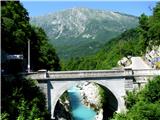 2
2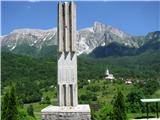 3
3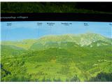 4
4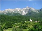 5
5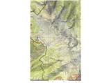 6
6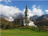 7
7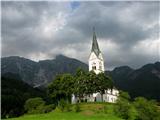 8
8 9
9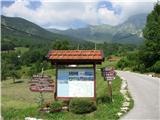 10
10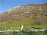 11
11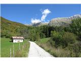 12
12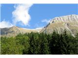 13
13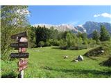 14
14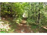 15
15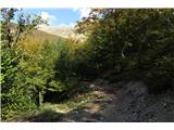 16
16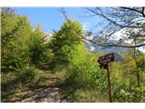 17
17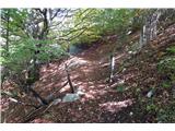 18
18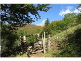 19
19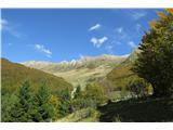 20
20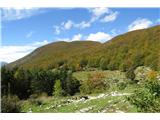 21
21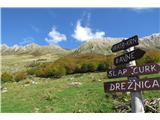 22
22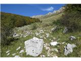 23
23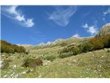 24
24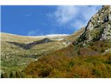 25
25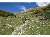 26
26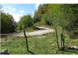 27
27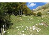 28
28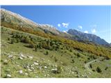 29
29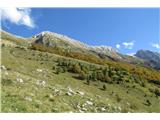 30
30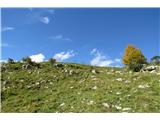 31
31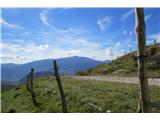 32
32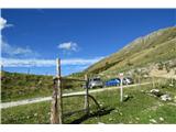 33
33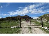 34
34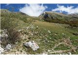 35
35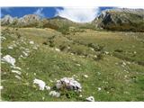 36
36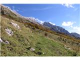 37
37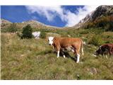 38
38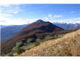 39
39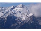 40
40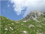 41
41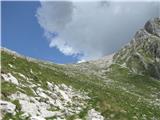 42
42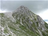 43
43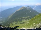 44
44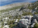 45
45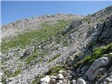 46
46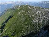 47
47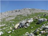 48
48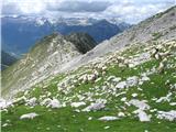 49
49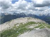 50
50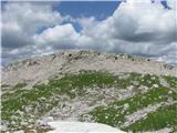 51
51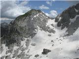 52
52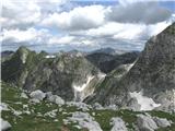 53
53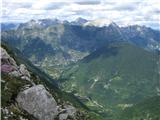 54
54 55
55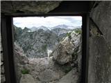 56
56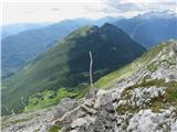 57
57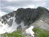 58
58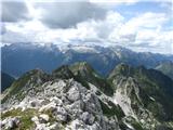 59
59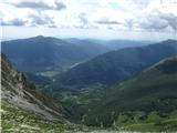 60
60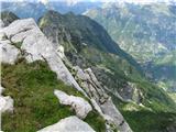 61
61 62
62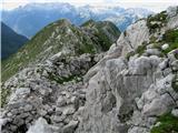 63
63 64
64 65
65 66
66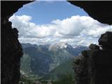 67
67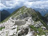 68
68 69
69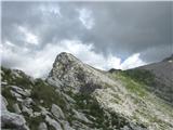 70
70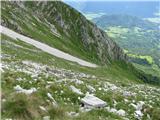 71
71 72
72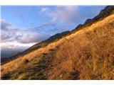 73
73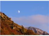 74
74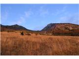 75
75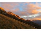 76
76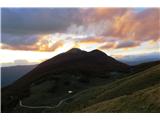 77
77 78
78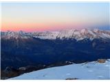 79
79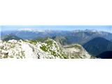 80
80
Discussion about the trail Drežniške Ravne - Lopatnik
|
| ljubitelj gora30. 12. 2013 |
Novi opis  na Lopatnik sem se povzpel v novembru začel sem na izhodišču Drežniške Ravne po cesti do parkiršče Zapleč od tam pa v strmine po cik cak potki proti Lopatniku. K sreči ni bilo zelo vroče, niti mrzlo ravno prav, poleti pa mora bit kar hud napor v vročini. Ko prispem na Lopatnik so se odprli krasni razgledi na Krnčico se nisem podal sem se pa odpravil po grebenu do Vršiča, slikovit greben, mulatjera, vojaški bunkarji, vseeno pa je greben v zimskih razmerah zelo naporn, z vrha Vršiča sem se vrnil na sedlo in sestopil več slik: https://plus.google.com/photos/114400986607884783562/albums/5947277119021183537?sort=1
|
|
|
|
| darinka42. 03. 2016 |
Ljubitelj gora , zanima me, Lopatnik, in kdaj , je primeren čas, za vzpon.Ali je izhodišče, enako, kot na Krnčico.?Se da iti krožno, mislim, če je kakšna drga pot za sestop, vendar prideš, na izhodišče.?
|
|
|
|
| IgorZlodej3. 03. 2016 |
Imaš pod "trenutne razmere-forum", če pod "iskanje" vtipkaš Lopatnik kar tri odrte teme, možnosti pa tudi kar nekaj, tudi za krožno turo. Meni najbolj ugodno v jeseni, ko še ni snega, eno tako turo sem tudi opisal pred časom. Izhodišče pa pri koritu nad Drežniškimi Ravnami ali Zapleč, če se gor pripelješ.
|
|
|
|
| darinka43. 03. 2016 |
Hvala Igor , bom pogledala.
|
|
|
|
| darinka47. 05. 2021 18:10:25 |
Kar sem slišala, se pot zarašča. Pa je škoda. Tudi cesta iz Drežniških Raven je precej luknjasta. Če je čas na razpolago je skoro bolje iti peš. Letos , ko bo sneg skopnel bo morda le kdo šel tja gor.
|
|
|
|
| mirank7. 05. 2021 19:34:28 |
Ravno nasprotno imam jaz informacijo izpred 14dni, da je cesta v popravilu. Malo slabši je le odsek v strmini takoj nad koritom, kar je bila vedno glavna težava, potem do Zapleča praktično ni nikoli bilo večjih težav.
|
|
|
|
| darinka425. 08. 2021 21:16:51 |
Bili danes . Namen je bil prehoditi celoten greben od Lopatnika vse do Kala. In spustili smo se z zadnjega vrha Kal po jarkih smrti. Vsaj tako so jih poimenovali takrat v prvi svetovni vojni. Na tem vrhu so bili avstrijski in italianski vojaki blizu . Še danes je polno ostankov iz vojnih časov. Naleteli smo na neeksplodirano ročno bombo, ki je imela še vžigalno vrvico. Tam redkokdo zaide. Razgleden greben, čeprav je bilo na Lopatniku vetrovno in hladno. Kasneje po grebenu pa vse topleje.
|
|
|