GEOSS - Sveti Florjan (Zgornja Gora)
Starting point: GEOSS (645 m)
| Lat/Lon: | 46,1203°N 14,8157°E |
| |
Time of walking: 35 min
Difficulty: easy marked way
Altitude difference: 53 m
Altitude difference po putu: 65 m
Map: Ljubljana - okolica 1:50.000
Recommended equipment (summer):
Recommended equipment (winter):
Views: 1.010
 | 2 people like this post |
Access to the starting point:
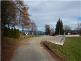
a) From the road Ljubljana - Litija, in the settlement Spodnji Hotič, turn left (from the route Litija right) in the direction of the settlement Vače. Follow the ascent to the village, then go left and follow the signs for GEOSS. In the village of Spodnja Slivna, you will reach the Vrabec Inn, from where it is only a short 100 m drive to the GEOSS parking lot.
b) From the Moravče - Izlake road, in Kandrše, by the Trata bar, turn right (left from Izlake) onto the road towards GEOSS. There is some climbing, then continue right (left Vače) out of the junction and follow the signs for GEOSS at the following junctions. Park in the parking lot next to GEOSS.
Path description:
From GEOSS return to the Vrabec Inn, and from there continue straight on in the direction of Gora. Go around the turn-off to the GEOSS Adventure Park on the left, then continue along the slightly worse road in the direction of Gora, which crosses the slopes to the right. Initially, the path offers beautiful views, but then it transitions into the forest, where it leads past a crossroads to a crossroads at the edge of the hamlet of Zgornja Gora.
Go left here and follow the signs for the path around Slivna. Above the hamlet, the road becomes steeper and in a few minutes leads us to the Church of St Florian, from which we have a beautiful view of Posavsko hribovje, and in good visibility the view extends all the way to the Alps.
Description and pictures refer to the situation in 2018 (December).
Pictures:
 1
1 2
2 3
3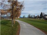 4
4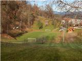 5
5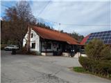 6
6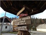 7
7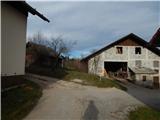 8
8 9
9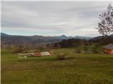 10
10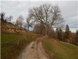 11
11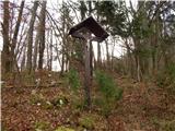 12
12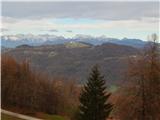 13
13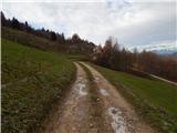 14
14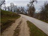 15
15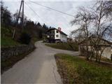 16
16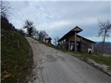 17
17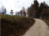 18
18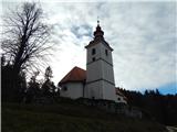 19
19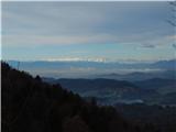 20
20
Discussion about the trail GEOSS - Sveti Florjan (Zgornja Gora)