Gorenje - Gora (Sveti Lovrenc)
Starting point: Gorenje (632 m)
| Lat/Lon: | 45,8298°N 14,144°E |
| |
Time of walking: 1 h 15 min
Difficulty: easy marked way
Altitude difference: 387 m
Altitude difference po putu: 390 m
Map: Nanos 1:50.000
Recommended equipment (summer):
Recommended equipment (winter): ice axe, crampons
Views: 7.849
 | 1 person likes this post |
Access to the starting point:
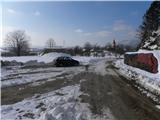
a) From the motorway Koper - Ljubljana, take the exit Postojna and then continue in the direction of Postojna. When you reach the old Ljubljana - Koper road, turn right and drive towards the centre of Postojna. A few junctions further on, turn left in the direction of Postojna cave, Predjama and Studena. Continue along the main road for a few kilometres towards Predjama, then continue straight on towards Planina and Studen. Follow the main road towards Planina for 200 metres and then turn left towards the village of Belsko. A slightly narrower road quickly leads to Belsko, where you turn right at a marked crossroads in the direction of Gorenje. Continue along a slightly steeper road, which soon leads to the start of Gorenj. Turn slightly right here and head into the centre of the village, where you will turn right again. The village ends quickly, and we continue driving for another 100 metres before parking in a suitable place on the roadside.
b) From the motorway Ljubljana - Koper, take the exit Unec, then continue to Planina. At Planina you will reach the old Ljubljana - Postojna road, and we follow it to the left (you can also reach it from the direction of Kalc near Logatec) and follow it to the crossroads, where the signs for the Postojna cave direct you to the right. At the end of Planina, the road climbs a little more, then it flattens out and leads to the village of Lohača. Follow the main road through the village of Studeno before it starts to descend more steeply. After a short descent, you will come to a crossroads where you turn right towards the village Belsko. A slightly narrower road quickly takes you to Belsko, where you turn right at a marked crossroads in the direction of Gorenj. Continue along a slightly steeper road, which soon leads to the beginning of Gorenj. Turn slightly right here and head into the centre of the village, where you will turn right again. The village ends quickly, and we continue driving for another 100 metres before parking in a suitable place on the roadside.
Path description:
From the starting point, continue along the road along which you parked, which splits into two parts after just a few metres. Continue along the marked road on the right, which climbs moderately and turns more to the left at a higher altitude. We continue to climb gently across a meadow, from where we can see Nanos to the left and Gora or Svätý Lovrenec to the right. A little higher, you reach a crossroads, at which you see some direction signs.
From the crossroads, an unmarked trail branches off to the left (to Gora), a short road branches off to the right towards a nearby hunting lodge, and we continue straight on towards Sveti Lovrenec.
From the crossroads we continue along the road for a short distance, then the markings direct us to the left onto a path that begins to climb gently through a rare pine grove. The path leads us through a meadow, after which it enters the forest and a few metres later joins the cart track. Climb briefly along cart track, and then the path changes to slightly steeper slopes, over which it begins to climb to the right. The path continues along a grassy slope, over which it climbs quite steeply for a few minutes. At first we get a nice view of the Postojna basin, then the path returns to the forest. A few minutes of moderate climbing follows and the path leads us to the top of Sveti Lovrenec.
From the top, you can descend in two minutes to the nearby church of St. Lovrenec.

Pictures:
 1
1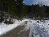 2
2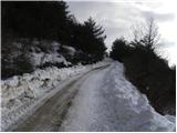 3
3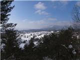 4
4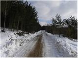 5
5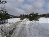 6
6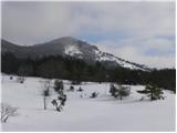 7
7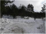 8
8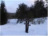 9
9 10
10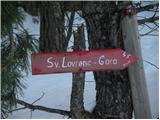 11
11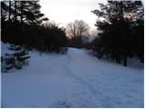 12
12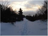 13
13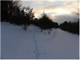 14
14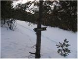 15
15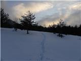 16
16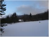 17
17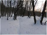 18
18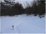 19
19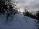 20
20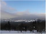 21
21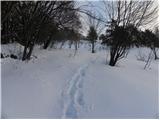 22
22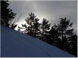 23
23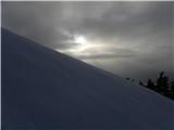 24
24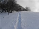 25
25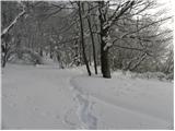 26
26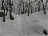 27
27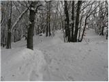 28
28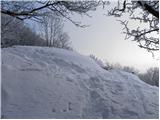 29
29 30
30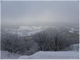 31
31 32
32
Discussion about the trail Gorenje - Gora (Sveti Lovrenc)