Hotavlje - Špik (Vranškov grič)
Starting point: Hotavlje (409 m)
| Lat/Lon: | 46,1072°N 14,1176°E |
| |
Time of walking: 1 h 35 min
Difficulty: easy marked way
Altitude difference: 499 m
Altitude difference po putu: 500 m
Map: Škofjeloško in Cerkljansko hribovje 1:50.000
Recommended equipment (summer):
Recommended equipment (winter): ice axe, crampons
Views: 969
 | 2 people like this post |
Access to the starting point:
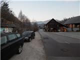
a) From Železniki, Kranj or Medvode, drive to Škofja Loka, and from there continue in the direction of Gorenje vasi in the Poljane valley and Žirem. After Gorenja vasja, in Hotavlje, leave the main road towards Žire at the junction after Gostilna Lipan and turn right towards the ski resort Cerkno and the village of Leskovica. Just after the junction, park in a suitable place on the roadside.
b) From Horjul or Polhovy Gradec, drive to Lučine and from there descend to Gorenjska vas. In Gorenjja vas, turn left towards Žire, then at Hotavlje, at the junction after Gostilna Lipan, turn right towards the ski resort Cerkno and the village of Leskovica. Just after the crossroads, park in a suitable place on the roadside.
c) From Vrhnika, Logatec or Spodnja Idrija, drive to Žiri, from there continue to Gorenjska vas and Škofja Loka, and follow the main road only to Hotavlje, where you turn left towards the ski resort Cerkno and the village of Leskovica. Just after the crossroads, park in a suitable place on the side of the road.
d) First drive to Cerkno and from there continue over the Kladje (Podlanišče) pass towards Sovodnje. From Sovodnje, drive along the Hobovščica stream, then turn left at a slightly larger junction towards Gorenje vas (right Žiri). Follow the main road towards Škofja Loka to Hotavlje, where you turn left towards the ski resort Cerkno and the village of Leskovica. Just after the crossroads, park in a suitable place on the roadside.
Path description:
From the starting point, where the vending machine of the farm pr Šupc is located nearby, continue along the road towards the village Leskovica and in the direction of the hiking trails to Blegoš, Ermanovec and Slajko. Walk along the roadside for a few minutes, partly on the pavement, and then the signs for Ermanovec and Slajka direct you to the left (straight ahead Blegoš), where you cross the bridge Kopačnica, and just after the bridge, at the church of St. Lawrence, continue to the right and gradually start climbing. At first we climb past a few more houses, then the signs direct us sharp left, where we continue for some 10 steps along cart track, and on the hayfield cart track turns into a path, which turns slightly to the right and leads us past one more house. Higher up, we cross some poorer cart tracks, and the markings lead us through the slightly overgrown path lane to an asphalt road, which we only cross. On the other side of the road, you first climb steeply and then continue along a narrower track which continues along a small valley, where the route of the power lines also runs. From the valley, you soon ascend across to the right, where you reach a ridge (here another path joins from the right), and here the path turns to the left. A little further on, cross another track, and when you leave the forest, climb quickly to an asphalt road, which you follow to the right. The tarmac road then leads us past a bench, where the path to Vrh Slajke branches off to the right, and we follow the semicircular road to the left to a nearby farm, from which we are only a minute's walk from Dom na Slajki.
From home, we return to the nearby farm, where we bypass the main buildings on the upper side and continue our journey along the dirt road, which turns into a track in the nearby meadow. Walk through the lane of a forest, and when you leave the forest, turn right (straight ahead Ermanovec) onto an unmarked path, initially a track, which continues along the edge of the forest. When the forest on the right ends, continue climbing along a grazing fence, which leads along a grassy ridge, but higher up the ridge flattens out and turns left. Continue along the edge of the forest to a viewpoint, and from the viewpoint go slightly right into the forest. Climb west to north-west through the forest, occasionally spotting an older marker along the way. After a few minutes of climbing through the forest, you reach a vegetated summit, on which stands a small cairn.
Hotavlje - Dom na Slajki 1:30, Dom na Slajki - Špik 0:20.
Description and figures refer to the situation in January and December 2020.

Pictures:
 1
1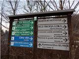 2
2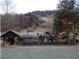 3
3 4
4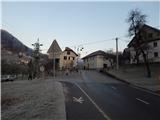 5
5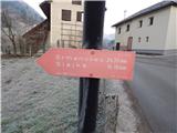 6
6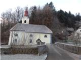 7
7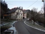 8
8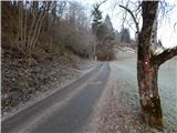 9
9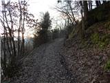 10
10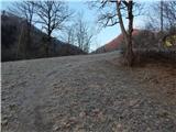 11
11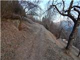 12
12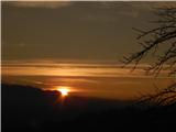 13
13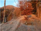 14
14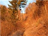 15
15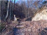 16
16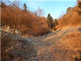 17
17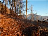 18
18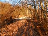 19
19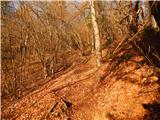 20
20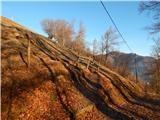 21
21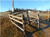 22
22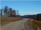 23
23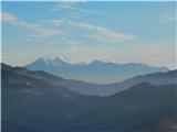 24
24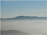 25
25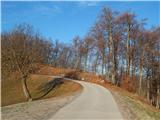 26
26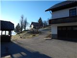 27
27 28
28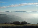 29
29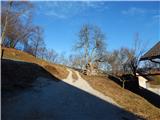 30
30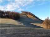 31
31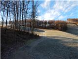 32
32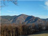 33
33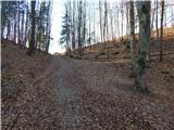 34
34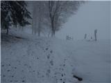 35
35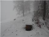 36
36 37
37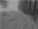 38
38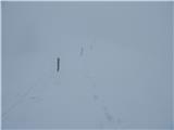 39
39 40
40 41
41 42
42 43
43 44
44 45
45 46
46 47
47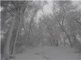 48
48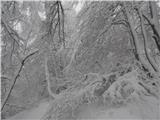 49
49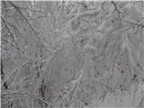 50
50 51
51
Discussion about the trail Hotavlje - Špik (Vranškov grič)
|
| ločanka10. 01. 2021 |
Včeraj na tej poti. Hvala, da ste nam predstavili ta hrib, sicer nikoli ne bi vedela zanj  . Da se pa izogneš tisti zaraščeni poti, pa predlagam, da pri sliki 14 nad klopco zavijete desno in tako odpadejo slike 15, 16 in 17. Potki se združita na grebenu, torej pri sliki 18. Tako pot delajo domačini in bolj prav imajo, je dosti bolj razgledna. Me smo za vzpon ubrale to opisano varianto, za povratek pa smo izbrale bolj uhojeno pot, kot sem napisala. Drugače pa čudovit izlet, ker do Slajke je skoraj malo premalo !
|
|
|