Hotovlja - Bukov vrh (footpath)
Starting point: Hotovlja (400 m)
| Lat/Lon: | 46,1184°N 14,1944°E |
| |
Name of path: footpath
Time of walking: 1 h
Difficulty: easy marked way
Altitude difference: 432 m
Altitude difference po putu: 432 m
Map: Škofjeloško in Cerkljansko hribovje 1:50.000
Recommended equipment (summer):
Recommended equipment (winter):
Views: 18.176
 | 1 person likes this post |
Access to the starting point:
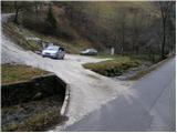
From Škofja Loka, drive towards Gorenjska vas. The road then leads to a semaphorised crossroads in the village of Poljane above Škofja Loko. Turn left here towards the village of Hotovlja. Just after the crossroads, the road crosses the Poljanščica River over a bridge and then leads to the next crossroads, where you continue to the left. The road then leads between the houses in the village, where you can also see the start of the footpath to Bukov vrh. Here we drive on for a few dozen metres to a parking area on the other side of the stream along which we are driving.
Path description:
From the parking lot, return a few metres along the road back to the marked start of the mountain trail at Bukov vrh. The path then crosses a small bridge over a stream and climbs steeply on the other side. The path continues for a good 20 minutes climbing through the forest, then leads us to a sparsely vegetated slope where the steepness eases. Here, two crosses are seen along the path, only a few metres apart. Just a little further on, the path leads us to a small hamlet, where the path continues on a worse road which we follow only for a short time. When you reach the fence, continue through the gate and continue climbing up between the fences. Follow this path, along which there are very few signs, for a few minutes until you reach a place where you come out on a bad road. Here we see a marker for Bukov vrh, which directs us along a grassy slope towards the church, which we can already see in front of us. Just below the summit, the path briefly climbs a little more and, with the views getting better and better, quickly leads us to the summit.

Pictures:
 1
1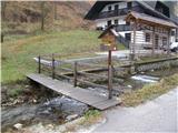 2
2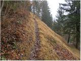 3
3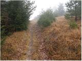 4
4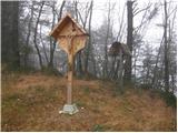 5
5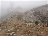 6
6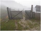 7
7 8
8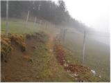 9
9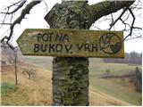 10
10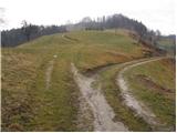 11
11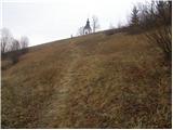 12
12 13
13
Discussion about the trail Hotovlja - Bukov vrh (footpath)
|
| KARAMELICA1. 04. 2013 |
Bila danes na Bukovem vrhu, vendar smo štartali v vasi Visoko pri Poljanah. Pot na začetku poteka po asfaltu, nato mimo osamljenih kmetij po grebenu. Glede na to, da sneg ni shojen, priporočam dobro obutev. Škoda, da je bila vidljivost slaba, saj je ob lepem vremenu prekrasen razgled na Škofjeloško pogorje. Na Bukovem vrhu stoji tudi prekrasna cerkev Sv. Sobote. Priporočam 
|
|
|