Starting point: Hudajužna (385 m)
| Lat/Lon: | 46,1747°N 13,9151°E |
| |
Time of walking: 3 h 15 min
Difficulty: easy marked way
Altitude difference: 1245 m
Altitude difference po putu: 1245 m
Map: Julijske Alpe - vzhodni del 1:50.000
Recommended equipment (summer):
Recommended equipment (winter): ice axe, crampons
Views: 27.912
 | 2 people like this post |
Access to the starting point:
From Most na Soči we are heading towards Idrija. In Bača pri Modreju turn left in the direction of Podbrdo. Pass through the villages of Klavže, Kneža and Grahovo, and after Koritnica you will arrive in Hudajužno. Just 50 metres before the sign marking the end of the village, you will see a small bridge over the river Bača on the right. As soon as you cross it, you will see a place where you can park your car.
Path description:
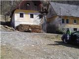
From the parking lot, go under the railway underpass and after a few steps you will come across a dilapidated house, where the sign for Porezen is clearly visible. Follow the torrent, over which a poorly visible and rather worn path stretches. After a few moments, the path leads us to the remains of a bridge (three pieces of iron), from where we walk along the torrent for about a hundred metres, then on the right we see a pile of fallen trees and markings above it. When we manage to get above the torrent, the path corrects itself and the markings are more frequent from here on.
Further walking leads us to an old house, where the path turns the other way. It starts with a moderate ascent, which leads us to a ridge. We walk along the ridge for a while, passing almost collapsed buildings, and then climb steeply to reach the top of Durnik.
We continue eastwards along the rugged ridge, past Robija vrh, until we reach the edge of the plateau, where we get a magnificent view to the south. The path leads through the spruce forest just above the southern edge of the plateau until you emerge from the dense forest and join the path coming from Podbrdo. After a few steps, we are back at the fork in the trail, where we keep to the left. The last hundred metres of walking along the ridge to the summit remain.

Pictures:
 1
1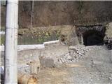 2
2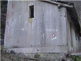 3
3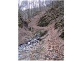 4
4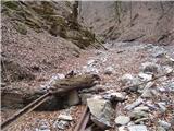 5
5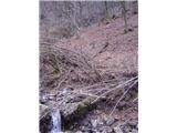 6
6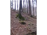 7
7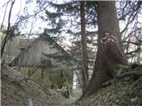 8
8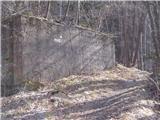 9
9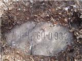 10
10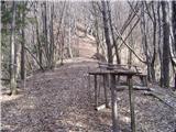 11
11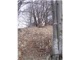 12
12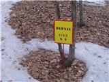 13
13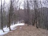 14
14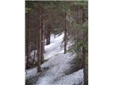 15
15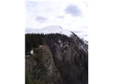 16
16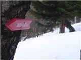 17
17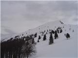 18
18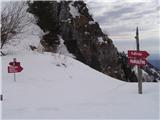 19
19 20
20
Discussion about the trail Hudajužna - Porezen
|
| marinka673. 08. 2014 |
Če štartamo z železniške postaje, je to blizu? Prišli bi namreč z vlakom iz Boh. Bistrice. OZ ali lahko krenemo že iz Podbrda, če je kaj markirano? Teh lepih krajev žal namreč sploh ne poznamo. Koliko pa je hoje na vrh Porezna? Hvala. 
|
|
|
|
| marinka677. 08. 2014 |
Miri, hvala, to znam tudi sama, ampak zanima me, če je iz PODBRDA markirana pot, verjetno si mislil Petrovo brdo?
Hvala še enkrat.
|
|
|
|
| valerija1127. 08. 2014 |
Marinka,tudi iz Podbrda je markirana pot na Porezen.Začneš v bližini železniške postaje.
Varen korak in obilo užitkov.
|
|
|
|
| valerija1127. 08. 2014 |
Dodajam,okviren čas hoje Podbrdo-koča na Poreznu je 3 ure.
|
|
|
|
| marinka6711. 08. 2014 |
Hvala, super. Torej bomo združili dve doživetji:vožnjo z vlakom skozi tunel in vzpon na Porezen. Super za otroke in velike"otroke"! 
|
|
|
|
| LidijaJesih17. 01. 2016 |
Markacije na hiški na sliki 3 so prebarvane, pot skozi grapo pa težko prehodna. Takoj za prehodom s slike 2 se na desno dvigne strma steza, ki pripelje na greben in če ji sledimo, se združi po kakšne pol ure z markirano potjo. Posebej označena ta sprememba ni nikjer, povedala je domačinka na izhodišču.
|
|
|
|
| Matjaž6093. 01. 2020 |
Iz Hudejužine proti Poreznu se je spremenil pristop. Pristop pri železniški postaji se opušča, ga ne vzdržujejo več. Preko reke Bače je potrebno iti tam, kjer je smerokaz za Zakojco. Po nekaj sto metrih so nove markacije, ki sovpadajo z markacijami maratona. Nova pot se kasneje združi s staro, ki pelje preko Durnika.
|
|
|
|
| Lapuh20719. 09. 2021 16:06:04 |
Včerajšnji lepi popoldan smo izkoristili, da se s tega izhodišča v Hudajužni povzpnemo na Durnik (1152m); za več bi nas že lovil mrak. Novi pristop, ki ga zgoraj omenja Matjaž, se začne v spodnji Hudajužni, slab kilometer od železniške postaje ob Bači navzdol. Mi pa smo preverili varianto, ki jo omenja zgoraj Lidija, in ni nam bilo žal. 100m po prehodu pod železnico (čisto blizu postaje) se v grapi, še pred stavbo na sliki št. 3, ostro v desno odcepi stezica v precejšno strmino, a kar kmalu doseže greben. Zdaj ostro levo in po manjšem travniku naravnost navzgor v gozd, kjer se vije stezica, pravzaprav več stezic. Lahko slediš tudi drogovom el. napeljave, pa kmalu prideš do opustele kmetije Na Rovtu. Nad kmetijo nadaljuješ naravnost gor po slabo vidni stezici v gozd in malo pod grebenom prideš na markirano stezo, po kateri poteka gorski maraton štirih občin. Gozdovi, strmine, pustote, mir, lepi razgledi. Nekaj slik naložim v forum. Srečali nismo nikogar.
|
|
|