Kamnolom Ljubelj - Vranilac (Kalnik) (path 2)
Starting point: Kamnolom Ljubelj (220 m)
Name of path: path 2
Time of walking: 1 h 10 min
Difficulty: partly demanding marked way
Altitude difference: 423 m
Altitude difference po putu: 423 m
Map:
Recommended equipment (summer):
Recommended equipment (winter): crampons
Views: 6.616
 | 2 people like this post |
Access to the starting point:
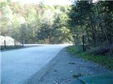
a) Leave the Varaždin - Zagreb motorway at the exit for Novi Marof, and turn left towards Ljubeščice. After a kilometre, turn right towards the village of Ljubelj and the Ljubeščica quarry, which is visible from the motorway. Continue past the quarry and some farms along Križevačka Street. The road then turns into a gorge and a little further on to another quarry, from which the road continues towards the villages of Kalnik and Borje. Park in a mediocre place at the beginning of the quarry.
b) From the old road Varaždin - Zagreb, at Novi Marof, take the exit towards Varaždinske Toplice at the roundabout. A little further on, you will reach a crossroads from where you can enter the motorway. Continue in the direction of Ljubelščice, then follow the above description.
Path description:
From the starting point, continue through the quarry along the unpaved road Ljubelj - Borje. There are a few parking places behind the quarry. When you reach the Sanctuary of the Hrušovská Mother of God, the first slight climb begins. Leave the road after about 15 minutes and then continue left into the forest. Continue along cart track, which climbs steeply through the forest and follow the signs. Along the way you will also see a ski jump for mountain bikers. A little further on, trail 2b, which was built a few years ago, branches off to the left from our trail and its purpose is to avoid three streams that are more difficult to cross in the rain, but we continue to the right slightly downhill and soon arrive at the crossing of the first stream, where there is still a lot of mud a few days after the rain. On the other side of the stream, the path starts to climb steeply, but it ends at the second stream (also here it is quite muddy after rain). Here the path leaves the cart track for a while and changes to a narrower forest path. When we return to cart track we have a third stream crossing. The path then leaves cart track again, but only for 2 minutes, and then returns to another wider cart track, where it almost imperceptibly joins path 2b on our left. Here the path is laid, and then a slight ascent leads to a larger crossroads.
At the crossroads, we join the path from Varaždininske Toplice via Pec, the educational path and the unofficial path along the forest road towards the mountain lodge. Continue ahead and follow the signs for the summit. Three successive paths to the mountain lodge branch off from the trail to the left, and the path from Novi Marof and the Zagorje mountain trail join us from the right. A little higher, at some old willows, continue to the right towards the summit (the branch is marked).
Here the path becomes slightly more difficult and continues along steep partly rocky slopes, which are also slightly exposed in some places. There are a few short ascents and descents and the path leads to a beautiful viewpoint. Before reaching the ridge, two difficult paths branch off to the left towards the Sedmi zob rock. When we reach the ridge, a beautiful view opens up to the south-east, and we continue to the right to the west and quickly arrive at the base of the peak. Here, we are helped by a rock to climb over the steep rock to the summit. There is a geodetic point at the top, and the registration book is slightly below the top, reached by a cable car.

Pictures:
 1
1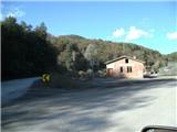 2
2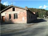 3
3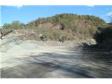 4
4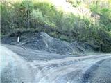 5
5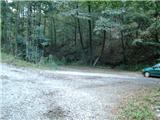 6
6 7
7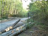 8
8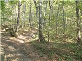 9
9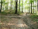 10
10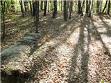 11
11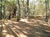 12
12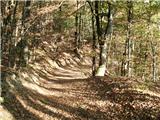 13
13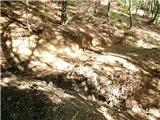 14
14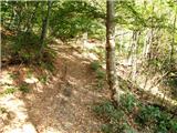 15
15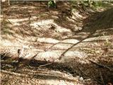 16
16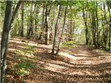 17
17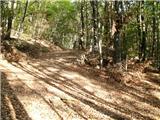 18
18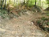 19
19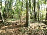 20
20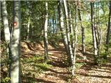 21
21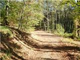 22
22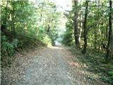 23
23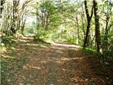 24
24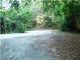 25
25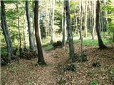 26
26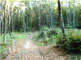 27
27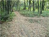 28
28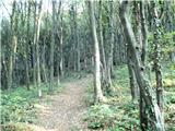 29
29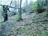 30
30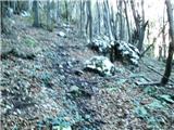 31
31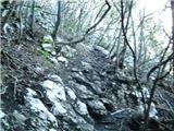 32
32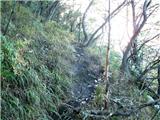 33
33 34
34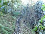 35
35 36
36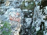 37
37 38
38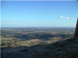 39
39 40
40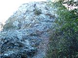 41
41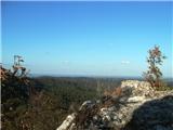 42
42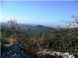 43
43
Discussion about the trail Kamnolom Ljubelj - Vranilac (Kalnik) (path 2)
|
| Marx2. 10. 2012 |
Zdaj sam opazil napako v opisu - ko pridemo na greben nadaljujemo desno na zahod , ne levo na vzhod. Opravičujem se za napako , ampak na tem je mestu na poti nemogoče zgrešiti ker je tja vrh viden.
Na vrhu se nahaja tudi katastarski stolp ki je viden z okolja (visok je nekaj več kot en meter).
|
|
|
|
| Marx26. 12. 2012 |
Neposredno pri razpotju kjer se odcepi varianta 2b (slika 12) je še eno razpotje kjer se nalevo odcepi pot do izvira kjer se lahko okrepčimo.
|
|
|
|
| Marx4. 08. 2013 |
V izdelavi je tudi varianta 2c. Ta se bo ob poti 2 odcepila nekjer med slikami 7 i 8 in šla strmo navzgor do vrha Peca ki je v gozdu in nima razgled , ampak je ob njemu zelo interestanten gozdni svet. Za zdaj je markirano več kot pol poti , ob vrhu Peci se bo ta varianta priključila na pot ki z Varaždinskih Toplic gre skoz vaz Kapelski Ljubelj. Ta pot na pot 2 pride na raspotju na sliki 25.
|
|
|
|
| zdomec12. 09. 2013 |
Pred tremi tedni sem obiskal Kalnik. Vozilo sem parkiral pri tistem svetisch (Majka bozja hrusovska)Od gdaj obstaja in gdo je to naredil
Kaj pomeni tisto Svetisce. Kar lepo je urejeno, in kot se vidi po zahvalnim predmetom kar obiskano. Ima svetisce kak pomen. Ce gdo kaj vec ve o tem, bi prosil za pojasnilo.
Mogoce bi Marx vedel nekaj vec povedati.
|
|
|
|
| Marx5. 12. 2014 |
Ko sam zadnjič šel po poti sem videl da je pot rahlo zmenjen.
Zdaj na sliki 24 ne gremo več desno , ampak rahlo levo rahlo navzgor na opuščen kolovoz. Ta nas spet pripelje na razpotje na sliki 25. Ni problema če na sliki 24 le nadaljujemo po stari poti , spet bomo prišli na razpoje, ampak je ta pot zdaj izjemno blaten.
|
|
|
|
| zdomec6. 12. 2014 |
Letos avgusta ko sem obiskal Kalnik, sem si izbral eno malo daljso varijanto pristopa. Pearkiral sem avto pri svetiscu matere bozje hrusovske in se podal na pot stv. 4. Od svetisca se pot rahlo spusti in takoj potem dvigne po gozdu navzgor do prvega krizisca na katerem se pridruzi pot od varazdinskih toplic. Potem se pot nadaljuje zmerno do drugega krizisca-sedla na katerem se pridruzi pespot od novega marofa in PZP. Iz sedla se pot spusca na sedlo in do makadamske ceste Ljubelj-Burje. Po cesti ca. 50 metrov navzgor do prvih markacij kjer se zacne "Poucna staza". Tukaj se lahko odlocimo, ali takoj na glavni greben in po njem do vrha, ali pa po stazi do doma. Ta pot je daljsa, ca. 2 h do doma, ampak zelo lepa. Ob vrnitvi do avta po poti stv. 2 sem srecal prijaznega mozakarja-markacista, kateri mi je podrobneje pojasnil vse varijante in je rekel da se markira pot 2b katera naj bi vodila tudi na vrh Pece, (manjsi vrh v kalnickem pogorju. Mozakar je bil pravi leksikon informacij. Pravil mi je da vecinoma sam skrbi za markacije in tavle ter pozna celotno kalnicko pogorje. Prav prijetno je bilo se z njim pogovarjati. To pot priporocam vsem tistim ki si zelijo malo daljsi sprehod po gozdovih kalnika. 
|
|
|
|
| Marx7. 12. 2014 |
Zdomec!
Pravi cilj te poti je vrh Mali Kalnik na keterem se nahajajo ruševine stareg gradu. Vrh se strmo vzdiga nad vasjo Gornja Rijeka.
Dal si mi namig za še en opis poti na Kalniku. V prihodnosti bom šel po ti poti , ter jo z Maleg Kalnika nadaljeval vse do Vranilca. Ob cesti Kalnik-Borje je pak mogoče izbrat kar tri variante - Poučno stezo , obhodnico ZPP (Oba pridu do doma , učna po južem , obhodnica po severnem podstenju) ter varianto ki prek razglednika Zmijski vidikovac in uzletišča jadralcev Drugi start pride na vrh - ta je v enem delu tudi zahtevna.
Možaker ki si srečal je pa legendarni Štefek Jembrek ki volonterski skrbi za poti in markacije na Kalniku. Moje je mnenje da bi Kalnik bil kar zapuščen da njega ni. Razen planinskih poti je uredil tudi stezo za brdske kolesarje B.O.K. (Biciklom oko Kalnika)
|
|
|