Koča na Šumiku - Žigartov vrh
Starting point: Koča na Šumiku (1100 m)
| Lat/Lon: | 46,48469°N 15,44292°E |
| |
Time of walking: 1 h 55 min
Difficulty: easy marked way
Altitude difference: 246 m
Altitude difference po putu: 340 m
Map: Pohorje 1:50.000
Recommended equipment (summer):
Recommended equipment (winter): ice axe, crampons
Views: 255
 | 1 person likes this post |
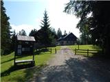
Access to the starting point:
a) From the motorway Ljubljana - Maribor take the exit Slovenska Bistrica - south, then follow the signs for Šmartno na Pohorju, and from there drive to the settlement of Smrečno. Continue along forest roads to Pohorje, where you drive along the Bistrica River. Higher up, we merge with the road leading past the Ruška hut on Pohorje. Here go left towards Osankarica, and at the next crossroads turn slightly right towards the Šumik estate (slightly left Osankarica). When you get to the estate, park in the gravel parking lot in front of the estate.
b) Leave the Štajerska motorway at the exit for Slivnica and Rogoza, then follow the signs for Pohorje and Areh. The road continues through Spodnje and Zgornje Hoče, Slivnica Pohorje, and after the settlements follow the signs for Areh. From Areh, follow the signs for Cojzerica and Šumik and Osankarica. After a few kilometres go slightly right towards the Šumik estate (slightly left Osankarica). When you reach the estate, park on the gravel parking lot in front of the estate.
c) Drive to Ruše, then follow the road towards Fala. After crossing Lobnica, go left in the direction of Smolnik and Šumik, then follow the signs for Šumik estate, where you park in the parking lot in front of the Forestry Cottage at Šumik.
Path description:
From the starting point, follow the marked trail towards Osankarica and Koča na Klopnem vrhu (a slightly shorter unmarked trail leads along the road), where you will climb back to the road through the lane of a forest. When you reach the road, continue straight on (right Ruše), and at the nearby fork in the road, take the road slightly left (slightly right Klopni vrh), which will quickly take you to a marked crossroads.
From the crossroads, continue left downhill (straight Koča na Pesku and Tiho jezero, right Klopni vrh) and follow the moderately steep path back down to the road, where you will join up with a slightly shorter path that leads along the road. Cross the road, and a little lower still, cross Lobnica, after which return to the road. Continue along the road to the left and pass the trail branch to Rušy - the Holcarska trail at Lobnica, which leads past the two Šumik waterfalls and past the trail branch to Črni jezero and Sv. Trem kralji (St. Three Kings).
At both crossroads, follow the trail towards Ruška koča na Arehu, and it soon leaves the road, crossing a little higher up the road towards Osankarica. There is a cross-country climb up the northern slopes of Bajgotov Peak (1161 m), then the path becomes flat and we follow the markings at the crossroads. The way ahead leads us along a worse macadam road, and after a short descent we cross a wider macadam road. There is some more walking through the forest, and then we reach another road, where the path from Sv. Treh kraljev joins from the right. Continue along the road to the nearby NOB monument, from where you continue along the marked path, and a few minutes higher up the path joins the cart track, where you follow the markings. Higher up, cross the worse forest road, and a little further on, arrive at a marked crossroads, where the path to Žigartov vrh branches off to the left.
Continue in the route mentioned above (straight ahead Ruška koča na Arehu) and initially follow the wider cart track. Continue to cross the slopes to the left, and when the forest ends, continue right in a belt of sparse young forest on an often overgrown path, with signs along the way. After less than 5 minutes, you reach another path, which you follow to the right, and continue through the forest to Žigart Peak.
Description and pictures refer to June 2022.

Pictures:
 1
1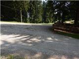 2
2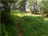 3
3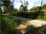 4
4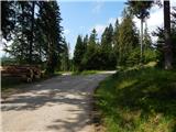 5
5 6
6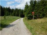 7
7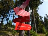 8
8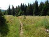 9
9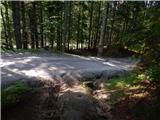 10
10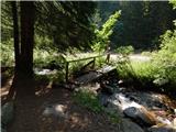 11
11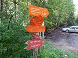 12
12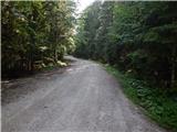 13
13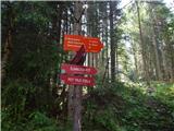 14
14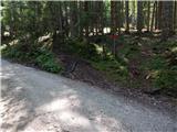 15
15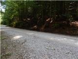 16
16 17
17 18
18 19
19 20
20 21
21 22
22 23
23 24
24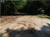 25
25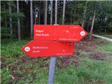 26
26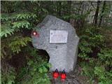 27
27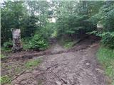 28
28 29
29 30
30 31
31 32
32 33
33 34
34 35
35 36
36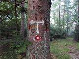 37
37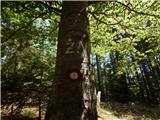 38
38 39
39 40
40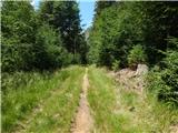 41
41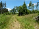 42
42 43
43 44
44 45
45 46
46 47
47 48
48 49
49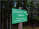 50
50
Discussion about the trail Koča na Šumiku - Žigartov vrh