Kozarnice - Iztokova koča pod Golaki
Starting point: Kozarnice (1068 m)
| Lat/Lon: | 45,9619°N 13,8561°E |
| |
Time of walking: 25 min
Difficulty: easy marked way
Altitude difference: 192 m
Altitude difference po putu: 192 m
Map: Goriška 1:50.000
Recommended equipment (summer):
Recommended equipment (winter):
Views: 7.174
 | 1 person likes this post |
Access to the starting point:
a) From central Slovenia, first drive to Logatec and then continue towards Idrija. At Kalce near Logatec, turn left towards Colo, then continue along the winding road towards Colo. Turn right at Col and then left after 100 m in the route Predmeja. Continue along the road, which is sometimes a little narrower and also partly winding, to Predmeja. At the end of Predmeja turn right towards Lokva (left down Ajdovščina), and we follow the main road for another 2 km, or until the sign for Golake, which directs us right onto a forest road. The road, still asphalted at first, soon becomes macadam, and we follow it straight ahead at the first crossroads, then right at the second, and then drive another 100 m or so to the parking lot at the end of the carriageway.
b) From the expressway Razdrto - Nova Gorica take the exit Ajdovščina and follow the road towards the village Lokavec (Lokavac can be reached from the centre of Ajdovščina, or from the old road Ajdovščina - Nova Gorica, where you turn right at Cesta). From Lokavac, continue driving along the ascending winding road in the direction of Predmeja. When the road is slightly smother, we reach a crossroads where the road from Cola joins us from the right, and we continue straight ahead and follow the main road for another 2 km, or until we reach a sign for Golake, which directs us to the forest road on the right. The road, still asphalted at first, soon becomes gravel, and we follow it straight ahead at the first crossroads, then right at the second, and then drive another 100 m or so to the parking lot at the end of the carriageway.
Path description:
From the parking lot, continue along the wider cart track, which begins to climb steeply through the forest. The forest soon thins out, and we see a spruce tree with an unusual shape along the way, rather reminiscent of the so-called columnar spruce. We continue along the relatively winding cart track, which joins a dirt road just a few minutes higher up, which we follow to the right. Follow the road to the first crossroads, from where you continue straight ahead along the marked footpath, which takes you 5 minutes to reach Iztok's hut below Golaki.
Pictures:
 1
1 2
2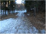 3
3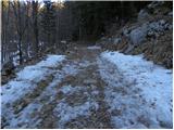 4
4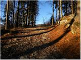 5
5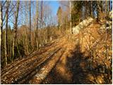 6
6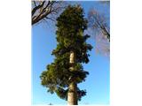 7
7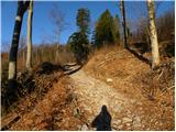 8
8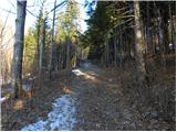 9
9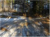 10
10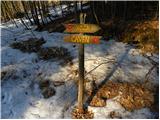 11
11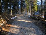 12
12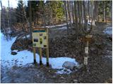 13
13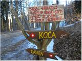 14
14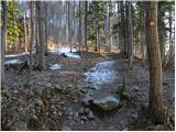 15
15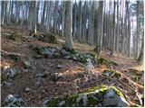 16
16 17
17 18
18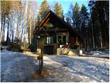 19
19
Discussion about the trail Kozarnice - Iztokova koča pod Golaki