Starting point: Križevska vas (584 m)
| Lat/Lon: | 46,1091°N 14,7147°E |
| |
Time of walking: 40 min
Difficulty: easy marked way
Altitude difference: 252 m
Altitude difference po putu: 252 m
Map:
Recommended equipment (summer):
Recommended equipment (winter): ice axe, crampons
Views: 1.990
 | 3 people like this post |
Access to the starting point:
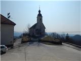
a) From the Ljubljana - Celje motorway, take the Šentjakob exit and follow the road towards Litija. From the roundabout at Dolsko, take the exit towards Vinje, and at the next junction turn right towards Križevska vas. You will then follow a slightly narrower and mostly ascending road for approximately 5 km to the Church of St. Cross in Križevska vas. Park in a suitable place near the church.
b) First drive to Litija, then continue to Ljubljana. When you reach the crossroads at Senožeti, take the exit towards Senožeti. The road then immediately leads into the village, where you turn right at the junction and drive past the fire station, after which you reach the next junction, where you turn left. Continue straight ahead and follow the road until you reach Velika vas, where you turn left. Continue to Križevska vas, where you park in a small parking lot near the Church of the Holy Cross.
Path description:
Opposite the church, next to the playgrounds, you will see a sign for St Nicholas, which directs you to a path that passes the playgrounds on the left and a nearby house on the right, after which you will come to cart track, which you will follow to the right. At first, cart track opens up a nice view of Križevska vas and the surrounding hills, then the path turns into a forest, through which it climbs all the way up cart track, which makes some serpentines. Higher up, the ridge of Ciclja is reached, and we continue to the right (Buven farm and Murovica on the left), following cart track, which turns into a gradually steeper footpath a little higher up. As the path regains a higher level, the hunting trail from Velika vas joins us on the right. Here again we continue straight on and after a minute's further walking we arrive at the forested Cicelj
Pictures:
 1
1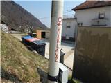 2
2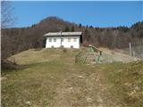 3
3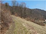 4
4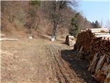 5
5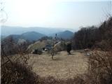 6
6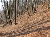 7
7 8
8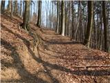 9
9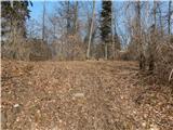 10
10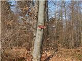 11
11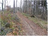 12
12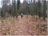 13
13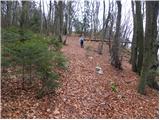 14
14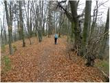 15
15 16
16
Discussion about the trail Križevska vas - Cicelj