Kurnikovo sedlo - Hochobir (Ojstrc) (footpath)
Starting point: Kurnikovo sedlo (997 m)
| Lat/Lon: | 46,4858°N 14,5334°E |
| |
Name of path: footpath
Time of walking: 3 h 5 min
Difficulty: easy marked way
Altitude difference: 1142 m
Altitude difference po putu: 1142 m
Map: Karavanke - osrednji del 1:50.000
Recommended equipment (summer):
Recommended equipment (winter): ice axe, crampons
Views: 26.013
 | 2 people like this post |
Access to the starting point:
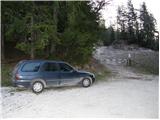
After crossing the Jezersko border crossing or Pavličevo sedlo, drive to Železna Kaplo / Eisenkappel from where you continue westwards in the direction of "Hochobir". Follow this road for about 3km to a junction where a signpost for the "Eisenkappler Hütte" directs you to the right onto a further asphalted road, which begins to climb steeply and leads you higher up to where the toll is collected. Park here in the marked parking area.
In winter there is a ban on driving and parking.
Path description:
From the parking lot, continue along the asphalted road, which climbs moderately, mostly through the forest. The road crosses several torrential streams and after an hour's walk leads to Obirsko mountain pasture.
From mountain pasture, where the shepherd's tent stands, continue along the road, which soon makes a big right turn. After the bend, a marked footpath branches off to the left uphill (possible continuation on the road). The path, which starts to climb slightly steeper, crosses cart track and takes us through the forest in less than 30 minutes, leading to a worse forest road. The road takes us higher out of the forest and then turns left. After a few metres, the footpath leads to the grassy slopes below the 'Eisenkappler Hütte', which is only a few steps away.
In the summer season, when the road is open, you can drive almost all the way to the Eisenkappler Hütte (this shortens the journey by about 1. 5 hours).
From the hut, continue in the direction of the nature trail (Naturkundlicher Rundwanderweg), which climbs moderately, partly through the forest and partly across meadows. Along the way, there are educational signs which tell you interesting things about the area you are walking through. The trail then crosses the wods at the emergency shelter and continues through increasingly sparse forest. Just a little further on, we get a beautiful view of Obir with its highest peak Hochobir / Hochobir. The path, which is very wide in places, then leads us to the grassy slopes where we can look out towards Slovenia and see the ridge of the Košuta Mountains. At 2042m we reach the ruins of the former highest Austrian meteorological station.
We continue on and the trail leads us to a crossroads where we join the trail from Schajda / Zell-Scheid. From the crossroads to the summit, we have only a few minutes of easy walking on the panoramic mountain slope.
Starting point - Obirska planina 1:00, Obirska planina - Eisenkappler Hütte 30 minutes, Eisenkappler Hütte - Hochobir 1:30.

Pictures:
 1
1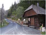 2
2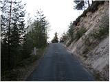 3
3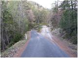 4
4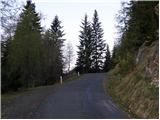 5
5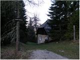 6
6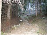 7
7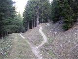 8
8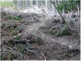 9
9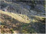 10
10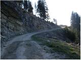 11
11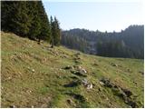 12
12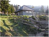 13
13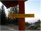 14
14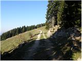 15
15 16
16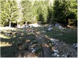 17
17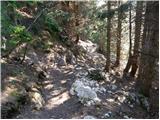 18
18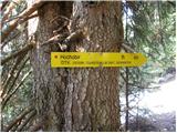 19
19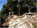 20
20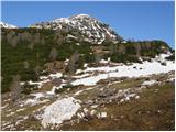 21
21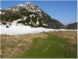 22
22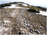 23
23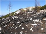 24
24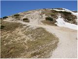 25
25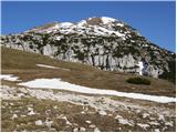 26
26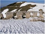 27
27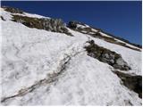 28
28 29
29
Discussion about the trail Kurnikovo sedlo - Hochobir (Ojstrc) (footpath)
|
| francija15. 08. 2009 |
fajn izlet. Bili danes na vrhu 
|
|
|
|
| geppo9. 09. 2010 |
2008 je bila 5evrov. Plačala se je pa v planinski koči kjer parkiraš.
Lp
|
|
|