Laško - Storžič (via Javornik)
Starting point: Laško (740 m)
| Lat/Lon: | 46,3256°N 14,3969°E |
| |
Name of path: via Javornik
Time of walking: 4 h 10 min
Difficulty: easy marked way
Altitude difference: 1392 m
Altitude difference po putu: 1450 m
Map: Karavanke - osrednji del 1:50.000
Recommended equipment (summer):
Recommended equipment (winter): ice axe, crampons
Views: 63.126
 | 4 people like this post |
Access to the starting point:
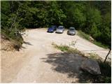
a) From the motorway Ljubljana - Jesenice, take the exit Kranj - East, then continue driving in the direction of Jezersko. When you reach Preddvor, leave the main road and turn left towards the centre of the town, and from there follow the signs for Bašelj. When we arrive in Bašelj, first at the beginning of the left turn in the direction of straight ahead there is a narrower road leading to the parking lot at the log cabin TD Bašelj (in the descriptions the starting point Bašelj), and from the mentioned crossroads we continue along the main road for another 100 m to the next crossroads, where we continue to the right along the road towards the Gamsovemu raje and the hamlet Laško (Laško hamlet). Only about 50 m further on, continue along the left-hand road, which gradually starts to climb moderately. At the hamlet of Laško, turn left again, then the asphalt ends and you continue along a steep macadam road, which you follow to a parking area, at a small crossroads. There are red mountain direction signs at the crossroads.
b) From the motorway Jesenice - Ljubljana, take the exit Kranj - West and continue left at the first junction. Continue through the underpass under the motorway and then to the roundabout, from where you continue in the direction of Golnik. The road continues through Mlaka pri Kranju, and at the end of the village we turn right in the direction of Srakovlje. Then drive through Srakovlje, Spodnja Bela, Srednja Bela, Zgornja Bela (in Zgornja Bela we join the road from Preddvor) to Bašlja, where the main road makes a long left turn, where a narrower road continues in a straight direction, leading to the parking area at the log cabin TD Bašelj (in the descriptions the starting point Bašelj), and from this junction we continue along the main road for another 100 m to the next junction, where we continue right along the road towards Gamsovem raje and the hamlet of Laško. Only about 50 m further on, continue along the left-hand road, which gradually starts to climb moderately. At the hamlet of Laško, turn left again, and then the asphalt ends and you continue along a steep dirt road, which you follow to a parking area at a small crossroads. There are red mountain direction signs at the crossroads.
Path description:
From the parking lot, take the steep cart track towards Lovrenec. The steepness soon gives way and the path leads to a crossroads where the path to the church Sveti Lovrenc branches off to the right. We continue on the lower dirt track, which again climbs steeply and after a 15-minute walk from the car leads us to our home in Lovrenec. At the house we continue along the path towards Storžič. After a few steps, the path leads us out of the forest and onto the meadows below the church. The church Sveti Lovrenc can be reached in a few minutes on foot through the meadow. At the church, we turn slightly right into the wods, where a gently descending dirt track leads us to an undistinguished little seat, where we join the path from a slightly higher starting point. Continue in the route Storžič on the cart track, which climbs gently. After a few minutes, Cart track turns into a footpath which starts to climb steeply through the forest. After about half an hour's walk from where the track ends, you emerge from the forest. Beautiful views of the southern slopes of Storžič open up. The steepness of the trail does not let up for another 30 minutes to the bench at the crossroads. Continue to the left towards Javornik and Poljana (Kališče on the right). The trail continues westwards across the southern slopes of Storžič with a few short descents and ascents. After 20 minutes of traversing, you reach a crossroads in the south-western ravine of Storžič. Planina Javornik is visible to the left (5 minutes) and we head right towards Storžič (along a gully). The path starts to climb along an initially narrower gully, which soon widens. The steepness of the path starts to increase and the path climbs up the steep grassy slopes of the south-west gully Storžič. In winter, this part of the trail is prone to avalanches. After an hour and fifteen minutes of ascent, the path leads to a ridge with a fine view to the east. From here, continue left along the summit slope Storžič, the top of which can be reached in 15 minutes on foot.
Laško - Javornik 2:15, Javornik - Storžič 1:55.

Pictures:
 1
1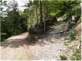 2
2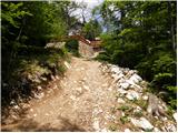 3
3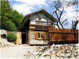 4
4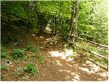 5
5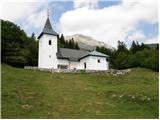 6
6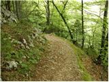 7
7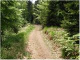 8
8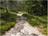 9
9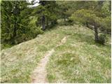 10
10 11
11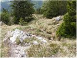 12
12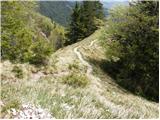 13
13 14
14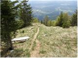 15
15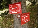 16
16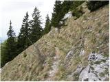 17
17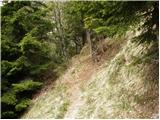 18
18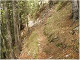 19
19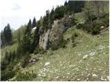 20
20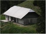 21
21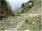 22
22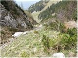 23
23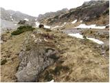 24
24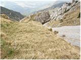 25
25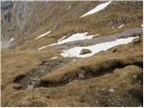 26
26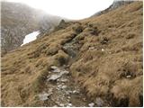 27
27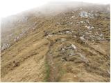 28
28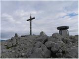 29
29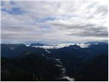 30
30
Discussion about the trail Laško - Storžič (via Javornik)
|
| MartinaZ1. 07. 2008 |
29.06.08 smo prehodili to bot. Bila je ena najlepših. Zelo slikovita in razgibana, ob poti veliko rož. Srečo pa smo imeli, da se je sonce malo skrivalo, drugače bi bili pečeni-dobesedno  Priporočam zgodnji štart.
|
|
|
|
| Fazo2. 08. 2009 |
Okoli krničarjeve koče na planini javornik je vse razrito, po grapi navzgor pa je še polno podrtega drevja od pretekle zime. Tu je pot prav "grda" vse ostalo je pa super. Danes je bilo prekleto vroče!
Lp, matevž
|
|
|
|
| Mate076. 09. 2009 |
Tole pot sem opravil danes v Nedeljo. Pot je zelo dobro označena edino nekje na sredini poti je razpotje DESNO (Kališče) ali LEVO ( za lažjo pot se obrnite LEVO...slika 16. Je pa sama tura zelo naporna, tako da za kakšne, ki nimajo kondicije odsvetujem.
Jaz sem porabil celih 4 ure, da sem prišel gor. Sem pa namerno toliko časa hodil, ker sem veliko počival in si ogledoval naša mesta, naselja, vasi, gore, planine....
|
|
|
|
| pikicapikica11. 04. 2010 |
Zanima me, če je to najlažja/najmanj nevarna pot na Storžič? Če ne, katero pot svetujete? Katera pa je najlepša? Kondicija ni problem, imam pa strah pred prepadi. Hvala lepa!
|
|
|
|
| Bojan_A11. 04. 2010 |
Ta pot in tista s Povelj sta edini povsem brez varoval. V kopnem sta povsem varni. Trenutno - pozimi pa je seveda drugače.
|
|
|
|
| serajko11. 04. 2010 |
Pikicapikica
Ta pot je varna šele ko povsem skopni sneg. Vtem času je še velika nevarnost talnega plazu , ki skoraj vsako leto pustoši po žlebu. Zoprna je tudi po dežju saj postane blatna: V slučaju slabše kondicije je možen pohod tudi od Doma pod Storžičem . Lansko leto je ta vzpon opravila brez problemov pohodnica s podobnimi problemi " vrtoglavico". Če rabiš več info, pošlji zs pa ti pojasnim detalno.
lp
|
|
|
|
| pohodnica5313. 04. 2010 |
Hojla pikicapikica; ja, pohodnica53 je lani poleti, kljub vrtoglavosti in strahu pred prepadi, brez problemov prilezla na Storžič  ; bilo je krasno,nič prepadno (Psice sem se izognila na široko hehehe), startala pa sem od Doma pod Storžičem, nato mimo Velike in Male Polane ter planine Javornik, sicer pa ti bo serajko zagotovo pomagal z izčrpnimi informacijami tako kot je meni; pa lp
|
|
|
|
| Iguana25. 05. 2010 |
Bojan A, bo zaziher vedel.....je še dosti snega na poti iz Laškega do vrha Storžiča?
|
|
|
|
| Gorazd G25. 05. 2010 |
Laško-Kališče-Storžič(vzhodni greben)-JZ grapa-Lovrenc-Laško. Bili včeraj. V JZ grapi sta na poti še dve kratki (nekaj metrov)zasneženi prečnici, ki pa se ju da verjetno tudi obiti. Težav ni. Snežni jezik je spodaj še skoraj do razcepa Kališče/Povlje, po katerem se da lepo "posmučati", seveda pa je možen tudi peš sestop.
|
|
|
|
| Iguana25. 05. 2010 |
Bom jaz še malo počakala, me je prečenja snega od lanske izkušnje prava groza, pa tudi če je samo meter.Storžič me bo počakal.
Hvala Gorazd za poročilo.
|
|
|
|
| Branee1. 07. 2011 |
Pozdrav!
Imam namen opraviti tole pot v nedeljo pa me zanima ali je v visokogorju napoved dobra?
Ker nekaj sem bral da je majhna moznost ploh oz neviht popoldan drugace pa pretezno jasno (vendar je bilo za julijce) pa me zanima ali lahko pricakujem tudi v kam. sav. podobno vreme?
Pozdrav Brane
|
|
|
|
| ANČIKA11. 09. 2011 |
Ojla! Pohodnica53, prosim če mi poveš bolj natančno pot od Doma pod Storžičem mimo Velike in Male Polane ter planine Javornik na Storžič, ker bi rada naredila podobno turo kot si ti napisala 13.4.2010 Hvala in lp
|
|
|
|
| Alni9. 07. 2012 |
Koliko je makedama po tej poti z avtom in kakšna je cesta? Hvala
|
|
|
|
| anč22. 09. 2013 |
Pot iz Povelj preko Javornika ni zelo zahtevna, je pa zelo strma. Tudi časi so realni, sama porabim 1h 50min iz Polvelj do vrha.
|
|
|
|
| Darxta22. 09. 2013 |
Jaz se strinjam, da 1h 30min iz iz Javornika ni realno. Za nek normalen tempo bi bilo bolj primerno 2h. Je pa zato dolžina celotne poti (4h) primerno navedena
|
|
|