Starting point: Laze (850 m)
| Lat/Lon: | 46,1513°N 14,0753°E |
| |
Time of walking: 2 h
Difficulty: easy marked way
Altitude difference: 712 m
Altitude difference po putu: 725 m
Map: Škofjeloško in Cerkljansko hribovje 1:50.000
Recommended equipment (summer):
Recommended equipment (winter):
Views: 31.758
 | 1 person likes this post |
Access to the starting point:
a) From Škofja Loka drive towards Gorenjska vas and on to Hotavlje, where turn right towards Leskovica. The road soon leads to the village of Kopačnica, after which it begins to climb steeply and leads us higher up to the village of Leskovica. From Leskovica continue towards SC Cerkno, and follow the road only as far as the next village of Laze, where the signs for the Ribič and Blegoš apartments direct you to the right towards that village. Park a good 100 m higher up, by the sports field of ŠD Gamsi Laze.
b) Drive to Cerkno, then follow the road towards the ski resort Cerkno and Dolenji Novaky. In Dolenji Novaki leave the road leading to the ski resort and Železniki and continue along the road towards Gorenji Novaki, Leskovica and Gorenjska vas. Follow the road to Gorenjska vas or Hotavlje to Laze, where the signs for Apartment Ribič and Blegoš direct you to the left towards the aforementioned village. Park a good 100 m higher up, by the sports ground of ŠD Gamsi Laze.
Path description:
Just a few metres before the playground, you can see the start of the marked trail leading to Blegoš. Follow the path, which begins to climb moderately along the wide cart track. Higher up, cart track narrows, and it turns into a dense forest, where after a few minutes' further walking it leads to an unmarked crossroads.
Continue slightly right (slightly left Črni vrh along the unmarked path) and continue the ascent along the marked cart track. A little further on, cart track is transiently laid down, and then begins to climb steeply up the slopes of Kovka. Higher up, cart track turns into a footpath, which quickly leads out of the forest onto grassy slopes, where it turns to the right and lays completely flat. It crosses a large meadow and then returns to the forest, where it climbs gently to the right. The path continues past a small spring, and after a few minutes of further walking through the forest, joins the path from the villages of Leskovica and Volaka. There is a short cross-climb and the path leads us to a small pass, where we step out of the forest.
At the pass, where there is a marked crossroads, continue right in the direction of the hut on Blegoš (left Črni vrh, straight ahead Črni Kal) along a less well marked road, which will take you up to the hut on Blegoš in a few minutes.
From the hut on Blegoš, continue along the initially winding path, which climbs over a grassy slope with a view. The path soon begins to climb steeply and leads us to the edge of the forest, where it then climbs along a narrow uncultivated strip. The steepness soon gives way and the path leads to the scenic ridge Blegoš, which is climbed to the summit in a few minutes.

Pictures:
 1
1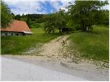 2
2 3
3 4
4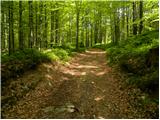 5
5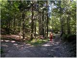 6
6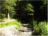 7
7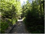 8
8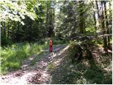 9
9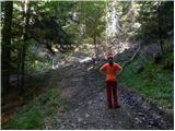 10
10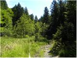 11
11 12
12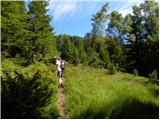 13
13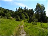 14
14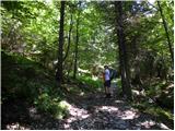 15
15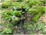 16
16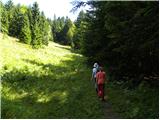 17
17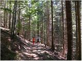 18
18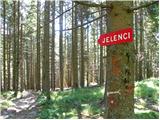 19
19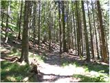 20
20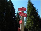 21
21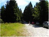 22
22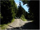 23
23 24
24 25
25 26
26 27
27 28
28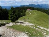 29
29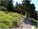 30
30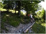 31
31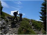 32
32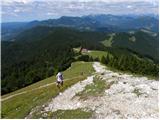 33
33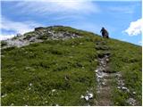 34
34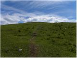 35
35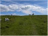 36
36 37
37
Discussion about the trail Laze - Blegoš
|
| bo_zl3. 05. 2020 |
Pot na začetnem delu, do razcepa, ki je na travniku (na sliki št. 14) slabše označena. Markacije zbledele, precej novih vlak, dvakrat zgrešil. Od travnika naprej pa zgledno markirano.
|
|
|
|
| Jernej9683. 07. 2020 |
Predlagam, da avtor doda tudi opis dostopa do izhodišča s primorske strani, to je iz smeri Cerknega.
|
|
|
|
| Tadej3. 07. 2020 |
Hvala za predlog, sem dodal.
|
|
|
|
| ločanka28. 01. 2024 06:31:36 |
Ob športnem igrišču se ne sme več parkirati (avtodomi), za planince velja parkirišče malo nižje, ob začetku poti, slika dve. Tam je tudi oznaka za parkiranje. Pri sliki 10 lahko izbereš za pot na Blegoš tudi levi odcep, skozi lepo Slugovo dolino in se na Slugovem griču priključiš ponovno na markirano pot. Ali pa tam spet izbereš nemarkirano pot čez greben Špehovš. Najbolje pa za vzpon eno varianto, za povratek pa drugo  !
|
|
|