Ljubelj - Srednji vrh (above Završnica) (via source of Završnica)
Starting point: Ljubelj (1058 m)
| Lat/Lon: | 46,4324°N 14,2602°E |
| |
Name of path: via source of Završnica
Time of walking: 2 h 40 min
Difficulty: easy marked way
Altitude difference: 738 m
Altitude difference po putu: 860 m
Map: Karavanke - osredji del 1:50.000
Recommended equipment (summer):
Recommended equipment (winter): ice axe, crampons
Views: 25.745
 | 2 people like this post |
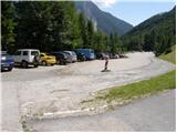
Access to the starting point:
From the motorway Ljubljana - Jesenice, at the Podtabor fork, continue in the direction of Ljubelj and Tržič. Continue along the first expressway and then the regional road, which you follow all the way to the Ljubelj border crossing. Just before the border crossing, turn left (direction Zelenica) and then park in a large parking lot after driving for a few 10 metres.
Path description:
From the parking lot, follow the footpath towards Zelenica, Vertatscha and Hochstuhla. The dirt track, which runs along the left-hand side of the ski slope, leads us after about 15 minutes of moderate ascent through the forest to the aforementioned slope along which we then climb. The path, which offers beautiful views of the extensive scree Begunjščica on the left and the ridge Ljubeljščica on the right, then leads us in a gentle ascent to the hut at Vrtača. From the hut, continue straight along the marked path, which slowly turns slightly to the left and, after a short cross-climb, leads us to lane of dwarf pines. The path then climbs steeply for a short time and then leads to cart track (transport-rescue road), which is then followed in a moderate ascent to the mountain home at Zelenica.
From the hut on Zelenica, continue right in the direction of Hochstuhla and Vertatscha (Begunjščica on the left) along the path which immediately after the home turns left and climbs by the children's ski lift. Somewhere halfway along the cableway, you will come to a less obvious crossroads where the path to Vertatscha branches off to the right. Continue straight ahead on the path, which quickly leads to the top of the children's ski lift. Continue along a wide path which begins to descend gently, first along the edge of the second lift and then through the forest. After about 20 minutes' walk from the house on Zelenica, the path leads to the hut at the source of the Završnice River.
Here continue right towards Vertatscha and Hochstuhla along the path, which quickly changes from Smokuška planina into a smaller, at first undefined valley between Srednji vrh on the left and Vertatscha on the right. After a moderately steep trail, a good half-hour walk from Smokuška planina leads us to the Šija saddle, where the next crossroads are located.
From the saddle, continue left up (straight Hochstuhl, right Vertatscha) along the sometimes less traceable path, which in the middle part runs along a slightly steeper ridge (slip hazard in winter). Higher up, the path turns slightly left and climbs over the lane of dwarf pines to the summit of the scenic peak.
Ljubelj - Zelenica 1:20, Zelenica - Koča pri izviru Završnice 20 minutes, Koča pri izviru Završnice -
Srednji vrh 1:00.

Pictures:
 1
1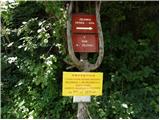 2
2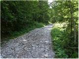 3
3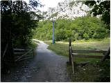 4
4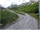 5
5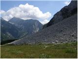 6
6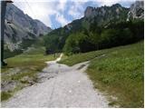 7
7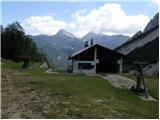 8
8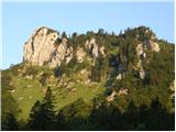 9
9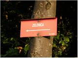 10
10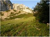 11
11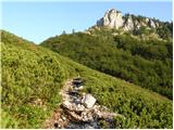 12
12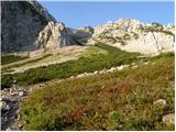 13
13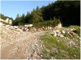 14
14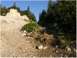 15
15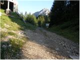 16
16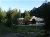 17
17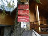 18
18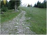 19
19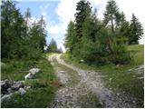 20
20 21
21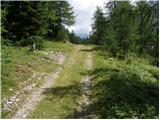 22
22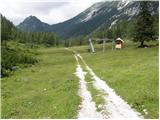 23
23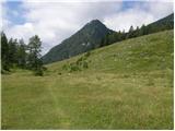 24
24 25
25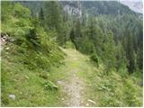 26
26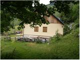 27
27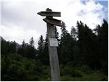 28
28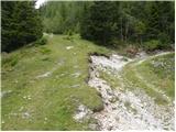 29
29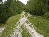 30
30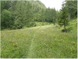 31
31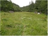 32
32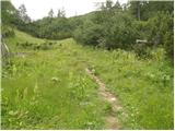 33
33 34
34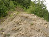 35
35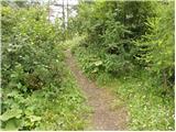 36
36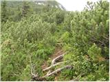 37
37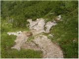 38
38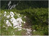 39
39 40
40
Discussion about the trail Ljubelj - Srednji vrh (above Završnica) (via source of Završnica)
|
| Kriška19. 08. 2008 |
Tale tura je za menoj danes. Pripomnila bi, da boste pot, ki vodi na sedlo Šija zlahka zgrešili, če ne boste pozorni, pa čeprav je na zemljevidih označena kot markiran pot. Odcep namreč ni nikjer označen, tudi steza je čisto na začetku tako rekoč nevidna. Tudi v nadaljevanju je steza minimalno markirana (nekaj starih, obledelih markacij), občasno široka in dobro vidna, včasih pa skoraj povsem izgine. Pot na sedlo se odcepi od gozdne ceste proti domu pri izviru Završnice na ovinku nad domom, torej zavijete preden pridete do doma.
Pot od sedla Šija na Srednji vrh se mestoma zmerno vzpenja, na nekaj predelih pa precej strmo. Danes je bila rahlo razmočena, tako da je bilo na par mestih treba kar popaziti, da ne bi zdrsnila in pristala v blatu.
Razgledi z vrha so zelo lepi!
|
|
|
|
| lynx16. 11. 2008 |
glede odcepa za Šijo(prejšnji komentar je precej kriptičen): res ni označen, vendar se iz ovinka vidi ena markacija, nizko na skali kakih 20m naprej.
Torej, prvo do koče, ob kateri je smerokazni kol, kolovoz pa gre levo. Sledimo mu in namesto da gremo po par metrih v prvi ovinek, stopimo s kolovoza in se držimo iste smeri.
|
|
|
|
| heinz17. 11. 2008 |
Vredno obiska, čeprav vrh za tisti predel Kravank ne sodi med višje. Razlog so lepi razgledi v vse smeri.
Mislim, da je od sedla Šija dosti manj kot 30 min, dodam pa naj še, da temu delu poti ne bi rekel "lahka ali nezahtevna pot", saj je pri spustu v zimskih razmerah na rahlo izpostavljenem delu treba paziti, oz. je potrebno imeti zim. opremo.
Vse ostalo je popolnoma nezahtevno.
|
|
|
|
| _d_10. 12. 2014 |
Pot je označena, markirana. Od Doma pri izviru Završnice do sedla Šija in naprej na vrh. Markirana je tudi pot, ki pelje po pobočju pod Vrtačo do sedla Šija.
|
|
|
|
| pohodnica5312. 09. 2016 |
Vse pohvale vredno zgledno urejena (krčeno ruševje od sedla)in sveže markirana pot, z lepimi usmernimi tablami; zgodaj zjutraj sicer malce drsna, razgledi prelepi; srečala sva tudi gada, zato malce previdnosti ni odveč, saj je po besedah obiskovalke tu kar pogosto srečanje z njimi; lp
|
|
|
|
| Pelca13. 09. 2016 |
Tudi mi smo na poti od Zelenice do Koče pri izviru Završnice srečali mladega gada na stezi tik pred izvirom potoka. Smo se ustavili in se je pridno počasi umaknil 
|
|
|