Loke - Planinski dom Vrhe
Starting point: Loke (380 m)
| Lat/Lon: | 46,2139°N 15,0077°E |
| |
Time of walking: 1 h 50 min
Difficulty: easy marked way
Altitude difference: 528 m
Altitude difference po putu: 585 m
Map: Posavsko hribovje - zahodni del 1:50.000
Recommended equipment (summer):
Recommended equipment (winter): ice axe, crampons
Views: 4.863
 | 1 person likes this post |
Access to the starting point:
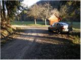
a) From the Ljubljana - Maribor motorway, take the Vransko exit and continue along the parallel old road towards Celje. Drive along the main road for a few kilometres, then signs for Tabor and Ojstriška vas point you to the right. Continue through Ojstriška vas to Tabor, and from there continue towards the village of Loke. In Loke, you will come to a crossroads where you will turn left towards Zajčeva koča (straight ahead Krvavica) along a road that will soon lead you to the next crossroads. Here, continue right in the route "Zajčeva koča - footpath" (straight ahead Zajčeva koča on the road) along the road, which crosses a bridge and then leads to a small roadside parking lot on the other side of a meadow.
b) From the motorway Maribor - Ljubljana, take the exit Šentrupert and then continue along the parallel old road towards Trojany. Follow the main road for a few kilometres and then the signs for Tabor and Ojstriška vas will direct you to the left. Continue through Ojstriška vas to Tabor, and from there continue towards the village of Loke. In Loke you will come to a crossroads, where you continue left towards Zajčeva koča (straight ahead Krvavica) along a road that will soon lead you to the next crossroads. Here, continue right in the route "Zajčeva koča - footpath" (straight ahead Zajčeva koča on the road) along the road, which crosses a bridge and then leads to a small roadside parking lot on the other side of a meadow.
Path description:
Leave the road near the parking lot and continue climbing along cart track, which branches off the road to the left. After a few metres, Cart track descends to a stream, crosses it and turns into a steep footpath on the other side, which climbs higher parallel to another track. The path, which passes through the forest, leads us higher up to a partly overgrown clearing, after which it turns slightly right and leads us to a dilapidated house.
Here, continue on the right-hand side of the house along cart track, which climbs crosswise (this part of the path is poorly marked) and makes a left-hand bend a little higher up. The moderately steep track then turns slowly to the right and leads us higher up to grassy hay meadows above which we cross a less good forest road.
Continue on the poorly marked cart track, which after a while starts to descend and then joins a dirt road, which is followed to the right to the next crossroads. At the junction in the middle of the bend, continue and after about 100 m of further walking, the road leads to a place where a worse forest road branches off to the right downhill towards Zajčeva koča.
Here, continue straight ahead in the direction of "Vrhe" and continue your ascent along the road. A little higher up, the path leads us to a chapel, where we continue straight on, and we continue along the road, which leads us on past the Krvavičnik farm. Just above the farm, we reach the next crossroads, where we turn sharp left. The path ahead leads us over a grassy slope with a view, and then the road leads to the next crossroads, where we step onto an asphalt road. Follow the road to the right, and it gradually passes to the other side of Kisovec Peak. Next, we cross-climb through the forest for a short time, and then walk past a few houses and look at the nearby Javor to the Vrhe Mountain Home.

Pictures:
 1
1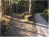 2
2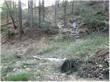 3
3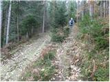 4
4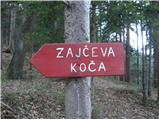 5
5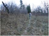 6
6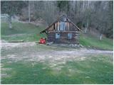 7
7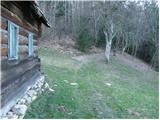 8
8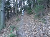 9
9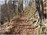 10
10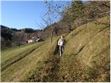 11
11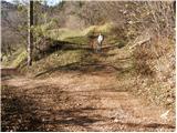 12
12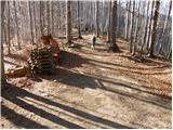 13
13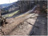 14
14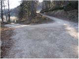 15
15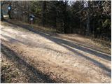 16
16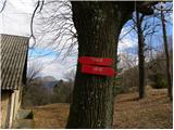 17
17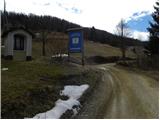 18
18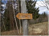 19
19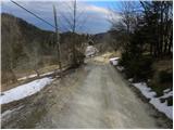 20
20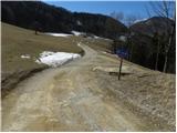 21
21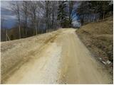 22
22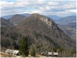 23
23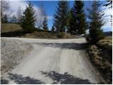 24
24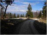 25
25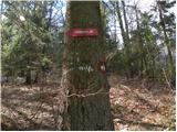 26
26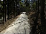 27
27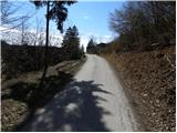 28
28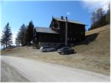 29
29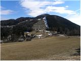 30
30
Discussion about the trail Loke - Planinski dom Vrhe
|
| navdušena8. 03. 2019 |
Ali je Planinski dom Vrhe zdaj odprt ali je to v zasebni lasti? Je tam možno kaj popiti, pojesti?
|
|
|
|
| garmont8. 03. 2019 |
Ko sem pred 14 dnevi hodil tam mimo je bil na vratih napis " Privat". Tudi delovnega časa nisem videl... 
|
|
|