Markova raven - Kalški greben (on marked path)
Starting point: Markova raven (980 m)
| Lat/Lon: | 46,2969°N 14,5618°E |
| |
Name of path: on marked path
Time of walking: 4 h 30 min
Difficulty: easy marked way
Altitude difference: 1244 m
Altitude difference po putu: 1380 m
Map: Kamniške in Savinjske Alpe 1:50.000
Recommended equipment (summer):
Recommended equipment (winter): ice axe, crampons
Views: 7.067
 | 1 person likes this post |
Access to the starting point:
a1) First drive to Kamnik, then continue in the direction of Kamnik Bistrica and the Črnivec Pass. At Stahovica, leave the main road towards the Črnivec Pass and turn left in the direction of Kamnik Bistrica and the cable car to Velika planina. A few 10 metres before the large parking lot of the Kings Hrib (the parking lot is located near the lower station of the pendulum on Velika planina), turn left onto the macadam road, which first descends to the Kamniška Bistrica River, which it crosses via a bridge. On the other side of the bridge you reach the valley of the Korošice River, along which you continue driving. Soon the first road branches off to the right, and we continue straight on (level Markovo can also be reached on the right road description a3) to the next crossroads, where we turn left (straight on Markovo level description a2). The road then turns sharp right and continues to lead us over several torrents (after heavi rains or storms the road is difficult to follow or not at all). We continue for a few kilometres and then we come down the slope into the Korošica valley, where the road turns sharp right, and in the middle of the bend a wide cart track or worse road branches off to the left. Park in a suitable place on the roadside, or take the worse road for another 10 metres to another small "parking area".
a2) First drive to Kamnik, then continue in the direction of Kamnik Bistrica and the Črnivec Pass. At Stahovica, leave the main road towards the Črnivec Pass and turn left in the direction of Kamnik Bistrica and the cable car to Velika planina. A few 10 metres before the large parking lot of the Kings Hrib (the parking lot is located near the lower station of the pendulum on Velika planina), turn left onto the macadam road, which first descends to the Kamniška Bistrica River, which it crosses via a bridge. On the other side of the bridge you reach the valley of the Korošice River, along which you continue driving. Soon the first road branches off to the right, and we continue straight on (Markovo level can also be reached by the right road description a3) to the next crossroads, where we also continue straight on (left Markovo level description a1). For some time we continue to climb moderately along the Korošica stream, then the road becomes very steep and partly unpaved (after heavi rains it is often impassable). Higher up, a dirt road (description a3) joins us from the right, then after a few 100 metres it starts to climb steeply again in serpentines. When you reach the left-hand bend in the middle of which a wide cart track or worse road branches off to the right, you are on the Markovo level. Park in a suitable place on the roadside, or take the minor road for another 10 metres to another small "parking area". a3) First drive to Kamnik, then continue in the direction of Kamnik Bistrica and the Črnivec Pass. At Stahovica, leave the main road towards the Črnivec Pass and turn left in the direction of Kamnik Bistrica and the cable car to Velika planina. A few 10 metres before the large parking lot of the Kings Hrib (the parking lot is located near the lower station of the pendulum on Velika planina), turn left onto the macadam road, which first descends to the Kamniška Bistrica River, which it crosses via a bridge. On the other side of the bridge you reach the valley of the Korošice River, along which you continue driving. Soon you will reach the first crossroads, where you will take a sharp right (straight ahead Markovo level description a1 and a2). After a short drive, you quickly reach the slopes above the Kamniško Bistrica River, where you turn left at the nearby crossroads (straight ahead is the road that returns to the main road to the Dom v Kamniški Bistrica). The trail climbs for some time along the torrential stream, then turns left and crosses the slopes of the Mokrice River. A little further on, a road branches off to the right, which ends in a forest after a few 100 metres, and we continue straight on to where it joins the road leading through the Korošice valley (description a2). Here, continue slightly right and the road climbs higher over some steep serpentines. When you reach a left turn in the middle of which a wide cart track or worse road branches off to the right, you are on the Markovo level. Park in a suitable place on the roadside, or take the minor road for another 10 metres to another small "parking area".
b1) From Gornji Grad, drive towards Kamnik via the Črnivec Pass or from Luce via the Volovljek Pass, and follow the main road to the end of the Stahovica settlement, where turn right towards Kamniška Bistrica and the cable car to Velika planina. A few 10 metres before the large parking lot of the Kings Hrib (the parking lot is located near the bottom station of the pendulum on Velika planina), turn left onto a macadam road, which first descends to the Kamniška Bistrica river, which it crosses via a bridge. On the other side of the bridge you reach the Korošice valley, along which you continue driving. Soon the first road branches off to the right, and we continue straight on (level Markovo can also be reached on the right road description b3) to the next crossroads, where we turn left (straight on Markovo level description b2). The road then turns sharp right and continues to lead us over several torrents (after heavi rains or storms the road is difficult to follow or not at all). We continue for a few kilometres and then we come down the slope into the Korošica valley, where the road turns sharp right, and in the middle of the bend a wide cart track or worse road branches off to the left. Park in a suitable place on the roadside, or take the minor road for another 10 metres to another small "parking area".
b2) From Gornji Grad, drive towards Kamnik via the Črnivec Pass or from Luce via the Volovljek Pass, and follow the main road to the end of Stahovica, where you turn right towards Kamniška Bistrica and the cable car to Velika planina. A few 10 metres before the large parking lot of the Kings Hrib (the parking lot is located near the bottom station of the pendulum on Velika planina), turn left onto the macadam road, which first descends to the Kamniška Bistrica river, which it crosses via a bridge. On the other side of the bridge you reach the Korošice valley, along which you continue driving. Soon the first road branches off to the right, and we continue straight on (Markovo level can also be reached by the right road description b3) to the next crossroads, where we also continue straight on (left Markovo level description b1). For some time we continue climbing moderately along the Korošica stream, then the road becomes very steep and partly unpaved (after heavi rains it is often impassable). Higher up, a dirt road (description b3) joins us from the right, then after a few 100 metres it starts climbing steeply again in serpentines. When we reach the left bend in the middle of which a wide cart track or worse road branches off to the right, we are on the Markovo level. Park in a suitable place on the roadside, or take the minor road for another 10 metres to another small "parking area".
b3) From Gornji Grad, drive towards Kamnik via the Črnivec Pass or from Luce via the Volovljek Pass, and we take the main road to the end of the Stahovica settlement, where we turn right towards Kamniška Bistrica and the cable car to Velika planina. A few 10 metres before the large parking lot of the Kings Hrib (the parking lot is located near the bottom station of the pendulum on Velika planina), turn left onto a macadam road, which first descends to the Kamniška Bistrica river, which it crosses via a bridge. On the other side of the bridge you reach the Korošice valley, along which you continue driving. Soon you reach the first crossroads, where you turn sharp right (straight ahead Markovo level description b1 and b2). After a short drive, you quickly reach the slopes above the Kamniško Bistrica River, where you turn left at the next crossroads (straight ahead is the road that returns to the main road to the Dom v Kamniški Bistrica). The trail climbs for some time along the torrential stream, then turns left and crosses the slopes of the Mokrice River. A little further on, a road branches off to the right, ending in a forest after a few 100 metres, and we continue straight on to where it joins the road leading through the Korošice valley (description b2). Here we continue slightly to the right, and the road climbs higher over some steep serpentines. When you reach a left turn in the middle of which a wide cart track or worse road branches off to the right, you are on the Markovo level. Park in a suitable place on the roadside, or take the minor road for another 10 metres to another small "parking area".
Path description:
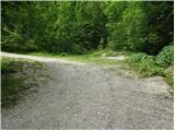
From the starting point, continue along the wide cart track or worse road, which after a few 10 metres leads to another "parking area" or turning point, from where you continue straight on the slightly narrower cart track, which turns left. After a few minutes, cart track splits into two parts, and we continue on the marked right one, which we also walk on for only a few minutes, as the markings lead us a little further to the right on a marked path towards Kamniški vrh, Krvavec and mountain pasture Koren (the branch is not marked, so we have to follow the markings carefully), which starts climbing through the forest. The path continues up the right-hand side of the nearby torrent and climbs quite steeply, and we walk along it to the next, this time slightly better marked, crossroads.
At the crossroads, continue to the right in the direction of the sign "ZA VRATA" and continue through the gradually less dense forest, so that we occasionally cross a clearing, meadow or a shorter scree slope, from where we get a nice view, especially of the peaks around the Korošica valley. The way forward leads us under the foot of a shorter wall, where an unmarked path branches off to the right up towards mountain pasture Koren and also a cross-hunting trail towards Medvedja jama.
From this crossroads, continue along the left-hand path, which bypasses the nearby cliff on the left. A slight descent follows and the path leads to a small refreshing spring, which unfortunately dries up on dry days. We then move to the left side of the small spring and start climbing again. There is a short lane of dwarf pines climb, then the path changes to a grassy slope, where it becomes more difficult to follow, but the few markings are helpful. After about 20 minutes of ascent from the small spring, we reach a small hunting hut, above which the trail turns left and joins the more beaten and also marked trail leading from Kriška planina towards mountain pasture Koren.
When you reach the marked trail, continue right and cross the forest. The path quickly leaves the forest and passes through bushes and dwarf pines, and then gradually leads through a pasture fence to the next unmarked crossroads, which is located right in the middle of a sharp right-hand bend. From the serpentine, an unmarked path continues straight ahead towards the Razor saddle (the saddle between Krvavec and Velika Zvoh), and we continue to the right along the further marked path. There is a short cross-climb and the path leads us to the southern part of mountain pasture Koren, from where we have a nice view over the central part of mountain pasture and the surrounding peaks. From the southern part of mountain pasture there is a short descent to the nearby shepherd's hut, which is located in the central part of mountain pasture Koren.
Here our route continues slightly left (slightly right mountain pasture Košutna) through the meadows on the valley floor (the path is initially not very visible). The path then becomes steeper and steeper and after less than 30 minutes of walking leads us to a small puddle where there is a less well-marked crossroads. Continue straight on (right Košutna) and follow the gently sloping path to the next crossroads, where you continue left in the direction of Vrh Korena (straight Kompotel). The way ahead starts to climb steeper and quickly leads us through the karst world to the place where we join the path from Veliki Zvoh to Vrh Korena (the ridge of Jez). Continue to the right and the path leads in a few steps to a place where the path to Vrh Korena branches off to the right (1 minute). The path continues to descend the slope, which is partly covered with dwarf pines. After 15 minutes of descent, the path leads to the crossroads at Škrbini.
Here we continue straight in the direction of Kalški greben and Cojzova huts along the path, which after a few further steps leads us to the next crossroads. Continue slightly to the left (Kalška gora and Cojzova koča to the right) along the path, which begins to climb gently up the slopes, which are becoming more and more scenic. The pleasant path, which can be very hot in the middle of the day, leads us first near a small ridge, and then gradually turns slightly more to the left and leads us from dwarf pines to beautiful meadows where we will find various types of flowers. The wide slope we are walking on then narrows and the meadows are gradually replaced by rocks. Higher up, the path leads to the scenic main ridge, which is then followed to the summit, which is often full of sheep droppings.

Pictures:
 1
1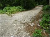 2
2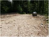 3
3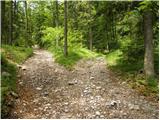 4
4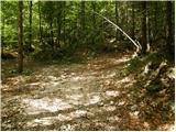 5
5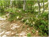 6
6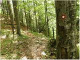 7
7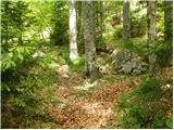 8
8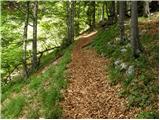 9
9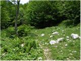 10
10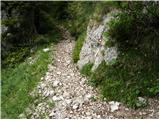 11
11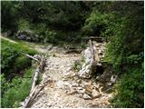 12
12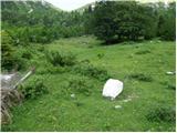 13
13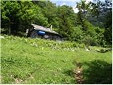 14
14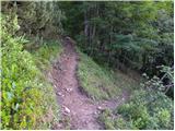 15
15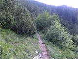 16
16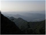 17
17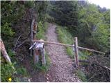 18
18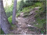 19
19 20
20 21
21 22
22 23
23 24
24 25
25 26
26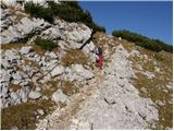 27
27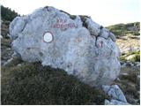 28
28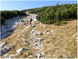 29
29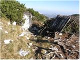 30
30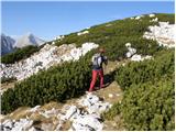 31
31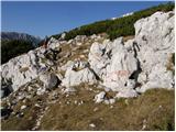 32
32 33
33 34
34 35
35 36
36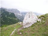 37
37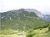 38
38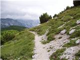 39
39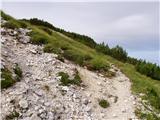 40
40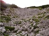 41
41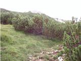 42
42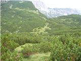 43
43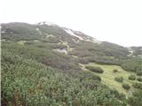 44
44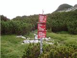 45
45 46
46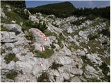 47
47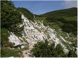 48
48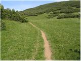 49
49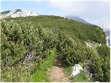 50
50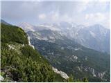 51
51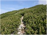 52
52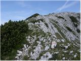 53
53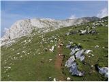 54
54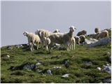 55
55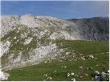 56
56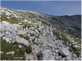 57
57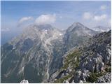 58
58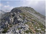 59
59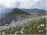 60
60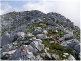 61
61 62
62
Discussion about the trail Markova raven - Kalški greben (on marked path)
|
| GričarA29. 10. 2014 |
Je kdo že šel po tej poti? Kakšno je trenutno stanje ceste do izhodišča in naprej do vrha?
|
|
|
|
| pclop13. 06. 2020 |
12. 6. 2020 naj bi bila desna cesta neprevozna, na levi pa naj ne bi bilo posebnosti.
|
|
|