Moškrin - Sveti Križ (Križna Gora) (by road)
Starting point: Moškrin (400 m)
| Lat/Lon: | 46,189°N 14,2915°E |
| |
Name of path: by road
Time of walking: 1 h
Difficulty: easy marked way
Altitude difference: 280 m
Altitude difference po putu: 280 m
Map: Škofjeloško in Cerkljansko hribovje 1:50.000
Recommended equipment (summer):
Recommended equipment (winter):
Views: 7.083
 | 2 people like this post |
Access to the starting point:
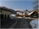
a) From Gorenje vas, Ljubljana or Kranj, drive to Škofja Loka, then continue to Železniki. At the end of Škofja Loka, you will see signs for Križna Gora, which will direct you to the right onto a slightly narrower road, which will quickly take you to the village of Moškrin. At the beginning of the village, continue slightly left (right centre of the village Moškrin) along the road, which leads you into the forest. Park in a suitable place on the roadside.
b) Drive to Železniki, then continue driving towards Škofja Loka. At the beginning of Škofja Loka, just a little further on from the turnoff for the village of Trnje, turn left in the direction of Križna Gora and the village of Moškrin, and then drive along a slightly narrower asphalt road, which will quickly take you to the beginning of the village of Moškrin. At the beginning of the village, continue slightly left (right centre of the village Moškrin) along the road, which leads you into the wods a little further on. Park in a suitable place on the roadside.
Path description:
From where you parked, continue along the asphalt road, which climbs moderately through the forest. After about 15 minutes of walking, you reach a crossroads, where you turn right (on the left is the hamlet of Cavrn). From the crossroads, you climb through the forest for a few more minutes, and then the forest ends and you arrive at the village of Križna Gora, with beautiful views. At the beginning of the village, at a small unmarked crossroads, continue left, then walk past the chapel and the Inn at Boštjan to a nearby marked crossroads, where you continue left towards the church and the hunting lodge (Planica on the right).
The way forward leads along a more winding and further macadam road. After a few minutes of further walking along the road, which offers beautiful views of the Kamnik Savinja Alps and Škofjeloško hribovje and Ratitovec, we arrive at the Sveti Križ church and a little further on at the hunting lodge.
Pictures:
 1
1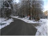 2
2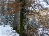 3
3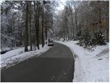 4
4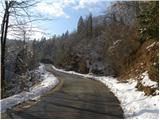 5
5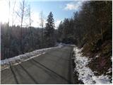 6
6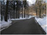 7
7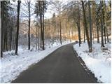 8
8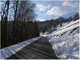 9
9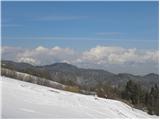 10
10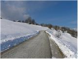 11
11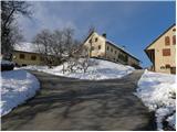 12
12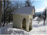 13
13 14
14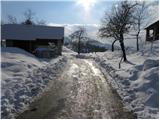 15
15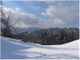 16
16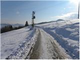 17
17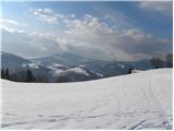 18
18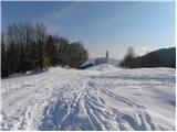 19
19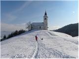 20
20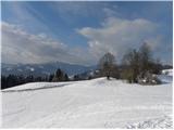 21
21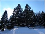 22
22
Discussion about the trail Moškrin - Sveti Križ (Križna Gora) (by road)