Olipova planina - Potoški Stol
Starting point: Olipova planina (1320 m)
| Lat/Lon: | 46,4414°N 14,1235°E |
| |
Time of walking: 2 h 40 min
Difficulty: easy unmarked way
Altitude difference: 694 m
Altitude difference po putu: 800 m
Map: Karavanke - osrednji del 1:50.000
Recommended equipment (summer):
Recommended equipment (winter): ice axe, crampons
Views: 7.342
 | 2 people like this post |
Access to the starting point:
From the Ljubljana - Jesenice motorway, take the Lesce exit and follow the road towards Žirovnica and Jesenice. After a few km of driving, you will come to a crossroads where the road to Žirovnica and Moste turns right (from Jesenice, left). Just a few metres further, at the next crossroads, turn left into Moste (right into Žirovnica). Continue past the memorial to the fallen fighters, where the road starts to climb uphill under the railway line. At the top of the hill, turn right (at the Vila Karin sign) and we continue towards Završniškem jezero and Valvasor's home. The road then bends and leads to a crossroads where the road to Valvasor's home branches off to the left. Take the road mentioned above (straight ahead to the cottage at the source of the Završnice River), which begins to climb, first gently and then steeply, along a road that is sometimes quite rough (the steepest parts are asphalted). Higher up, the road leads to a slightly larger junction, where you turn left in the direction of Potoška planina (to the right of the Doslovška mountain pasture). The road then lays down and leads us a little further on to the next crossroads, where the road to Valvasor's house branches off to the right, and we continue along the lower left road, which then continues for some time without any major changes in elevation. The road then leads us past the Ajdno trail junction and then starts to climb steeply on a sometimes quite bad road. The road then re-lays and leads us past Potoška planina to the Urbas well, near which there are a few small car parks. We continue on, and the road takes us over a few small junctions, always keeping to the one that is the roughest. The road then climbs steeply again and leads us a little higher to a larger car park, where we park.
Path description:
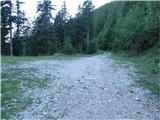
From the parking lot we continue along the deteriorating macadam road, which gradually turns into a wide cart track, which takes us past the trough, or water tank, to the edge of the mountain pasture Stamara, which opens up a beautiful view of the Julian Alps.
From mountain pasture, continue to the right past the shepherd's and hunter's huts on an initially slightly less visible path which goes higher into the forest and joins the wider path coming from the other part of mountain pasture. Further on, the path turns slightly right and starts to climb steeply. Higher up, the path leaves the wods onto slopes covered with dwarf pines and turns slightly to the left. There is a slight cross-climb and the path leads to Hrašenska planina, where a shepherd's hut can be seen.
Here, before crossing the pasture fence, turn right and ascend the initially easy-to-follow path. After a short climb over dwarf pines, the trail changes to slightly grassy slopes, where it starts to disappear (see the men). Continue along an occasionally barely visible track which crosses the slopes to the east. The track then becomes easier to follow again and leads to the shepherd's hut at mountain pasture below Belščica.
From mountain pasture, continue on a slight cross-climb towards the bivouac (eastwards), which can already be seen in front of you and is reached after a good 10 minutes of further walking.
Just slightly to the left of the bivouac, however, you will see a less visible path that continues to climb eastwards. Continue along the above-mentioned path, which climbs crosswise over sometimes slightly steeper slopes. A path crossing two more distinct ravines leads us higher up on a marked path, which we follow to the right. After a few steps on the marked path, the path to Weinasch branches off to the left (20 minutes), and we continue straight on the path, which turns slightly to the right and, after a few steps downhill, leads us into the valley between Weinasch and Potoški Stol (near Vajneže sedlo). The path crosses the valley itself and then climbs more steeply towards the ridge of Potoški Stol. At the ridge, the marked trail turns left and we follow it to where it leaves the ridge. We continue straight ahead along the wide and gently sloping ridge until we reach the top of Potoški Stol, which is reached in a walk of 10 steps. From the top, you can descend a few dozen metres to the cross on the Potocki Stol. The cross will be harder to find in the fog.
Starting point - mountain pasture Stamare 15 minutes, mountain pasture Stamare - Hrašenska planina 45 minutes, Hrašenska planina - bivouac on Belščić 40 minutes, bivouac on Belščić - Potoški Stol 1:00.

We can extend the trip to the following destinations: Vajnež,
Stol
Pictures:
 1
1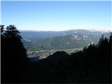 2
2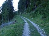 3
3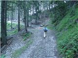 4
4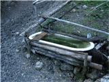 5
5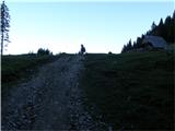 6
6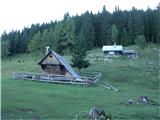 7
7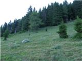 8
8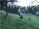 9
9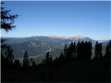 10
10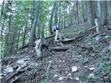 11
11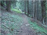 12
12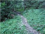 13
13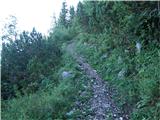 14
14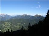 15
15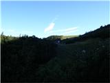 16
16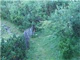 17
17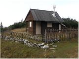 18
18 19
19 20
20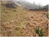 21
21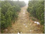 22
22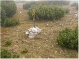 23
23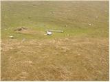 24
24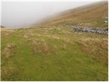 25
25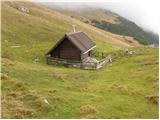 26
26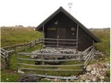 27
27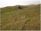 28
28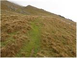 29
29 30
30 31
31 32
32 33
33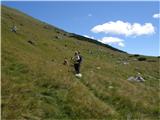 34
34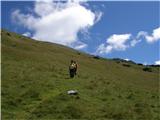 35
35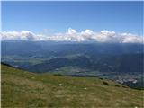 36
36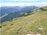 37
37 38
38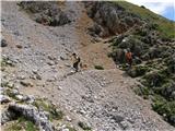 39
39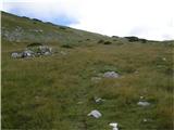 40
40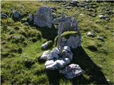 41
41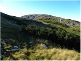 42
42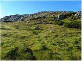 43
43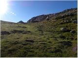 44
44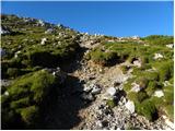 45
45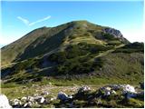 46
46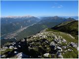 47
47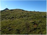 48
48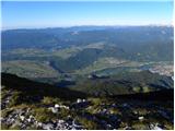 49
49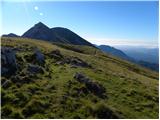 50
50 51
51
Discussion about the trail Olipova planina - Potoški Stol