Passo di Fedaia - Rifugio Padon
Starting point: Passo di Fedaia (2057 m)
| Lat/Lon: | 46,4534°N 11,8889°E |
| |
Time of walking: 50 min
Difficulty: easy marked way
Altitude difference: 350 m
Altitude difference po putu: 350 m
Map: Tabacco 07 1:25.000
Recommended equipment (summer):
Recommended equipment (winter):
Views: 2.595
 | 2 people like this post |
Access to the starting point:
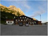
First, drive to Cortina d'Ampezzo (you can get here via Border crossing Rateče or Predel to Trbiž / Tarvisio and then take the motorway towards Udine to the Tolmezzo exit. From Tolmezzo, follow the road towards Ampezzo and the Passo della Mauria mountain pass. The road then descends and leads to a crossroads where you turn left (possibly right) towards Cortina d'Ampezzo. At all subsequent junctions, follow the signs for Cortina d'Ampezzo and then follow the signs for the Passo di Falzarego Alpine Pass. In the first part of the ascent towards the Falzarego Pass, you will reach a crossroads where the signs for Passo di Giau (2233 m) and Marmolado point to the left. After the Giau Pass, the road starts to descend and we follow it through the settlements in the lower part towards Marmolada or Passo di Fedaia. The road then starts to climb again and leads us higher up to the Fedaia Pass, where we park in the parking lot of the Rifugio Fedaia hut.
Access from Primorska: Take the motorway in the direction of Padua, but only as far as the motorway junction, where you continue in the direction of Veneto and Belluno. Near Belluno, the motorway ends and we follow the road towards Belluno, where we turn right at a major junction towards Agordo. From there, follow the frequent signs for Marmolada or Passo di Fedaia. When you reach the pass, park in the parking lot of the Rifugio Fedaia hut.
Path description:
From the parking area of the Rifugio Passo Fedaia, follow the dirt road towards the Rifugio Padon. The dirt road first crosses the main road via a bridge and then climbs along and over the ski slope. The road then turns slightly to the right and leads to the slopes below the cable car, which leads to the Padon hut. From the road, you have a magnificent view of the nearby Marmolada. The dirt road continues to climb near the cable car all the way up to the Passo Padon saddle.
At the saddle where the crossroads are, continue left along the road and it is only a short walk to the hut, which you can see from the road for some time.
Pictures:
 1
1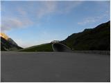 2
2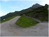 3
3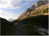 4
4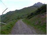 5
5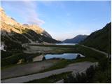 6
6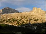 7
7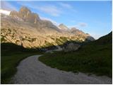 8
8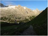 9
9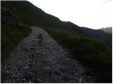 10
10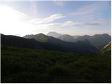 11
11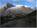 12
12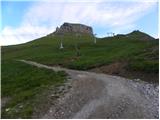 13
13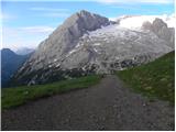 14
14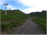 15
15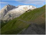 16
16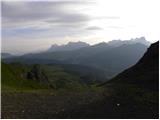 17
17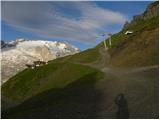 18
18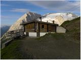 19
19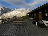 20
20
Discussion about the trail Passo di Fedaia - Rifugio Padon