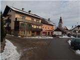
Pevno - Sveti Križ (Križna Gora)
Starting point: Pevno (403 m)
| Lat/Lon: | 46,1901°N 14,2995°E |
| |
Time of walking: 2 h 10 min
Difficulty: easy marked way
Altitude difference: 277 m
Altitude difference po putu: 465 m
Map: Škofjeloško in Cerkljansko hribovje 1:50.000
Recommended equipment (summer):
Recommended equipment (winter):
Views: 868
 | 1 person likes this post |
Access to the starting point:
a) Drive to Medvode, then continue driving towards Škofja Loka. Continue through Škofja Loka, then just after the main bus station, at the part where the main road turns slightly left, continue slightly right in the direction of Pevno. A little further on, at a marked crossroads, go right in the direction of Crngob and Pevne, and at the next crossroads go left in the direction of the paper mill, Crngrob and Pevne. Škofja Loka ends shortly after this, and the road continues across meadows. At the crossroads, where the road branches slightly to the right towards Papirnica, continue slightly to the left, and at the next crossroads, by the wooden sign, turn left towards the settlement Pevno (straight ahead Crngrob). After a few more 100 metres of driving, the road leads to Pevno, where you will see the first markings. There are no parking spaces at the starting point.
b) From Žiri or Cerkno, drive to Škofja Loka and from there turn left towards Železniki. Continue through Škofja loko, then just after the main bus station, at the part where the main road turns slightly left, continue slightly right towards the settlement Pevno. A little further on, at a marked crossroads, go right in the direction of Crngob and Pevne, and at the next crossroads go left in the direction of the paper mill, Crngrob and Pevne. Škofja Loka ends shortly after this, and the road continues across meadows. At the crossroads, where the road branches slightly to the right towards Papirnica, continue slightly to the left, and at the next crossroads, by the wooden sign, turn left towards the settlement Pevno (straight ahead Crngrob). After a few more 100 metres of driving, the road leads to Pevno, where you will see the first markings. There are no parking spaces at the starting point.
c) From Železniki, drive to Škofja Loka, then before the road turns slightly right and starts descending towards the main bus station, continue left towards Pevno. A little further on, you will reach the next marked crossroads, where you continue to the right, this time in the direction of Pevno and Crngrob. A few more junctions follow, and we continue following the signs for Crngrob and Pevno. Škofja Loka ends shortly after this, and the road continues across meadows. At the crossroads where the road branches slightly to the right towards Papirnica, continue slightly left, and at the next crossroads, by the wooden sign, turn left towards the settlement Pevno (straight ahead Crngrob). After a few more 100 metres of driving, the road leads to Pevno, where we see the first markings. There are no parking spaces at the starting point. d) First drive to Kranj, and from there continue to Škofja Loka. Before arriving at Škofja Loka, turn right at Dorfarje in the direction of Crngrob. First pass the Prevc furniture salon, then the turn-off to the farm at Brojan, and on past the Cegnar and Zakotnik nurseries, after which the rather narrow road through the village widens slightly. After the village, there is a short descent and the path leads past a large parking lot next to the Slovenian army firing range. Behind the parking lot, cross the small stream Ušovca, and the road passes into the forest and starts to climb moderately. Follow the asphalt road, then quickly arrive in the village Crngrob, where the church and a few houses are passed on the left. Continue through the forest, where the road leads you past the Red Sign, and when the forest ends, you drive between fields. At a nearby crossroads, turn right and pass the Church of St Ursula to the centre of Pevno, where you will see the first signs. There are no parking spaces at the starting point.
Path description:
From the place where you see the first markings, the path leads along a side road that splits into two parts at the hydrant. Continue along the lower road, which gradually turns into cart track, which turns right and climbs to the edge of the forest. At the edge of the forest, take the right-hand path, which is also marked, and the path passes into the forest, where it returns to the wider cart track at a slightly higher level. Continue along the wooded cart track, which climbs quite gently at first and then moderately. At the crossroads follow the markings for Planica. Higher up, cart track becomes steeper and transitions to a shorter steep slope. Above this part, the wider cart track is reached, leading out of the forest onto the grassy slope below Planica. With fine views towards the valley and the Alps, you quickly reach a small settlement, where you turn left at a crossroads (Planica Peak on the right).
Continue towards Križna Gora, following the road which soon leaves the village and then climbs crosswise over the grassy slope. When the crossing ends, you reach a kind of ridge, where you continue to the right, and then, with beautiful views, continue past a few more houses. Higher up, you reach the main ridge, where you take a sharp left onto cart track, which starts to descend gently (right along the road to the top of Planica).
The track soon descends even more steeply, and then leads out of the forest onto a grassy slope which offers a fine view of part of the Škofjeloško hribovje (view of the hills from Lubnik through Stari vrh to Blegoš). The track climbs gently over the slope and then returns to the forest, through which it begins to descend again. At a lower level you reach a dirt road, which you follow straight ahead, climbing gently to the nearby bus turnaround. At the NOB memorial, you come out of the forest again, and then follow the asphalt road down to a relatively new and well-maintained parking area above the village of Križna Gora.
From here it is downhill for a while and then, passing the turn-off for the Praprotno settlement, you will reach a crossroads in the middle of Križna Gora village, from where you continue to the right in the direction of the church and the hunting lodge. Continue along a fairly scenic and initially still asphalted road, which climbs gently towards a high-voltage power line. After the power line, the road flattens out, or even drops slightly, and then a path branches off to the left, leading directly towards the Church of St. Križ. Continue along the path that runs parallel to the road, which will take you to the church mentioned above in a few minutes.
From the church, where you can enjoy a beautiful view, follow the well-trodden path, which continues slightly to the right and returns to the road we have recently left. Once on the road, continue slightly left and within a minute's walk you will reach the hunting lodge, which is located at the edge of the forest.
Pevno - Planica village 1:15, Planica village - Sveti Križ 55 minutes.

Pictures:
 1
1 2
2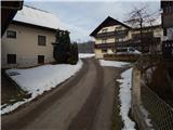 3
3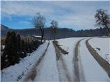 4
4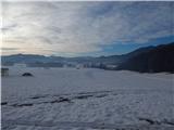 5
5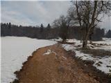 6
6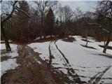 7
7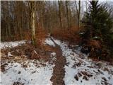 8
8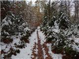 9
9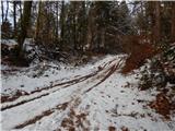 10
10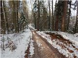 11
11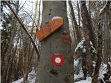 12
12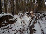 13
13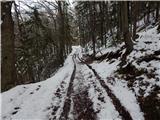 14
14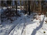 15
15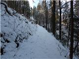 16
16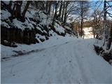 17
17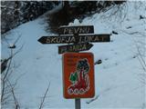 18
18 19
19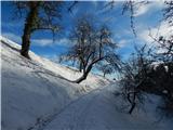 20
20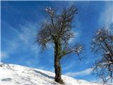 21
21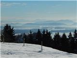 22
22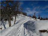 23
23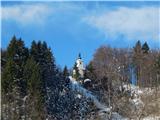 24
24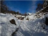 25
25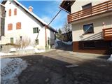 26
26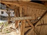 27
27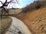 28
28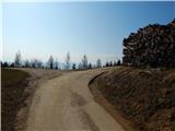 29
29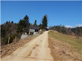 30
30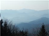 31
31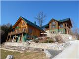 32
32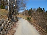 33
33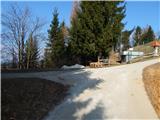 34
34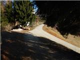 35
35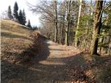 36
36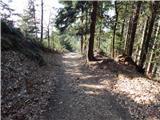 37
37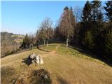 38
38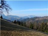 39
39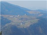 40
40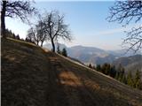 41
41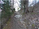 42
42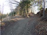 43
43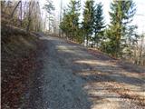 44
44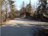 45
45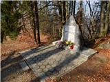 46
46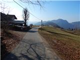 47
47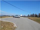 48
48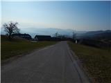 49
49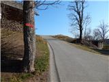 50
50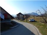 51
51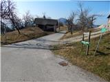 52
52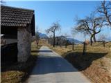 53
53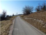 54
54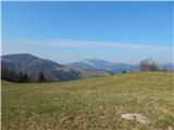 55
55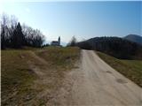 56
56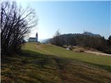 57
57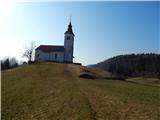 58
58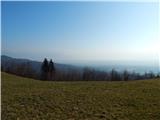 59
59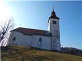 60
60 61
61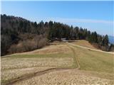 62
62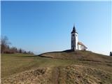 63
63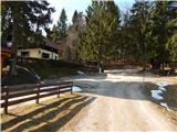 64
64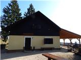 65
65
Discussion about the trail Pevno - Sveti Križ (Križna Gora)