Planina Kuk - Žabiški Kuk (path past Gradič (old military path))
Starting point: Planina Kuk (1150 m)
| Lat/Lon: | 46,2112°N 13,7872°E |
| |
Name of path: path past Gradič (old military path)
Time of walking: 2 h 20 min
Difficulty: partly demanding marked way
Altitude difference: 694 m
Altitude difference po putu: 705 m
Map: TNP 1:50.000
Recommended equipment (summer):
Recommended equipment (winter): ice axe, crampons
Views: 6.260
 | 2 people like this post |
Access to the starting point:
Between Most na Soči and Tolmin we see the signs for the village Poljubinj, which direct us to a side road that will soon take us to the village. Continue driving on the ascending road, which takes you a little higher to the village Ljubinj, where you turn left in the direction of Koča na planini Razor and mountain pasture Stador. Continue up the narrow, steep and asphalted road, which leads higher up to a point where the road branches off sharp right towards Koča na planini Stador and the Kobala airstrip. Continue straight on here, and then continue without any major changes in elevation to mountain pasture Lom. After mountain pasture Lom, follow the signs for Koča na planini Razor, and we follow the road, which climbs mostly transversely to the right, to the marked parking area in front of mountain pasture Kuk. No further driving is allowed.
Path description:
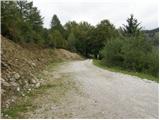
From the parking lot, continue along the road closed to public traffic, which will quickly take you to the pasture at mountain pasture Kuk (also Podkuk). Behind the pasture, the path begins to climb moderately to the right, and at the left turn (serpentini), the Geological Trail (also the path from Kneške Raven) joins us from the right.
Follow the road only as far as the nearby crossroads, where the path to Žabiški Kuk (also Žabijski Kuk) branches off to the right - the path past Gradič (an old military trail).
Continue on the above-mentioned path (straight ahead Koča na planini Razor for 30 minutes), but it starts to disappear on the grassy slope. During the ascent we are helped by wooden poles, which are painted red in the upper part. As we get higher into the forest, more paths appear, and we continue along the one with the red lines. We traverse a fairly steep slope to the right for some time, then emerge from the woods and arrive on steep grassy slopes. There is a slight downhill, where there is a risk of slipping, especially in wet conditions, and then the path turns left into a steep, mainly grassy gully, surrounded by dwarf pines. Following the unmarked gully, the path, which continues to be marked by red lines, climbs straight up, so that the steepness of the path is considerable. Higher up, the path curves slightly to the right and the slope also flattens out a little, and we reach an old mulatier with good views. We climb up the old mulatier for a while, and then the path goes from dwarf pines to the edge of the ridge, where we climb along the edge of the steep slopes. Higher up, the ridge becomes a little more distinct, and in a few more minutes we reach the miniature Aljaž Tower, located at Žabiški Kuk (1844 m).
If we continue along the ridge, in a few minutes we can climb to 1881, which is the highest point on the ridge of the Žabiská Kuka.
The description refers to the situation in July 2018 and the pictures are from different periods.

We can extend the trip to the following destinations: Vogel
Pictures:
 1
1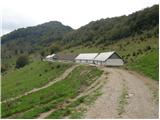 2
2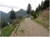 3
3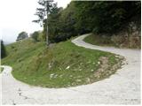 4
4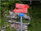 5
5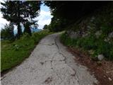 6
6 7
7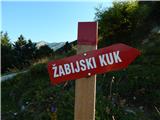 8
8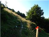 9
9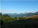 10
10 11
11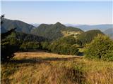 12
12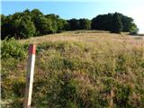 13
13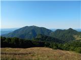 14
14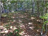 15
15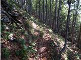 16
16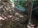 17
17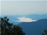 18
18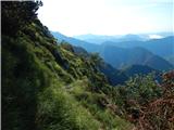 19
19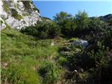 20
20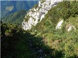 21
21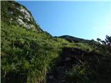 22
22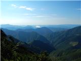 23
23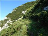 24
24 25
25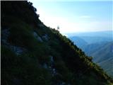 26
26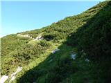 27
27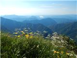 28
28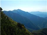 29
29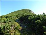 30
30 31
31 32
32 33
33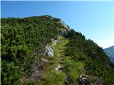 34
34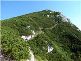 35
35 36
36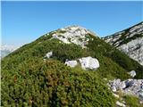 37
37 38
38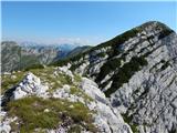 39
39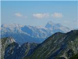 40
40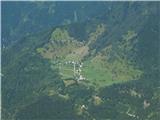 41
41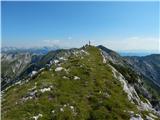 42
42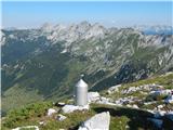 43
43
Discussion about the trail Planina Kuk - Žabiški Kuk (path past Gradič (old military path))
|
| ljubitelj gora28. 08. 2019 |
Zakaj je v opisu naveden Žabiški kuk na smerokazu pa Žabijski kuk. Domačini uporabljajo drugo ime.
|
|
|
|
| winni25. 05. 2020 |
Ko skrenemo s ceste na travnikje ena pot, ki pa ne pelje v smer Žabiškega Kuka. Zato je res najbolje da gremo direktno v smeri stebrov, ki nas pripeljejo na pravo pot v gozd.
|
|
|
|
| Jernej96820. 08. 2023 20:16:38 |
Danes prehodil to pot in je normalno prehodna. Za ljubitelje strmih in neobljudenih stezic.
|
|
|