Planina Podvežak - Deska (Veža)
Starting point: Planina Podvežak (1500 m)
| Lat/Lon: | 46,3319°N 14,6726°E |
| |
Time of walking: 1 h 30 min
Difficulty: easy unmarked way
Altitude difference: 470 m
Altitude difference po putu: 470 m
Map: Kamniške in Savinjske Alpe 1:50.000
Recommended equipment (summer):
Recommended equipment (winter): ice axe, crampons
Views: 15.795
 | 1 person likes this post |
Access to the starting point:
First drive to Luče, then continue into the Podvolovjek valley (direction Kamnik and Kranjski Rak). At the road marker between 11 and 11. 5 km, you will come to a small crossroads where the road to the right branches off towards Farmer Planinšek and the mountains Podveža, Ravne and Vodole (the branch is marked). Take this initially still asphalted road and follow it at the crossroads in the route mountain pasture Podveža. After a relatively long and in the upper part also worse macadam road you will reach the parking lot under mountain pasture Podveža (at the starting point there is a ramp and a number of mountain signs).
From Kamnik, drive towards the Črnivec Pass, but only as far as the crossroads, where the road to Kranjski Rak turns sharp left (the turn-off is marked and is located only 500 m before the pass). At the crossroads at Kranjski Rak, continue straight ahead on the main road, which starts descending into the Podvolovjek valley. In the valley, just 100 m after the Gams bar, you will reach a crossroads where the road to the left branches off towards the farmer Planinšek and the Podveža, Ravne and Vodole mountains (the branch is marked). Continue following the above description.
Path description:
From the parking lot, take the footpath (or road) in the route mountain pasture Podveža. Both the road and the footpath, which crosses a forest road during the ascent, lead us in 15 minutes of moderate ascent to the shepherd's hut at mountain pasture Podveža, from which we have a beautiful view towards Rogatec and Lepenatka.
From mountain pasture continue along the marked, but at first less visible path, which soon goes into the forest. The path through the forest climbs a little steeper and then enters a small uncultivated valley, above which it completely flattens out. It is followed by a few minutes of crossing the slopes below the side ridge of the board, and then the path leads to a less visible crossroads, where a slightly narrower path branches off to the left, leading towards Deska and the Watercourse Lake.
Continue along the above-mentioned path, which begins to climb crosswise towards the saddle between Deska and Tolstim vrh. From the point where we left the wider marked trail, we first climb through the dwarf pines zone and then across increasingly scenic grassy slopes. There is a slightly steeper traverse over a small scree slope and the path leads to the aforementioned saddle.
Here continue left (straight Vodotočno jezero, right Tolsti vrh) and follow the path initially along a slightly steeper grassy slope, which, after a few 10 steps, becomes steeper. This is followed by about 5 minutes of easy walking on the gentle grassy slope of the mountain.

Pictures:
 1
1 2
2 3
3 4
4 5
5 6
6 7
7 8
8 9
9 10
10 11
11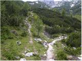 12
12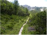 13
13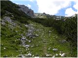 14
14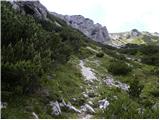 15
15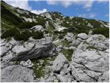 16
16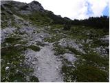 17
17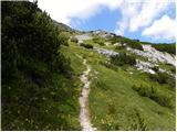 18
18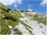 19
19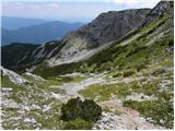 20
20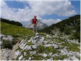 21
21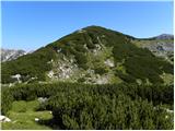 22
22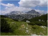 23
23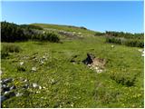 24
24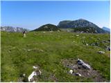 25
25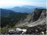 26
26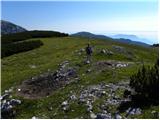 27
27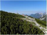 28
28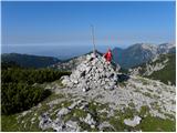 29
29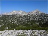 30
30
Discussion about the trail Planina Podvežak - Deska (Veža)
|
| garmont24. 10. 2012 |
Tudi ta pot je po novem markirana.
Markacije se nadaljujejo še naprej do Vodotočnika, kjer se pridružijo že prej markirani poti do Korošice.
|
|
|
|
| šošo20. 07. 2017 |
Mene pa zanima ali je na vrhu vpisna knjižica in žig
|
|
|
|
| legenda20. 07. 2017 |
Na Deski ni vpisne knjige in žiga.
|
|
|
|
| šošo22. 07. 2017 |
Hvala za odgovor.Zanima me pa še koliko je še do vodoročnega pjezera?
|
|
|
|
| jprim22. 07. 2017 |
Ja, do Vodotočnika, odvisno kako hitro greš,  , če se spustiš z Veže, kar hitro,približno 10 minut ali pa tudi manj. Zanimiva pot je še, če nadaljuješ na Lučki dedec in do Korošice. LP!
|
|
|
|
| Planinecizgg20. 02. 2020 |
Pozdravljeni,
ali je bil na Deski kdo zadnje čase, ker me zanima, če so potrebne dereze in cepin. Lep pozdrav.
|
|
|