Planina Storeča raven - Vogel (via upper station of chairlift Zadnji Vogel)
Starting point: Planina Storeča raven (1100 m)
| Lat/Lon: | 46,2651°N 13,8614°E |
| |
Name of path: via upper station of chairlift Zadnji Vogel
Time of walking: 3 h 45 min
Difficulty: partly demanding marked way
Altitude difference: 822 m
Altitude difference po putu: 1000 m
Map: TNP 1:50.000
Recommended equipment (summer):
Recommended equipment (winter): ice axe, crampons
Views: 6.291
 | 1 person likes this post |
Access to the starting point:
From the Ljubljana - Jesenice motorway, take the Lesce exit and follow the road towards Bled and on to Bohinjska Bistrica and Lake Bohinj. After Laški Rovt you will reach a small crossroads where the road branches off to the left, leading to the trailheads Rodica, mountain pasture Suho, Šijo, Vogel. . . and the Laški Rovt camping area. The dirt road immediately turns into a forest and first climbs past the above-mentioned camping area and then climbs relatively steeply for a few kilometres. After a little less than 6. 5 km of macadam, you will come to a slightly larger crossroads, where you continue to the right (straight ahead for about 50 m, the starting point of the route towards mountain pasture Suha, Rodica, Šija. . . ). Further on, we follow a slightly worse road, which crosses some torrents and leads us after a while to mountain pasture Storeča raven. On the other side of mountain pasture the road returns to the forest, and then only a few 100 m further on it leads to a right turn in the middle of which cart track branches off to the left, at which you see the signs for Vogel (a marked footpath to the Vogel leads along the cart track). Park about 20 m further on at a suitable place along the road.
From the main road to the starting point is about 9 km of macadam.
Path description:
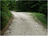
From the road, take the cart track in the direction of the Vogel, which at the beginning resembles a slightly smaller torrent. After an initial slight ascent, the path leads to a clearing, after which cart track turns into a footpath which begins to climb steeply. The path continues through the dense forest and is sometimes a little more difficult to follow due to fallen trees. A little higher up, the steepness suddenly subsides and a minute of flat walking ensues. The path ahead leads to an area where a major avalanche has triggered a large number of trees. Once over this section, the path turns right under the steep slopes of Storeč Peak and climbs steeply again. The steepness eases further and the path leads to the edge of the ski slope. Cross the lane rocks and reach a triangular crossroads, where you continue to the right in the direction of the cable car. Just a little further on, you come to a wide cart track, where you continue to the left but only a few metres. Soon the markings direct us to the right on a footpath which, ascending gently, leads quickly to the upper station of the pendulum.
Continue past the hotel and just a few metres further on you will see the signs for the Merjasec hut. Take a slight left and in a few steps you will reach the hut.
At the hut, follow the path in the direction of Vogel, Šija and Rodica. The path first begins to descend gently on a ski slope and then leads to an unmarked saddle where the path to Zlatorog branches off to the right. Continue left along the worse road, where there are no signs, but you will come across markings a little further on. The dirt road starts to climb and turns slightly right. A little further on, cart track has a crossroads but the left steep and right curving quickly merge. Then, on the right hand side, you see a cross where the minor road flattens out and leads to a fork in the path on a small plateau.
Here, on the right-hand side, we see the upper station of the double-seater Last Vogel. Take the ski slope, which starts to descend and soon makes a left turn. Our route descends to the right-hand bend of the ski slope, where we leave it.
We continue straight ahead, where we see a nice little track, which starts to climb gently and then steeply. The path climbs to a crossroads where it joins the path from under the Orlovih hlavi. Here we head in the direction of Komna, and the path starts to descend. The path then picks up a rhythm and starts to climb gently. A little further on, we reach a crossroads where a signpost for Vogel directs us upwards to the left. The trail starts to climb here and leads us over a scree slope to Škrbina, which is the lowest point between Primorska and Gorenjska from Mangart to Črna Prsta (if you don't count Vršič). At Škrbina, where we join the path below the slopes of Šija, we have a view of Primorska. Continue right along the ridge, which is exposed steeply upwards. The most difficult part of the route follows, crossing a short but precipitous ledge without fixed safety gear. Next, cross the gully and then the difficulties disappear. Below the top slope of Vogel, cross a scree slope, then the path climbs up grassy slopes to the saddle between Vogel and Vrh Krnic. From the saddle to the summit, it is a five-minute walk along a scenic, easy ridge.
Starting point - Merjasec 1:15, Merjasec - Vogel 2:30.

Pictures:
 1
1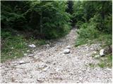 2
2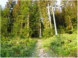 3
3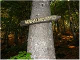 4
4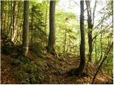 5
5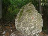 6
6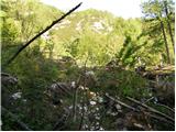 7
7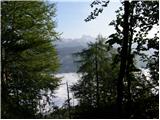 8
8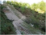 9
9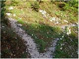 10
10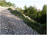 11
11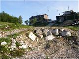 12
12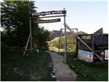 13
13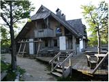 14
14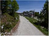 15
15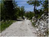 16
16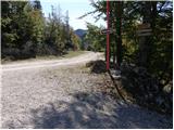 17
17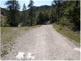 18
18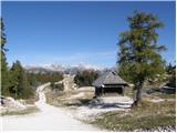 19
19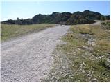 20
20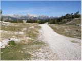 21
21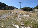 22
22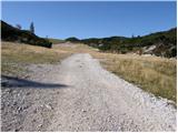 23
23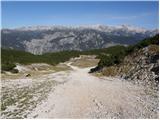 24
24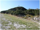 25
25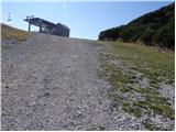 26
26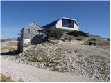 27
27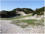 28
28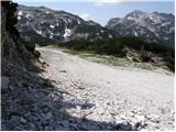 29
29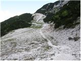 30
30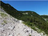 31
31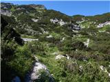 32
32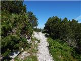 33
33 34
34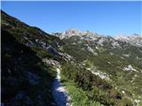 35
35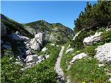 36
36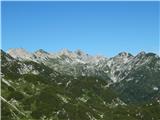 37
37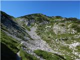 38
38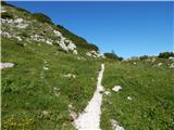 39
39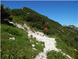 40
40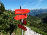 41
41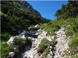 42
42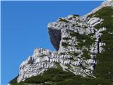 43
43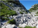 44
44 45
45 46
46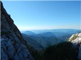 47
47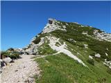 48
48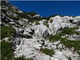 49
49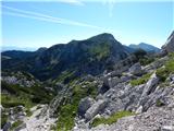 50
50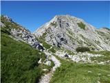 51
51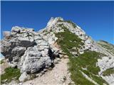 52
52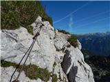 53
53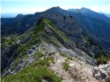 54
54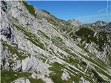 55
55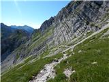 56
56 57
57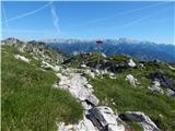 58
58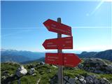 59
59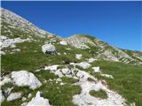 60
60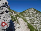 61
61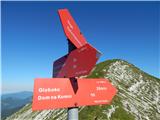 62
62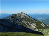 63
63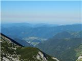 64
64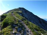 65
65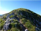 66
66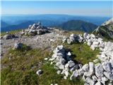 67
67 68
68
Discussion about the trail Planina Storeča raven - Vogel (via upper station of chairlift Zadnji Vogel)