Planinska Ravna - Boskovec (Sever way)
Starting point: Planinska Ravna (1140 m)
Name of path: Sever way
Time of walking: 1 h 25 min
Difficulty: easy marked way
Altitude difference: 447 m
Altitude difference po putu: 500 m
Map: Kamniške in Savinjske Alpe 1:50.000
Recommended equipment (summer):
Recommended equipment (winter):
Views: 19.386
 | 1 person likes this post |
Access to the starting point:
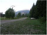
First, drive to Mozirje, where you will reach a roundabout and head in the direction of Golte and Šmihel. A little further on, you will reach a crossroads by a guesthouse, where you turn slightly right in the direction of Šmihel (the Golte cable car is on the left). Follow the road to the village, where you will see a church on the right side of the road. Just a little further on we come to a crossroads where we turn left in the direction of the Mozirska hut, Golte (Here we join the road from the Koroška side on the right, which is a possible access for the Koroška people). The road then soon leads us to the next crossroads, where we turn left onto the lower road. The road then soon becomes gravel, and we follow it to a large parking lot in front of the lock. The parking lot is on the right hand side of the road and is partly covered with grass.
Path description:
At the beginning of the parking lot, you will see mountain signs pointing you to the right on the footpath towards Mozirska hut. The path, which goes immediately into the forest, climbs moderately and after a few minutes leads us to a small crossroads, where we have two options for continuing. You can continue straight on the steep path or right on the sloping path. After a few minutes, the two paths merge and lead us higher up to a beautiful viewpoint, next to which a bench is placed. There is only a moderate climb of 10 minutes to Mozirska hut.
From the hut, continue left along the road to the chapel at which the signs for Boskovec (Severjeva pot) direct us slightly right into the forest. After a few steps, cross the grazing fence, and then the path climbs slightly more for a short time. Next, we cross a short scenic slope, and then a slight ascent leads us through the wods again to a worse forest road. Here a path branches off to the right to a viewpoint (5 minutes), and we continue slightly to the left, along a road that gradually descends. After a few minutes of gentle downhill, cart track branches off to the left uphill towards Boskovec. The climb up the cart track does not take long as the markings quickly direct us to the right on a footpath which leads us across the sometimes rather overgrown slopes to a larger meadow just below the summit. Continue along the right-hand side of the meadow, where the path quickly leads us into the forest and then to a crossroads. The signpost for Boskovec directs us to the right on a path that climbs moderately and after a few dozen steps leads us to the summit.
Planinska Ravna - Mozirska koča 30 minutes, Mozirska koča - Boskovec 1:00.

Pictures:
 1
1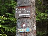 2
2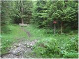 3
3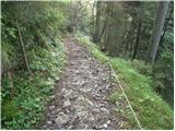 4
4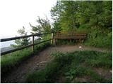 5
5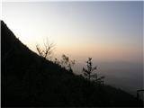 6
6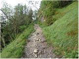 7
7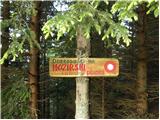 8
8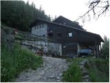 9
9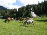 10
10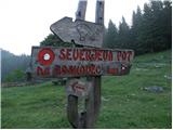 11
11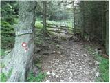 12
12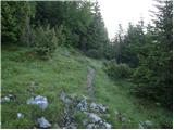 13
13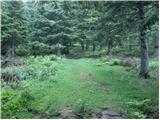 14
14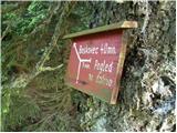 15
15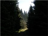 16
16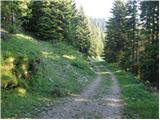 17
17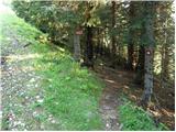 18
18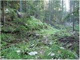 19
19 20
20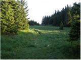 21
21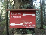 22
22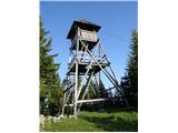 23
23
Discussion about the trail Planinska Ravna - Boskovec (Sever way)
|
| marinka6719. 05. 2013 |
Cesta od Šmihela je makadamska le kak kilometer, nato pa je spet asfalt, vse do parkirišča, kjer pa na desni strani ni več mogoče parkirati, je pa par 100m naprej tik pred zapornico na levi urejeno parkirišče. Midva vse do konca nisva vedela, ali sva na pravi poti, na srečo sva imela sprintano sliko parkirišča  . Škoda, da ne popravijo stolpa, ki žalostno propada.  Saj si mislim, finance.....
|
|
|
|
| radegunda29. 07. 2015 |
Ali je pot čez Hleviško planino manj zaraščena ? V kakšnem stanju pa je stolp?
|
|
|
|
| geppo29. 07. 2015 |
Stolpa, že kar nekaj česa ni več. Sicer, po poti čez Hleviško že nekaj mesecev nisem šel. Smatram, da kakšnih posebnih težav ne boš imela.
lp
|
|
|
|
| radegunda29. 07. 2015 |
No, ta je pa lepa... Mislim, da bomo šli le do razgledne točke, za katero je tabla na sliki 15. Razgledna točka bi verjetno še morala biti tam 
|
|
|
|
| geppo30. 07. 2015 |
Razgledna točka še obstaja. Pod njo je pa Janezov bivak, ki ga lahko obiščeš..
lp
|
|
|
|
| Stamp4. 08. 2019 |
Ima vidika sa ili blizu Boskovca ?
Kak je s Mozirskom kočom - s hranom je opskrbljena ?
|
|
|
|
| Stamp8. 08. 2019 |
Kružni hod napravili smo ove nedjelje. Utisak - tak-tak, hod za familiju, ni teško.. Zimi, po snegu je ziher interesantnije.. Sve slike SU TU a track kružnog hoda PA JE TU
|
|
|
|
| nejcf16. 06. 2020 |
Prejšnji vikend sem bil po večtedenskem premoru končno spet nekje malo višje. Opisana pot je le manjši del kroga, ki sva ga prehodila po Golteh. Mozirska koča je bila zaprta, česar nisva pričakovala in zato ostala brez kosila.
|
|
|