Podbrdo - Slatnik (northwestern peak)
Starting point: Podbrdo (515 m)
| Lat/Lon: | 46,2151°N 13,9739°E |
| |
Time of walking: 3 h 15 min
Difficulty: easy marked way
Altitude difference: 1094 m
Altitude difference po putu: 1105 m
Map: Škofjeloško in Cerkljansko hribovje 1:50.000
Recommended equipment (summer):
Recommended equipment (winter): ice axe, crampons
Views: 8.514
 | 1 person likes this post |
Access to the starting point:
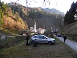
a) First drive to Škofja Loka, then continue to Železniki and Tolmin. When you arrive in Podbrdo, pay attention, because just after the church you will turn right onto a narrow local road that starts to climb along the river Bača. Park in a suitable place on the roadside, or in a small parking lot next to the local cemetery.
b) From the road Idrija - Most na Soči, turn right at Bača pri Modreju, or left if you are coming from the route of Posočje, and continue towards Podbrdo. At the end of Podbrdo, pay attention, because just before the church of St. Nicholas you will turn left onto a narrow local road, which begins to climb along the river Bača. Park in a suitable place on the roadside, or in a small parking lot next to the local cemetery.
Path description:
From the starting point, continue along the initially still asphalted road, from which a marked footpath soon branches off sharply to the left towards Vrhu Bače. Continue past an old residential house, gradually turning into the forest. Through the forest, we climb along a relatively well-marked and partly also quite steep mountain path, which is higher and leads us out of the forest to a short scenic slope, over which we walk to the nearby church of St Lenart.
At the church, you enter a narrow road, which leads you quickly to the village of Bača near Podbrdo. Through the small and picturesque village, follow the signs and they will lead you to cart track, which begins to climb through the forest. The narrower and at first slightly overgrown cart track, however, joins the old mulatier after a few minutes. Follow the wide mulatier to the right, and after a few minutes it leads to a small crossroads, where you continue along the upper left path in the direction of Vrh Bače (slightly to the right Petrovo Brdo).
We continue to climb for some time on the well-preserved and quite wide mule track, which we leave for a short time higher up, as the path leads us along a marked shortcut. Higher up, the mule track path is stopped a few times by some fallen trees, and we then approach the cliffs of Šance Peak, where we leave the mule track. Next, we climb up a rather steep path, which takes us 5 minutes of further walking to reach the hunting hut on Vrhu Bače.
From the hunting hut continue in the direction of Črna prst, then, a few steps below the indistinct saddle Vrh Bače, continue right in the direction of Šavnik and Cairn. The way forward climbs steeply through the forest for a short time, then leads to a grassy leveling, where the path is transiently laid. The way forward returns to the forest, where after a short climb it leads us to an old military bunker, which has been converted into a kind of weekend retreat, and the path bypasses it on the right-hand side. The moderately steep path then leads us to the edge of the ridge (here we can climb in a few steps to a beautiful viewpoint - a view of Baško Grapa and Kobla) along which we then climb through more or less compacted forest. Higher up, the trail turns left and completely flattens out. A good 5 minute walk follows, and then the path leads us to a larger grassy slope between Šavnik and Slatnik. Here we continue on the easy path, which turns to the right and after a few steps leads us to a marked crossroads. Continue straight on (left Šavnik) and cross the meadow called Na poljani. After a few steps, go around the emergency bivouac and just a little further on you will come to a less visible crossroads, where you continue slightly right (slightly left mountain pasture after Šavnik). The marked path then passes into the forest, where it starts to climb relatively steeply. Higher up, the forest thins out and the path leads to a small saddle between Možic on the left and Slatnik on the right. Here we continue to the right (sharp left cairn) along the path which climbs to the ridge of Slatnik. After a short climb, continue right (straight ahead Soriška planina) and climb the increasingly visible ridge to the unclimbed summit in a few minutes.

Pictures:
 1
1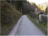 2
2 3
3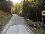 4
4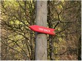 5
5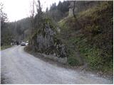 6
6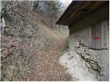 7
7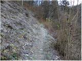 8
8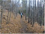 9
9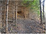 10
10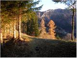 11
11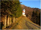 12
12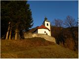 13
13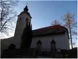 14
14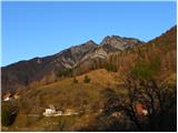 15
15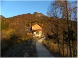 16
16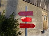 17
17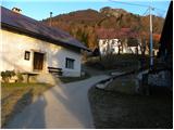 18
18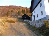 19
19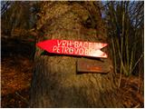 20
20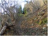 21
21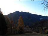 22
22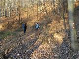 23
23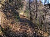 24
24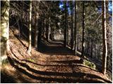 25
25 26
26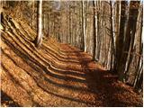 27
27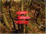 28
28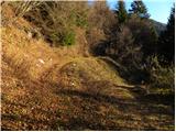 29
29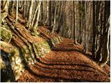 30
30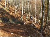 31
31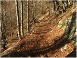 32
32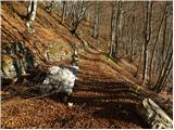 33
33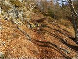 34
34 35
35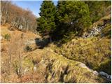 36
36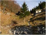 37
37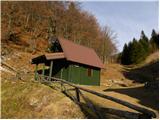 38
38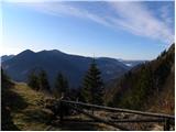 39
39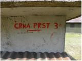 40
40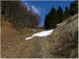 41
41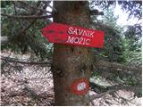 42
42 43
43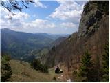 44
44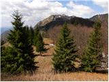 45
45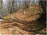 46
46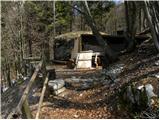 47
47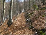 48
48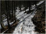 49
49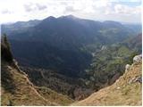 50
50 51
51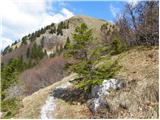 52
52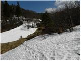 53
53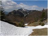 54
54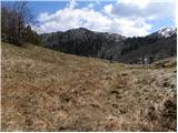 55
55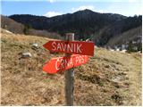 56
56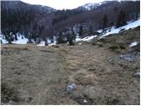 57
57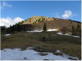 58
58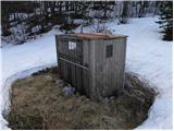 59
59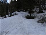 60
60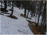 61
61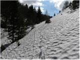 62
62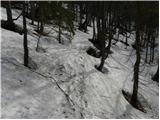 63
63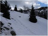 64
64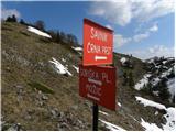 65
65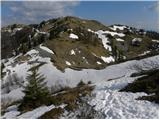 66
66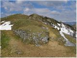 67
67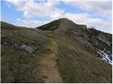 68
68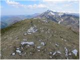 69
69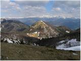 70
70
Discussion about the trail Podbrdo - Slatnik (northwestern peak)
|
| GregorC13. 12. 2011 |
Nisem ravno prepričan, da je ta vrh Slatnik. Na 67. sliki greš na Slatnik levo in ne desno. Sm tudi jaz mislil, da je to Slatnik, pa mi je bilo čudno, da gori ni bilo žiga, ker je le ta v Obhodnici Ratitovec. Na SLatnik greš levo naprej po poti in do naslednjega vrha. Na njem je žig, ki je pritrjen na rdečo štango.
|
|
|
|
| bats13. 12. 2011 |
tudi jaz bi rekel, da je leva varianta za Slatnik prava, desna pa pelje proti Možicu.Res pa je da že dolgo nisem kolovratil točno po tej poti.
|
|
|
|
| Skovik22. 12. 2012 |
S kolegom sva šla danes po omenjeni poti. Izhodišče sva našla brez problemov. Pot do lovske koče na Bači je bila normano prehodna (razen ene par plazov na poti).Naprej pa sta vse do vrha prav prišle dereze in cepin. Dva sta sicer pred nama šla brez oz. s pohodniškimi palicami samo sta se verjetno kar namučila v klanec. Lušna pot, ne preveč naporna. Razgled fantastičen!
|
|
|
|
| Skovik29. 12. 2012 |
Danes smo šli na Lajnar iz Pretrovega Brda in smo šli še na vrh levo od žičnice oz. Lajnarja. Na naše presenečenje je bil vrh - Slatnik! Na vrhu je žig za Slatnik. Prav tako smo pogledali na zemljevid.
Opis te poti, ki vodi na vrh kjer je neka votla, zarjavela cev s pokrovom, res ni Slatnik, kot sta omenila GregorC in bats.
|
|
|