Starting point: Podgorje (518 m)
| Lat/Lon: | 45,5353°N 13,9435°E |
| |
Time of walking: 1 h
Difficulty: easy unmarked way
Altitude difference: 131 m
Altitude difference po putu: 131 m
Map: Primorje in Kras 1:50.000
Recommended equipment (summer):
Recommended equipment (winter):
Views: 5.199
 | 1 person likes this post |
Access to the starting point:
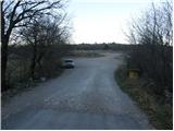
From the motorway Ljubljana - Koper take the exit Kozina. Follow the road towards Koper to the village Petrinje, where turn left towards Podgorje. The road, which climbs steeply at first, soon leads to the next crossroads, where you turn left. Continue to the village Podgorje, where you park in a large parking lot near the sports ground.
Access from Koper. Follow this road to a large parking lot near the sports ground, located in the village of Podgorje.
Path description:
From the parking lot, return to the main road and follow it in the direction of travel. After a few dozen metres, you reach a crossroads where wooden mountain signs direct you. At the crossroads, continue along the road in the direction of Kojnik. The road, which runs without changes in elevation, has a few crossroads at the beginning, but everywhere you continue along the one that is the "main" road. Here and there you can see some faded markings indicating the way to Kojnik. After a while, the road gradually starts to climb and takes us a little higher to a crossroads where we continue to the left. Follow this road for only a few minutes to where cart track branches off to the right up a small clearing. Take this cart track which, after a short climb, leads to a small saddle on the ridge. Here, where cart track ends, continue to the right along a less well-developed and rather overgrown path, which climbs only slightly along the edge of the cliffs. After about 15 minutes of walking along and along the ridge, we reach an undistinguished peak with a beautiful view to the sea.

Pictures:
 1
1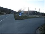 2
2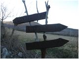 3
3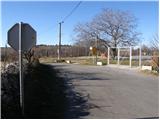 4
4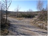 5
5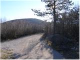 6
6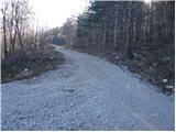 7
7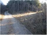 8
8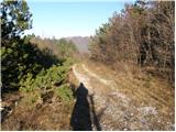 9
9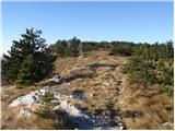 10
10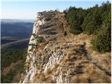 11
11 12
12
Discussion about the trail Podgorje - Jampršnik
|
| grega_p14. 02. 2010 |
Na Jampršnik priporočam tudi s Podpeči, mimo stolpa in po kraškem robu do vrha - pot je opisana v januarskem PV, je pa na določenih mestih slabše označena a orientacija ni težavna. Danes na poti sončno in že skoraj pomladno, na vrhu pa rahlo prevetrovno za mirno malico. Definitivno izlet za kakšen razgledno očiščen dan brez burje!
Srečno
|
|
|