Podolševa (Rogar) - Obel kamen (Olševa) (east path)
Starting point: Podolševa (Rogar) (1240 m)
| Lat/Lon: | 46,4398°N 14,6656°E |
| |
Name of path: east path
Time of walking: 2 h 10 min
Difficulty: difficult marked way
Altitude difference: 671 m
Altitude difference po putu: 685 m
Map: Kamniške in Savinjske Alpe 1:50.000
Recommended equipment (summer): helmet
Recommended equipment (winter): helmet, ice axe, crampons
Views: 999
 | 1 person likes this post |
Access to the starting point:
a) Drive to Luce, then continue on to the Logar Valley. In the village Solčava, before the bridge over the river Savinjek, leave the road towards the Logar valley and continue to the right in the direction of Podolševa and Črna na Koroškem. After a climb of about 5 km, you reach a crossroads where you turn left towards Sv. Duh (right Črna na Koroškem) and then follow the Solčava panoramic road to where the road to the tourist farm Rogar branches off to the right. Park in a suitable place near the crossroads. Parking in front of the farm is allowed for guests of the tourist farm. From the main road to the starting point is approximately 7,5 km.
b) Take the road to Črna na Koroškem and then continue driving in the direction of Koprivna and Solčava. Continue along the valley of the Meži River for a while, then turn left towards Solčava and the Logarska dolina. From there it is a short descent to a crossroads, where you turn right towards Sv. Duh, and then follow the Solčava panoramic road to where the road to the tourist farm Rogar turns off to the right. Park in a suitable place near the crossroads. Parking in front of the farm is allowed for guests of the tourist farm. From the centre Črna na Koroškem, the starting point is approximately 22,5 km.
c) Via Border crossing Pavličev Vrh, drive into Slovenia and start descending towards Solčava. Shortly after the Majerhold Mountain Lodge, turn left towards Podolševa and Solčava panoramic road. Follow the panoramic road for about 500 m further on from the Strevc Tourist Farm, which is located below the Church of the Holy Spirit. Park in a suitable place along the road, at the part where the road to the Rogar Tourist Farm branches off. From Border crossing Pavličev Vrh to the starting point is approximately 10,5 km.
Path description:
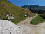
From where we parked, we first walk to the Rogar Tourist Farm, and from there we continue along the marked path towards Olševa. Above the farm, a beautiful view opens up, and the path soon turns into a forest. Climb through the forest for a few minutes and then cross the macadam road, where the path from the Strevc Tourist Farm joins from the left.
Continue in the direction of Potočka zijalka, Obel kamna and Govce. Continue along the well-trodden and gradually steeper path, which reaches the state border at a higher altitude. After a few minutes of steep climbing, the path from Austria joins us on the left.
Continue to the right and after another 10 minutes of climbing, you will reach the archaeological site Potočka zijalka.
Continue on the marked path, which bypasses the cave on the right and climbs up the right side of a fairly steep ravine using the fixed safety gear. A little further on, cross the gully with the help of wedges and then climb steeply out of the gully. The path continues to be quite steep, and with every metre gained in altitude it becomes more and more scenic.
At a small ridge, the path splits and we continue straight towards Govca (left Obel kamen). Then we cross the steep slopes of Olševa, and on the more exposed parts, we are helped by a few rocks. The path then turns left and leads to a marked crossroads.
This time, continue left towards Obel kamen (straight Govca), where you first cross the slopes to the left and then start climbing steeply. The last part of the climb before reaching the ridge is technically more difficult and not guarded. Above the short, difficult part, you reach a scenic ridge, along and over which you continue until you reach Obel kamen, which you can identify by the boundary stone with No XXII 1.
From the summit you can continue to the cross about 10 minutes away, where there is also a registration box.
Starting point - Potočka zijalka 1:05, Potočka zijalka - Obel kamen 1:05.
The description refers to the situation in August 2018, the pictures are from different periods.

Pictures:
 1
1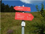 2
2 3
3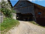 4
4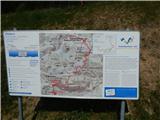 5
5 6
6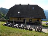 7
7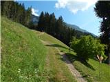 8
8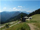 9
9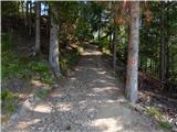 10
10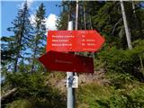 11
11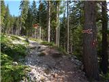 12
12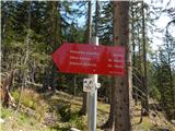 13
13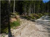 14
14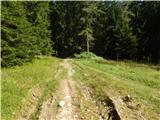 15
15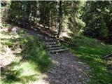 16
16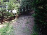 17
17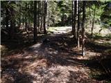 18
18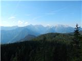 19
19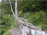 20
20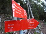 21
21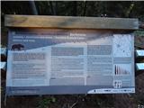 22
22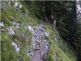 23
23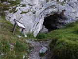 24
24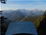 25
25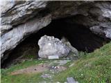 26
26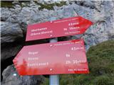 27
27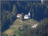 28
28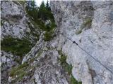 29
29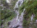 30
30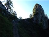 31
31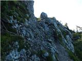 32
32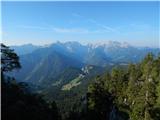 33
33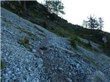 34
34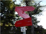 35
35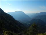 36
36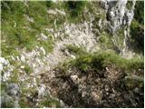 37
37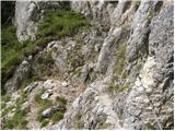 38
38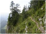 39
39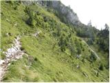 40
40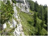 41
41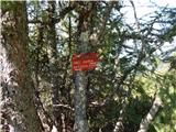 42
42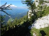 43
43 44
44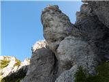 45
45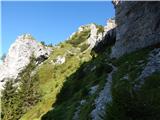 46
46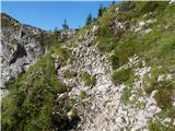 47
47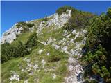 48
48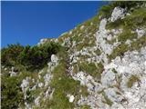 49
49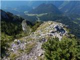 50
50 51
51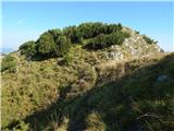 52
52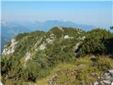 53
53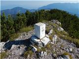 54
54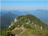 55
55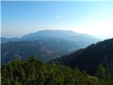 56
56 57
57
Discussion about the trail Podolševa (Rogar) - Obel kamen (Olševa) (east path)