Starting point: Pred Belo (571 m)
| Lat/Lon: | 46,3188°N 14,6005°E |
| |
Time of walking: 4 h 25 min
Difficulty: partly demanding marked way, easy pathless terrain
Altitude difference: 1394 m
Altitude difference po putu: 1394 m
Map: Kamniške in Savinjske Alpe 1:50.000
Recommended equipment (summer):
Recommended equipment (winter): ice axe, crampons
Views: 7.302
 | 1 person likes this post |
Access to the starting point:
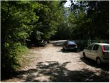
Drive into Kamnik and follow the road towards the Kamnik Bistrica valley. Approximately 2 km after the lower station of the pendulum at Velika planina, you will see a parking lot on the right side of the road and mountain signs for Presedljaj, Konja and Korošica (the parking lot is located behind the bridge).
Path description:
From the parking lot, follow the path in the direction of Presedljaj, Korošica, Konja and Ojstrica. After a few metres, the path turns right, where it climbs only slightly at first, then begins to descend and after a few minutes joins the wide cart track. The ascent continues along the folded cart track, which soon crosses a torrent and then climbs gently to moderately towards the valley of the Kamniška Bela.
After a good 30-minute walk from the starting point, we reach a marked crossroads, where we continue to the right along a marked path (to the left the Orglice waterfall and the Korošica River via Šraj peska). Cart track turns into an increasingly steep path shortly after the crossroads, and this path continues to lead us through the dense forest. Higher up, the path turns slightly to the left and crosses a torrential ravine. A little further on, the path over Najnar Štant (a difficult and exposed path leading to Korošica, higher up it joins the path over Šraj pesek) branches off almost imperceptibly to the left, and we continue straight on the marked path, which begins to climb in many switchbacks. Higher up, the path climbs even steeper for a short time and leads to a beautiful viewpoint with a table and a bench.
The path continues gently downhill, crosses a steep slope and leads to a torrential ravine. Here the path turns to the left side of the slope, climbs initially with the help of a few pegs and a higher rope, and then returns to the forest, where it climbs steeply for some time. Higher up, the path makes a transitional lay, then climbs steeply again and within a few minutes of further walking leads to the saddle Presedljaj, where there is a marked crossroads.
Continue left in the direction of Korošice (right Konj) along the path, which begins to climb up the left side of an indistinct ridge. After a few minutes the path turns to the right and lays down. The path continues along a path that is quite overgrown in places and climbs steeply through lane of dwarf pines. A little further on, the path crosses an exposed slope above the Lučka Bela valley, where there is also a memorial plaque to an unfortunate mountaineer. Just a few metres after the memorial plaque, the slope is laid and leads to an unmarked crossroads, where an unmarked path branches off to the left towards Vršiči and Vežice. Take the above-mentioned path (the path leads straight towards Korošica), which quickly leads you to the animal watering place via lane of dwarf pines (a nice wide passage). Here the path disappears and we keep slightly to the right, where we then see two less visible paths on the slope. The right one leads through a small valley, the left one between dwarf pines. Higher up, the two paths merge and lose each other on the grassy slope only a few 10 m further on. Continue left, passing the headland on the left, and just after this you will come out on a ridge with a view. There is a short descent, crossing a short lane of dwarf pines, and then climbing from a perch between the two peaks to a prominent and precipitous summit.

Pictures:
 1
1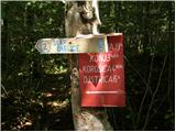 2
2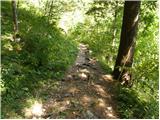 3
3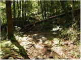 4
4 5
5 6
6 7
7 8
8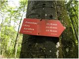 9
9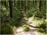 10
10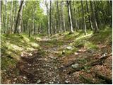 11
11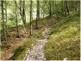 12
12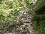 13
13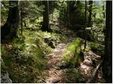 14
14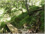 15
15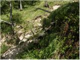 16
16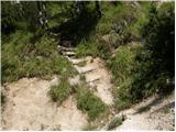 17
17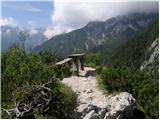 18
18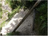 19
19 20
20 21
21 22
22 23
23 24
24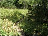 25
25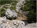 26
26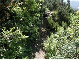 27
27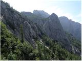 28
28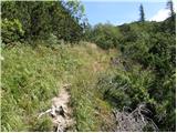 29
29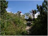 30
30 31
31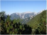 32
32 33
33 34
34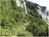 35
35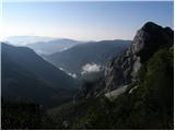 36
36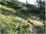 37
37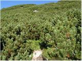 38
38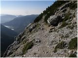 39
39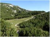 40
40 41
41 42
42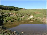 43
43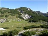 44
44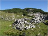 45
45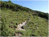 46
46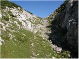 47
47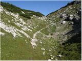 48
48 49
49 50
50 51
51 52
52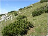 53
53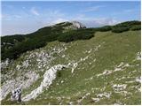 54
54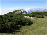 55
55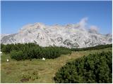 56
56 57
57 58
58 59
59 60
60 61
61 62
62
Discussion about the trail Pred Belo - Vežica