Predmeja (tunnels) - Veliki Rob (Srednječavenska pot)
Starting point: Predmeja (tunnels) (800 m)
| Lat/Lon: | 45,9377°N 13,8692°E |
| |
Name of path: Srednječavenska pot
Time of walking: 3 h
Difficulty: partly demanding marked way
Altitude difference: 437 m
Altitude difference po putu: 620 m
Map: Goriška 1:50.000
Recommended equipment (summer): helmet
Recommended equipment (winter): helmet, ice axe, crampons
Views: 3.460
 | 1 person likes this post |
Access to the starting point:
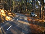
a) From the expressway Razdrto - Nova Gorica take the exit Ajdovščina and follow the road towards the village Lokavec (Lokavac can be reached from the centre of Ajdovščina, or from the old road Ajdovščina - Nova Gorica, where turn right at Cesta). From Lokavac, continue along the ascending winding road in the direction of Predmeja. Follow the road to the mountain signposts for Čaven, Veliki Rob and Kucelj (the signposts are located between the quarry and the tunnels, the road marking is approx. 10 km). Park a few 10 m down the road in the parking lot.
b) The starting point can also be reached from Godovič, via Črni Vrch and Colo to Predmeja. In this case, descend from Predmeja towards Ajdovščina and then park shortly after the third tunnel.
Path description:
From the parking lot, first walk to the route signs and then follow the Srednječavensko trail. The trail, which goes immediately into the forest, first climbs moderately and then continues crossing the slopes to the south. A wide and well-surfaced mountain path, it soon switches to steep slopes (danger of falling rocks) and gradually turns more and more to the right. A little further on, the path offers beautiful views of the Nanos and Vipava valleys, and the path gradually turns into a rockier world. A little further on, the path again enters a dense forest, where it begins to descend gently. After a short, gentle descent, you reach a crossroads, where you continue straight ahead (left down Lokavec, right up Koča na Čavnu) along a path which, although it runs at an altitude of about 900 m, takes on the appearance of a real high-mountain path. The trail then leads us out of the mostly pine forest onto a scree slope, from which we have a beautiful view of the valley, with steep rocky cliffs to our right. At the end of the scree slope, the path passes into the walls of the eastern Mala gora, where, with the help of a rope, we cross a wide and partly exposed ledge. At the end of the ledge, we have a nice view of the Slano mudslide above Lokavec, and we continue along the Srednječavenská trail, which turns a little more to the right, where it starts to descend slightly through the lane of bushes. After a short descent, the path flattens out and we see a large rocky wall and a nice bench next to it for a short or longer rest. The path then continues through the forest and quickly leads to the next crossroads.
This time continue right in the direction of Mala gora and Čavna (left down Stomaž, straight on continues the Srednječavenska trail) on a path that begins to climb steeply. After a few minutes of steep ascent, the steepness eases and the path leads to the uncultivated grassy slopes of Mala gora, where you also reach the next crossroads.
Here, continue left (straight up Koča na Čavnu) along the path, which mostly crosses the slopes to the west. After about 10 minutes' walk from the crossroads, the path descends and leads in a few steps to Hut na Mala gora. From the Hut on Mali gori, continue in the direction of Kuclj and Čavno. A few steps further on, cart track joins us from the left, coming from the nearby hunting hut. Continue along the cart track, which soon branches off to the right to the Cottage na Čavnu.
Continue straight ahead on the cart track, which then leads to the path from the Cottage on Čavnu towards Kuclju. Here, continue left along the path, which runs almost horizontally at first and then begins to climb. This path soon leads us out of the forest, where we can already see Kucelj in front of us, which is still 10 minutes away from a scenic climb.
From Kuclj we descend in the direction of Vrtovin, along a path which, after a short descent, leads us to a marked crossroads.
Continue right in the direction Veliki Rob on a pleasant path that descends gently over the grassy slopes. Lower down, the path passes into lane of bushes and then joins the old road or track between the Vipava valley and the Trnovo forest. Follow the cart track to the right, and after a few minutes the signs for Veliki Rob direct you left onto a footpath that gradually begins to climb the southern slopes of the Trnovski Forest. The occasionally quite scenic path retreats slightly to the right higher up the ridge and briefly passes into the dense forest, where the path from Cirque joins us from the right. After a short descent, the path begins to climb again, and this leads us out of the forest into the lane of dwarf pines, where it then continues along and along an occasionally quite steep ridge. Follow this path, which offers beautiful views, all the way to Veliki Rob, from which we have a nice view.
Predmeja (tunnels) - Mala gora 1:30, Mala gora - Kucelj 0:30, Kucelj - Veliki Rob 1:00.

Pictures:
 1
1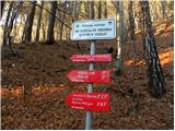 2
2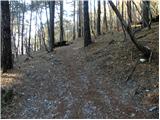 3
3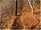 4
4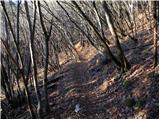 5
5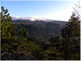 6
6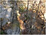 7
7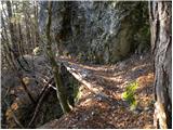 8
8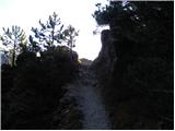 9
9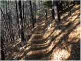 10
10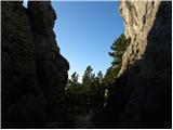 11
11 12
12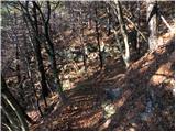 13
13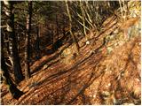 14
14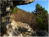 15
15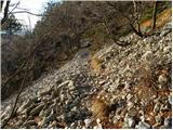 16
16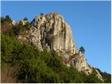 17
17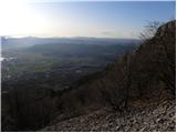 18
18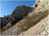 19
19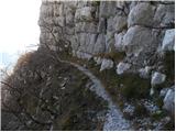 20
20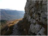 21
21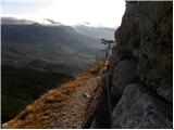 22
22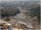 23
23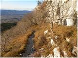 24
24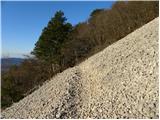 25
25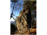 26
26 27
27 28
28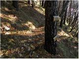 29
29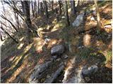 30
30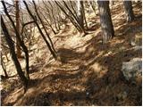 31
31 32
32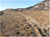 33
33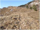 34
34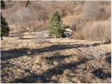 35
35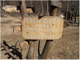 36
36 37
37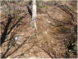 38
38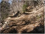 39
39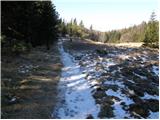 40
40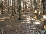 41
41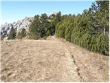 42
42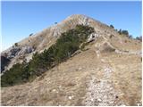 43
43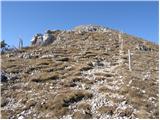 44
44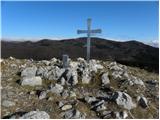 45
45 46
46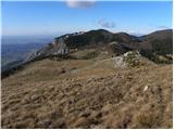 47
47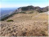 48
48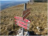 49
49 50
50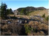 51
51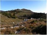 52
52 53
53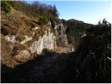 54
54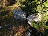 55
55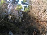 56
56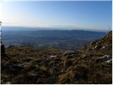 57
57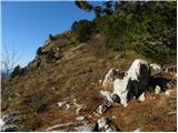 58
58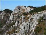 59
59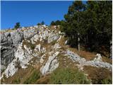 60
60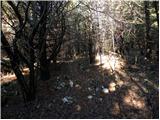 61
61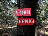 62
62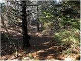 63
63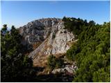 64
64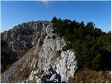 65
65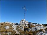 66
66 67
67
Discussion about the trail Predmeja (tunnels) - Veliki Rob (Srednječavenska pot)
|
| darinka46. 12. 2020 |
Lepa in sploh zanimiva je srednječavenska pot. Dolga , če prehodiš celo. A se jo splača prehodit spomladi ko je tam polno rož.
|
|
|
|
| mirank6. 12. 2020 |
Res je tako; sicer pa navedena pot na M goro ne pripelje. Že na sliki 29 samo prećka pot iz Stomaža in se nadaljuje v lepem položnem prećenju južnih pobočij Kuclja in V roba. Pri skalni zapori zavije desno in pripelje na sedelce 5min zah od V roba-t.i. Strma pot.
|
|
|
|
| garmont31. 05. 2021 19:47:50 |
Od zadnjega odcepa za Kucelj naprej, so ob poti starejše, že precej obledele markacije. Se vidi, da večina pohodnikov zavije na ta bližnji, isto visoki vrh.  Klopi so pa žal tudi značilni za te kraje. 
|
|
|