Starting point: Prelaz Vrhe (426 m)
| Lat/Lon: | 46,2583°N 15,7586°E |
| |
Time of walking: 1 h 5 min
Difficulty: easy unmarked way
Altitude difference: 169 m
Altitude difference po putu: 270 m
Map: Rogaška Slatina z Bočem in Donačko goro 1:25.000
Recommended equipment (summer):
Recommended equipment (winter): ice axe, crampons
Views: 98
 | 1 person likes this post |
Access to the starting point:
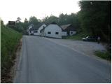
From the Ljubljana - Maribor motorway, take the Dramlje exit and follow the road towards Šentjurje, Rogaška Slatina and Rogatec. In Rogatec, the signs for Donačka gora direct you to the left onto a slightly narrower road, which you then follow towards the settlement of Žetale. At a small pass, just at the point where the municipality Rogatec ends, you will see a slightly larger parking lot on your right, where you park.
Path description:
From the parking lot, first walk to the pass, where you continue along the left ascending road towards Donačka gora. After a short climb, just a few metres behind a house with a thatched roof, the signs for Donačka gora direct us right to a folded cart track, which after a few steps goes into a short lane of forest.
Cart track quickly emerges from the forest and then continues along a hayfield. Higher up, the path leads to a secluded farmhouse, past which a waymarked path leads. Just above the farm, we join the slightly wider cart track, which we follow to the right (to the left Sveti Jurij and St Donat's Church). Cart track, which continues to climb crosswise, leads us mostly through the forest to the next crossroads, where the path to Žetale branches off to the right.
Here, continue straight on in the direction of Rudi's house (Donačka gora on the left) and descend crosswise. During the cross descent, cross the Kupčinji Vrh - Donačka gora trail and then reach a crossroads where you reach the slightly wider cart track.
Continue slightly left (sharp right Kupčinji Vrh and Žetale) in the direction of Rudi's home and cross the northern slopes of Donacca Mountain. After a while, just past the hunting observation post, you will reach a small, nondescript saddle, and turn right from the marked path onto an unmarked path, which will take you to Joški vrh in two minutes.

Pictures:
 1
1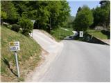 2
2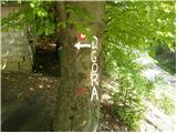 3
3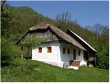 4
4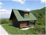 5
5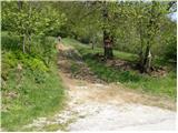 6
6 7
7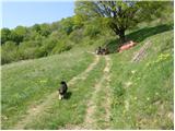 8
8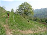 9
9 10
10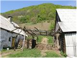 11
11 12
12 13
13 14
14 15
15 16
16 17
17 18
18 19
19 20
20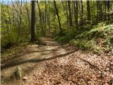 21
21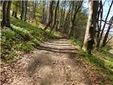 22
22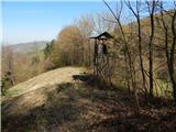 23
23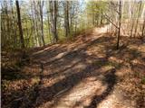 24
24 25
25 26
26 27
27 28
28
Discussion about the trail Prelaz Vrhe - Joški vrh