Rateče - Ofen/Peč (by road)
Starting point: Rateče (865 m)
| Lat/Lon: | 46,4979°N 13,7118°E |
| |
Name of path: by road
Time of walking: 2 h
Difficulty: easy marked way
Altitude difference: 643 m
Altitude difference po putu: 660 m
Map: Kranjska Gora 1:30.000
Recommended equipment (summer):
Recommended equipment (winter):
Views: 45.540
 | 2 people like this post |
Access to the starting point:
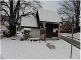
First we drive to Kranjska Gora, then we continue driving towards Rateče. At the crossroads where the road to Planica turns off to the left and Rateče to the right, continue straight ahead. Take the next crossroads in Rateče, which is located a few 10 m before the petrol station. At the Mojmir restaurant, continue straight ahead and then after 10 m turn sharp left onto the road towards Tromeja. The road then climbs up to the village and we park in a suitable place on the roadside.
Path description:
From the starting point, continue along the road along which you parked, which soon turns quite right and then climbs steeply eastwards. At the view of the Julian Alps peaks, the road gradually lays down and leads us into the forest, where a marked footpath joins us from the right.
We continue along the road, which becomes steeper, and we follow it for some time as we climb through the forest. Higher up, we cross a hay meadow, and the path returns to the forest and leads us to a marked crossroads. Here we continue straight on (right Dom na Tromeji 3 minutes) and follow the road, which soon makes a right turn. In the middle of the right turn, a steep footpath branches off to the left, leading to Ofen - Tromejo, and we continue to the right and continue on the dirt road. The road then climbs for a while crosswise to the right and then splits into two parts. Take the upper left path (the right road leads to Korenski sedlo) and continue climbing crosswise to the right for some time. Higher up, the road turns sharp left and slowly starts to approach the border ridge between Slovenia and Austria. When you have almost reached the border ridge, another forest road branches off sharply to the right. We continue straight ahead and follow the road to a kind of pass, where the road to the Austrian side branches off to the right.
Here we continue straight on (right hut Dreiländereck Hütte 3 minutes) and follow the moderately steep road, from which we get increasingly beautiful views, to the top of Peči, which we reach after about 15 minutes of further walking.

Pictures:
 1
1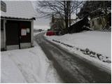 2
2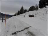 3
3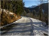 4
4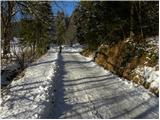 5
5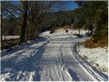 6
6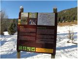 7
7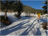 8
8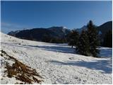 9
9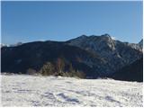 10
10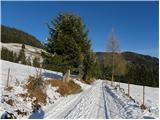 11
11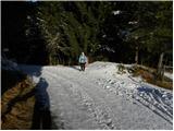 12
12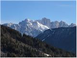 13
13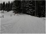 14
14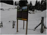 15
15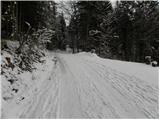 16
16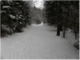 17
17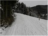 18
18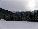 19
19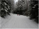 20
20 21
21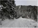 22
22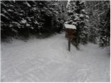 23
23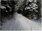 24
24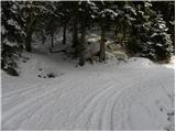 25
25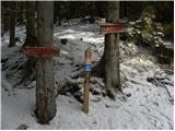 26
26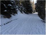 27
27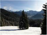 28
28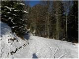 29
29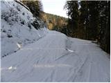 30
30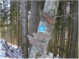 31
31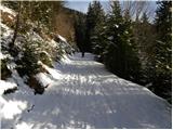 32
32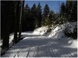 33
33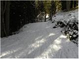 34
34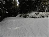 35
35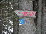 36
36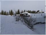 37
37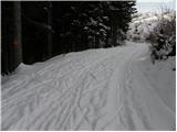 38
38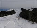 39
39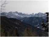 40
40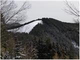 41
41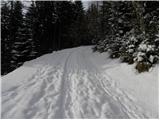 42
42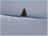 43
43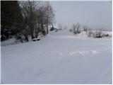 44
44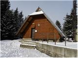 45
45 46
46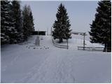 47
47 48
48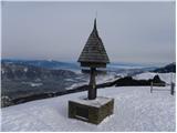 49
49 50
50
Discussion about the trail Rateče - Ofen/Peč (by road)
|
| Guest16. 01. 2007 |
Z šolo smo šli na ta izlet jeseni.Meni je bilo zelo všeč.Na vrh se splača jit ker je zelo lep razgled.
|
|
|
|
| Guest18. 01. 2007 |
ALi ima kdo prehojeno od Rtomeje do Stola?Približno koliko časa?
|
|
|
|
| Guest18. 12. 2007 |
A kdo ve, če se že da sankat s Tromeje?
|
|
|
|
| Guest18. 12. 2007 |
Pošiljka snega v tem delu Slovenije je bila premajhna za sankanje. Mogoče po snegu pomešanim s kamenjem, če ti je tudi to v užitek pol lahko greš, če ne pa še malo počakaj.
|
|
|
|
| starakapa3. 02. 2008 |
Da,jaz sem prehodil to pot od Stola do tromeje.Prvi dan sem spal na Golici,drugi dan v bivaku pod Kepo,tretji dan pa na tromeji.
Vreme sem imel lepo,dnevno pa sem hodil po potrebi ob 8do 10 ur.Četrti dan sem sestopil v Kranjsko goro in na avtobus.
Probaj pot je enkratna in izredno razgledna.Videl sem tudi svizce.Pomankanje vode ni bilo,le mnogo potrpljenja moraš imeti saj se pot mnogo spušča in vzpenja.Naj povem,da nisem vedno hodil po markacijak ,saj jih marsikje ni,še zlasti v bližini Podkorena in nato preko ceste proti tromeji.Ako želiš še več informacij ali pa slik iz poti pa napiši svoj naslov in z veseljem ti ustrežem.LP Starakapa
|
|
|
|
| starakapa3. 02. 2008 |
Tam sem se zmotil,ni Podkoren ampak Rateče,upam da to ne bo vplivalo na razumevanje opisa poti
|
|
|
|
| babica 53. 03. 2023 08:17:09 |
Za jutri je napovedano zelo lepo vreme, pa me zanima, kakšne so razmere za hojo? Ali naj grem po cesti ali po peš poti? Ne bi pa rada delala nove gazi.
|
|
|