Ravne - Klek (via Hruški vrh)
Starting point: Ravne (1200 m)
| Lat/Lon: | 46,4678°N 13,9917°E |
| |
Name of path: via Hruški vrh
Time of walking: 2 h 30 min
Difficulty: easy unmarked way
Altitude difference: 553 m
Altitude difference po putu: 800 m
Map: Kranjska gora 1:30.000 in Karavanke - osrednji del 1:50.000
Recommended equipment (summer):
Recommended equipment (winter): ice axe, crampons
Views: 7.904
 | 2 people like this post |
Access to the starting point:
Leave the Gorenjska motorway at the Hrušica exit and follow the road in the route Kranjska Gora, but only as far as the village Dovje near Mojstrana. Turn right here (direction Dovje) and the road will quickly lead you to the mentioned village from where you will continue in the route Frauenkogel. The road will lead you to a crossroads shortly after the village, where you will continue on the right road (sharp left Mittagskogel and Borovje). Continue for some time to the next crossroads, where you turn sharp left in the direction of Frauenkogel (straight ahead Plavški Rovt). Follow this road, which then leads you past the grassy hay meadows called Ravne (a few holiday homes), to a ramp which prohibits further driving. You can park a little further down the road in one of the car parks along the road (from Dovje to the starting point is about 6. 5 km).
Path description:
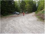
From the parking lot, continue along the road along which you parked. The road, which climbs moderately and takes us past the ramp, then climbs higher and takes us to a small saddle between Bele peči on the left and Frauenkogel on the right. We continue our ascent along the road which, after a few steps of further walking, leads us to a place where we leave it, as the markings direct us to the left on a steep footpath which continues to climb through the forest. The path crosses a grazing fence higher up, and a short scenic slope, and then returns to the forest, where it reaches a small unmarked crossroads. Continue left along the waymarked path (straight ahead to the source of the Starka spring, 1 minute), which climbs steeply again, then turns slightly to the right, where after a few minutes' further walking it leads to the lower edge of mountain pasture Dovšek Rosenbachsattel. Here the path turns left and, after a few minutes' climb through flowering meadows, leads us to a shepherd's hut at mountain pasture Dovška Rosenbachsattel.
From the shepherd's hut, continue to the right (not on the road) along the cross footpath, which climbs gently eastwards. The path soon crosses a short strip of forest and then continues in a gentle ascent towards the saddle between Frauenkogel and Hruški vrh. This part of the trail is dangerous for slipping (especially in wet conditions) in some places, due to the sometimes steep slopes to be crossed.
When you reach the border ridge, follow it to the right (direction east) and climb up it until you reach Rosenkogel, which you reach after a 10-minute scenic walk.
From Rosenkogel, continue eastwards along the less visible ridge path, which runs along the boundary line and descends gently. As the path flattens out, a path joins from the right, passing Rosenkogel. Here, a few metres below us, you can see a pleasant hunting lodge on Rožca (registration book).
Continue ascending along the border line on the path, which gradually starts to climb steeper, following the path surrounded by dwarf pines. Higher up, the path turns slightly to the left, flattens out and in a few further steps leads to the summit of Kleka.
Orientation is difficult in the fog.
Starting point - Dovška Rosenbachsattel 1:10, Dovška Rosenbachsattel - Rosenkogel 50 minutes, Rosenkogel - Klek 50 minutes.

Pictures:
 1
1 2
2 3
3 4
4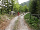 5
5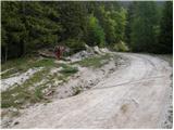 6
6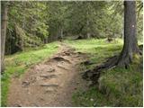 7
7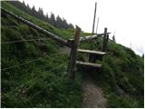 8
8 9
9 10
10 11
11 12
12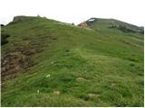 13
13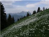 14
14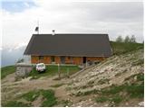 15
15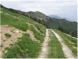 16
16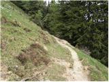 17
17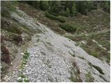 18
18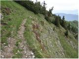 19
19 20
20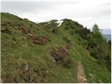 21
21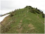 22
22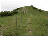 23
23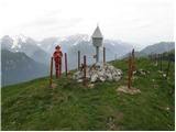 24
24 25
25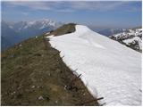 26
26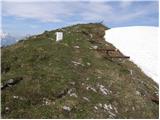 27
27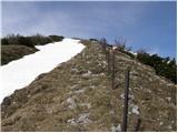 28
28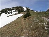 29
29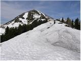 30
30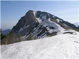 31
31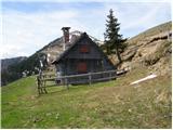 32
32 33
33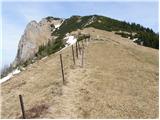 34
34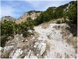 35
35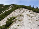 36
36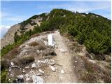 37
37 38
38
Discussion about the trail Ravne - Klek (via Hruški vrh)
|
| plaNinaPirsMajcen20. 05. 2025 19:27:11 |
Vabljeni k ogledu prelepih cvetočih narcis 🤍 https://youtu.be/Ms6yxbmQUc0?si=j1DeAlP8hRasXTJ4 Želela sem v hribih doživeti cvetoče bele narcise in ker sem se nameravala izogniti oblegani Golici, sva jo z mamo mahnili na sosednji Klek. Video je nastal 17.5. 2025. Morda kakšen teden prehitro, do polnega razcveta teh opojnih krasotic 🤍 Parkirali sva na izhodišču Ravne in se kar po makadamski cesti povzpeli do planine Dovška Rožca (kjer je tudi veliko narcis), od tam na Hruški vrh in navzdol do prevala Rožca. Na prevalu stoji ljubka Mokotova bajta, okrašena s travnikom narcis. Od bajte sva šli na vrh Kleka in uživali v okoliški panorami. Vračali sva se preko Hruške planine do izhodišča Ravne. Pot je od Mokotove bajte naprej dol sledljiva do Hruške planine, ni pa označena. Lp, Nina
|
|
|