Rifugio Dibona - Cima Formenton
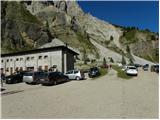
Starting point: Rifugio Dibona (2083 m)
| Lat/Lon: | 46,5326°N 12,0703°E |
| |
Time of walking: 4 h
Difficulty: very difficult marked way, easy unmarked way
Ferata: B/C
Altitude difference: 747 m
Altitude difference po putu: 900 m
Map: Tabacco 03 1:25.000
Recommended equipment (summer): helmet, self belay set
Recommended equipment (winter): helmet, self belay set, ice axe, crampons
Views: 2.069
 | 2 people like this post |
Access to the starting point:
Access from Gorenjska: Via Border crossing Rateče or Predel to Trbiž / Tarvisio and then along the motorway towards Udine to the Tolmezzo exit. From Tolmezzo, follow the road towards Ampezzo and the Passo della Mauria mountain pass. The road then descends and leads to a crossroads where you turn left (possibly right) towards Cortina d'Ampezzo. At all subsequent junctions, follow the signs for Cortina d'Ampezzo.
In Cortina d'Ampezzo, follow the signs for the Passo di Falzarego Alpine pass. Follow this ascending road to where a road forks off to the right in the direction of the rifugio Dibona hut (the fork is at about 1700m). The initially asphalted road leads higher up to a crossroads, where you continue on the lower road on the left (Duca d'Aosta hut on the right) and follow it to the parking lot behind the Dibona hut.
From the coastal side: take the motorway towards Venice/Venezia. At Portogruaro, leave the motorway towards Venice and turn right on the motorway towards Pordenone. At the next motorway junction near Conegliano, turn right towards Belluno. The motorway ends near Belluno and we continue towards Cortina d'Ampezzo at the next junctions. Continue as described above.
Path description:
From the parking lot at the Dibona hut, continue right on 421. The path initially crosses scree and begins to climb gently. The path runs eastwards and soon leads to a slightly wider torrential ravine. At the ravine, the path turns left and starts to climb steeply along the ravine. Due to the shifting sands, a little caution is needed in this part. The path then crosses the ravine and continues to climb quite steeply.
Later, a direct path branches off to the right quite inconspicuously towards hut Rifugio Duca d'Aosta, and just after that the protected Via ferrata Astaldi trail joins us from the left. From the crossroads, the trail then climbs for some time through dwarf pines and soon leads to the Rifugio Pomedes hut.
At the hut, continue northwards following the signs "Sentiero Attrezzato Giuseppe Olivieri", descending a little at first and then crossing the scree above the ski slope. The path then passes under the buttresses on the east side of the Punta Anna peak and climbs a few times along the cableway. The path then crosses some exposed ravines and then climbs above slightly steeper slopes.
Later on, the route becomes a little more challenging, climbing over a vertical ladder and then climbing steeply along a steel track a few more times. The path then turns slightly to the left and then climbs a less steep slope. The view from the path is very good, especially of the peaks above Cortina d'Ampezzo, but to the south we also get views towards Monte Pelmo and Civetta. Then comes the slightly steeper part of the trail, where we again have the help of a ladder and a few rope ladders. The trail then becomes less difficult and leads to the ski slope, from which we can see the view towards Tofani di Mezzo.
At the marked crossroads, continue downhill to the right towards the Rifugio Ra Valles hut, and to the left the path leads to the Punta Anna and Tofana di Mezzo peaks. The trail continues gently downhill for most of the way and leads to the Ra Valles hut, where there is also a gondola station.
From the hut, continue northwards, descending gently, and then bear left to the base of the Tofana di Mezzo and Tofana di Dentro peaks. The path then ascends for a short distance and soon enters the Parco Naturale delle Dolomites d'Ampezzo. The path then continues northwards for some time and leads to a marked crossroads.
To the right, the path leads down the Canalon de Ra Ola valley, while we continue slightly to the left and climb on the scree below the cliffs of the summit of Tofana di Dentro. The path along the scree leads to the military ruins from the First World War. Here we continue slightly to the right and the path leads us through a window to steeper slopes. The path then turns slightly to the left and climbs up the steep slope, mostly in steep switchbacks. The slope here is quite steep and occasionally we are helped by a small cable car. The path then turns to the right and there is a slightly exposed traverse which leads to a saddle on the south side of the summit of Cima Formenton.
At the saddle, where the view to the west opens up, leave the marked route to Tofana di Dentro and head right towards the summit of Cima Formenton. The path from the saddle is not marked but is relatively easy. All the way along the ridge you pass many military ruins from the First World War. Following this path, you will soon reach the summit.

Pictures:
 1
1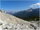 2
2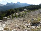 3
3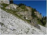 4
4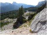 5
5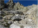 6
6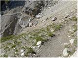 7
7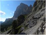 8
8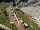 9
9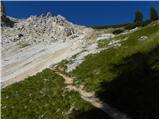 10
10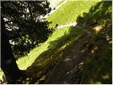 11
11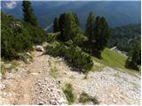 12
12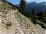 13
13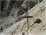 14
14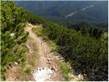 15
15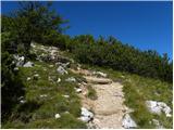 16
16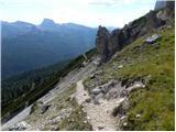 17
17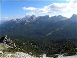 18
18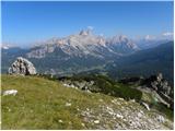 19
19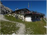 20
20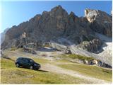 21
21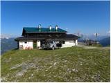 22
22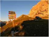 23
23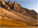 24
24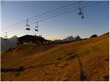 25
25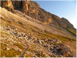 26
26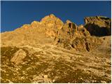 27
27 28
28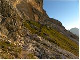 29
29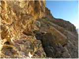 30
30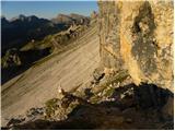 31
31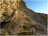 32
32 33
33 34
34 35
35 36
36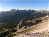 37
37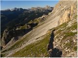 38
38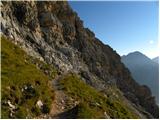 39
39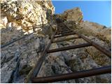 40
40 41
41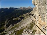 42
42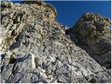 43
43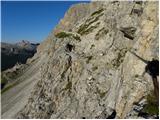 44
44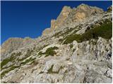 45
45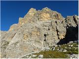 46
46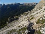 47
47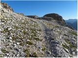 48
48 49
49 50
50 51
51 52
52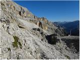 53
53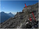 54
54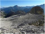 55
55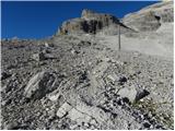 56
56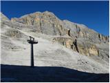 57
57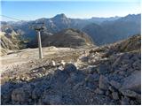 58
58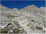 59
59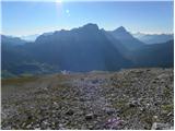 60
60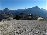 61
61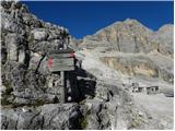 62
62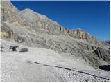 63
63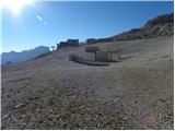 64
64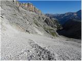 65
65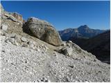 66
66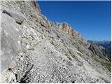 67
67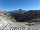 68
68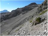 69
69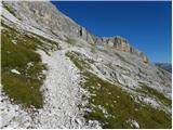 70
70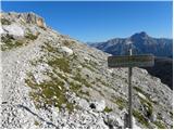 71
71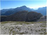 72
72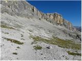 73
73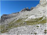 74
74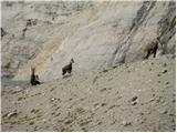 75
75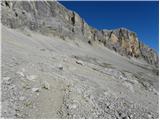 76
76 77
77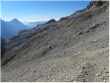 78
78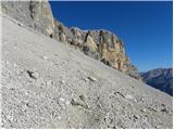 79
79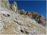 80
80 81
81 82
82 83
83 84
84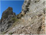 85
85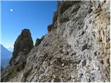 86
86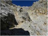 87
87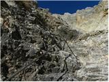 88
88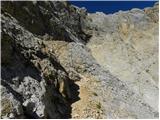 89
89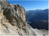 90
90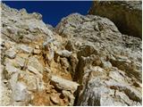 91
91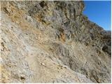 92
92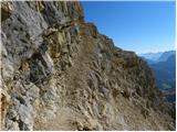 93
93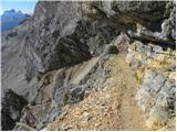 94
94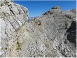 95
95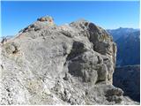 96
96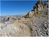 97
97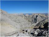 98
98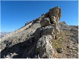 99
99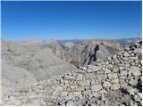 100
100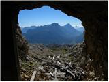 101
101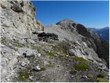 102
102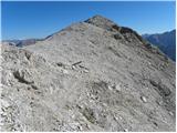 103
103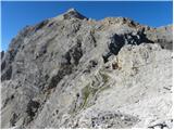 104
104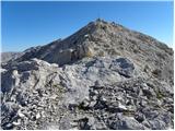 105
105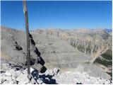 106
106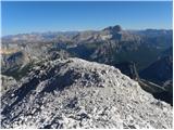 107
107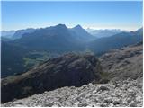 108
108 109
109
Discussion about the trail Rifugio Dibona - Cima Formenton