Rimske Toplice (Šmarjeta) - Koča na Kopitniku (via Lurd)
Starting point: Rimske Toplice (Šmarjeta) (213 m)
| Lat/Lon: | 46,1269°N 15,1944°E |
| |
Name of path: via Lurd
Time of walking: 1 h 40 min
Difficulty: easy marked way
Altitude difference: 652 m
Altitude difference po putu: 665 m
Map: Posavsko hribovje - zahodni del 1:50.000
Recommended equipment (summer):
Recommended equipment (winter): ice axe, crampons
Views: 7.851
 | 1 person likes this post |
Access to the starting point:
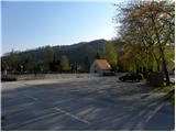
a) From the motorway Ljubljana - Maribor take the exit Celje - centre, then continue driving towards Laško and later Rimske Toplice. At the beginning of Rimske Toplice, turn right towards Hrastnik, and we drive along the main road towards Hrastnik for only about 50 m, then turn left onto the local road, which quickly leads to the nearby cemetery, where we park in a marked parking lot.
b) From Zasavje, first drive to Hrastnik, then continue to Celje. When you arrive in Rimske Toplice, just 50 m before the main crossroads where the road joins the Celje - Zidani Most motorway, turn right onto the local road, which will quickly take you to the nearby cemetery, where you will park in a marked parking area.
c) From the route of Posavje, take the first exit to Zidani Most and then continue towards Celje. When you arrive in Rimske Toplice, pay attention, because at the end of the town, the road leading to Hrastnik will branch off to the left. Take the road mentioned above, and we drive along it for only about 50 m, then turn left onto the local road, which will quickly take us to the nearby cemetery, where we will park in a marked parking area.
Path description:
From the parking lot by the cemetery, follow the road south. After just 10 metres, the priority road turns left and we continue straight on towards Lourdes. We continue along a slightly narrower road, and as we walk along, we can see the Church of St. Mother of God in Ogeci (Lourdes) on our right, which we will pass on the way to higher ground.
At the next crossroads, bear slightly left, then a few steps further on at the chapel, right up the hill. Here you will quickly reach a small triangular crossroads, at which there are a number of mountain direction signs. Continue right in the direction of Kopitnik and Lourdes and continue the ascent along the asphalt road, which climbs crosswise to the right. Higher up, the settlement ends and the road turns into a forest. Here, a second path from Šmarjeta joins from the right, and the road curves slightly further to the right, leading to the Church of St. Mother of God (Lourdes).
Just above the church, leave the asphalt road and turn left towards Kopitnik. From the road, the path climbs steeply at first, then flattens out and crosses a short, relatively steep slope. The slope quickly flattens out and the path leads out of the woods to the edge of a hay field, where it turns left to an abandoned house. On the other side of the house you reach a small crossroads, where you continue straight on in the direction of Kopitnik. Walk along the road for a few minutes and then the signs direct you slightly to the right to the marked cart track, which climbs parallel to the road. Cart track is quickly laid out and returns to the road at an older house. From the house climb up to a small pass, then continue left at two successive forks. Continue along a steeper forest path, which joins cart track at a higher altitude, which is then completely laid out and leads out of the forest to a large grassy clearing. Here the path turns slightly to the left and returns to the forest, through which it climbs steeply again from time to time. Higher up, we climb over a grassy hayfield and the path leads us to a macadam road where we join the other path from Rimske Toplice (starting point: Tuš shop and Rimske terme).
Continue along the gently sloping road, which leads to the homestead at Izera. At the homestead, the road becomes asphalted, and we walk along it for a few metres, then a sign on a tree "cottage" directs us left into the forest. We continue to climb through the forest for a short distance and then join the path from the villages of Marno and Turje. From the crossroads onwards, we step out of the forest, and the gently sloping path, which continues across a larger meadow, leads us in a few minutes to the Kopitnik Cottage.

Pictures:
 1
1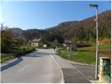 2
2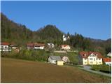 3
3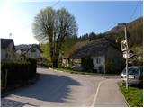 4
4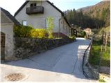 5
5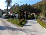 6
6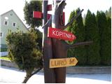 7
7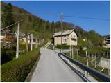 8
8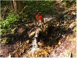 9
9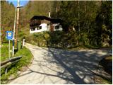 10
10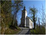 11
11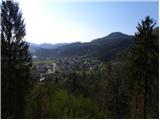 12
12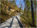 13
13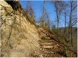 14
14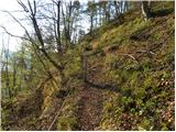 15
15 16
16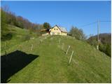 17
17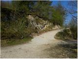 18
18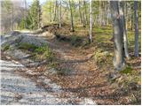 19
19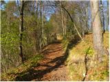 20
20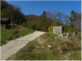 21
21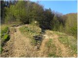 22
22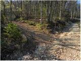 23
23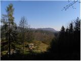 24
24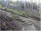 25
25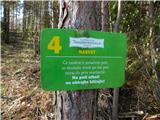 26
26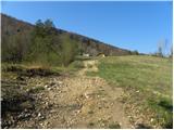 27
27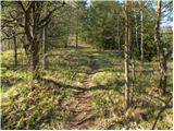 28
28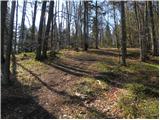 29
29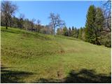 30
30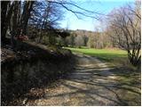 31
31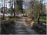 32
32 33
33 34
34 35
35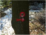 36
36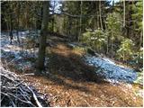 37
37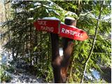 38
38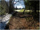 39
39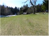 40
40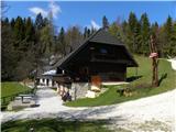 41
41
Discussion about the trail Rimske Toplice (Šmarjeta) - Koča na Kopitniku (via Lurd)