Rudno polje - Mrežce (via Zgornji Razor)
Starting point: Rudno polje (1347 m)
| Lat/Lon: | 46,3458°N 13,9236°E |
| |
Name of path: via Zgornji Razor
Time of walking: 2 h
Difficulty: easy unmarked way
Altitude difference: 618 m
Altitude difference po putu: 640 m
Map: Triglav 1:25.000
Recommended equipment (summer):
Recommended equipment (winter): ice axe, crampons
Views: 14.982
 | 1 person likes this post |
Access to the starting point:
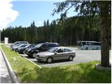
From the motorway Ljubljana - Jesenice take the exit Lesce and follow the road towards Bled. At the traffic lights in Bled, the signs for Pokljuka direct you to the right. Continue through Gorje and past the abandoned ski resort Zatrnik to Rudni Polje on Pokljuka (a large parking lot, a military barracks and a shooting range).
Path description:
From the parking lot, take the forest road (direction Triglav), which will take you up to the Viševnik ski slope in ten minutes. Here, signs lead you to the right (the Triglav trail continues along the road) onto a marked footpath, which continues to climb moderately along the edge of the forest and along the lift of the nearby ski resort. The path continues along the road, which first crosses the ski slope (Mt Krasce), then passes into the forest and splits into two parts.
Continue to the left (straight Blejska koča) and follow the forest road closed to public traffic, which quickly leads to a short scenic part of the trail. Here the road turns sharp left and leads back into the forest on a slight incline. A little higher up, the road turns to the right and then begins a gradual descent.
As the road starts to descend, keep your eyes peeled, as soon there will be a faint unmarked cart track to the left.
Continue along the above-mentioned cart track, which leads us to a clearing or clearing in 3 minutes. Here we climb straight up the clearing, where we see an old hunting track, along which we continue our ascent. The path then leads into the forest, where it completely lays down. For a short time, we continue along an undistinguished valley, where we can observe numerous karst phenomena (potholes, Škraplje, etc. ), and then we move on to the gently sloping slopes, where the path slowly begins to disappear, but at least for the time being there are no major problems with the traceability of the path. The trail continues for a while crossing the slopes to the right, and then leads us to the lower part of the Zgornji Razor valley. Here, the barely visible path turns slightly to the left and continues to climb along the edge of the aforementioned valley. Initially, we climb on the right side, but then the path, which is completely lost a few times, slowly passes to the left side of the valley, where it then climbs under the steep slopes. During the ascent, we have to cross some fallen trees, but the path, which is no longer a path, leads us out of the forest and onto the slopes, which are becoming more and more scenic. Here we continue straight along the widening valley, and after a few minutes' further walking we come out on the marked path leading from Blejska koča towards the Srenjski Preval. When you reach the marked trail, follow it to the right, and we will follow it to the nearest marked crossroads. At the crossroads, bear left up towards Mrežce (straight ahead Blejska koča), and we will reach the top of Mrežce after a slightly steeper path in about 10 minutes of further walking.

Pictures:
 1
1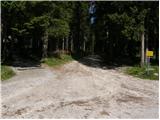 2
2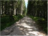 3
3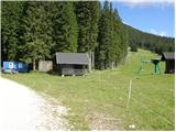 4
4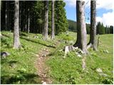 5
5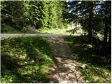 6
6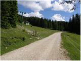 7
7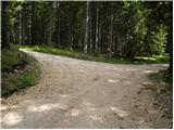 8
8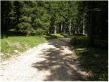 9
9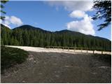 10
10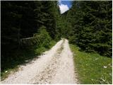 11
11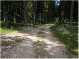 12
12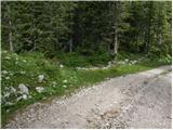 13
13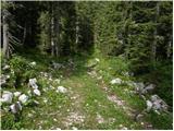 14
14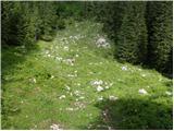 15
15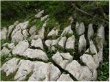 16
16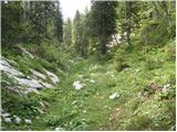 17
17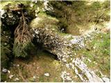 18
18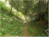 19
19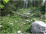 20
20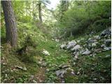 21
21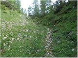 22
22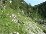 23
23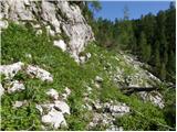 24
24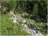 25
25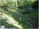 26
26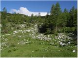 27
27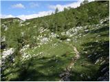 28
28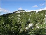 29
29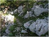 30
30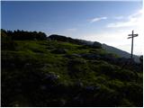 31
31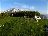 32
32
Discussion about the trail Rudno polje - Mrežce (via Zgornji Razor)
|
| miha ha13. 12. 2014 |
našla se je jakno/puhovka helly hansen, črne barve, na vrhu smučišča ob poti
če jo kdo pogreša pokličite
040 938 086
miha
|
|
|
|
| tango25. 01. 2022 19:44:10 |
Današnji cilj je bila sicer Debela peč, a ker proti Blejski koči očitno ni bila za naju dovolj vidna gaz, sva jo ucvrla preko planine Razor na Mrežce in ker sva nekje na 1860 m opazila priključek od Blejske koče, sva se ob povratku z Mrežc spustila do le- te in nadaljevala na Debelo peč. Nazaj podobna zgodba. Ko sva poskusila nad Blejsko kočo vdeti proti Rudnemu polju sva obupala, brez gazi, zato sva se povzpela nazaj na tistih 1860 m in se na Rudno polje vrnila po pristopni varianti. Derezice in palice so bile kar koristne, vreme odlično, na vrhu pa malo pihanja!
|
|
|