Selca - Miklavška gora (by road)
Starting point: Selca (430 m)
| Lat/Lon: | 46,222°N 14,1934°E |
| |
Name of path: by road
Time of walking: 1 h 45 min
Difficulty: easy unmarked way
Altitude difference: 525 m
Altitude difference po putu: 525 m
Map: Škofjeloško in Cerkljansko hribovje 1:50.000
Recommended equipment (summer):
Recommended equipment (winter):
Views: 5.859
 | 3 people like this post |
Access to the starting point:
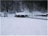
From Škofja Loka, drive to Železniki or vice versa. Only about 500m after (or before, if coming from Železniki) the village Selca, you will see a sign with the inscription Sports Park Rovn, which directs you to the left (from Železniki to the right). Park in the parking lot near the sports park.
Path description:
From the parking lot, walk first to the cottage of the Cynological Society (located on the left - east side of the park). Here you will notice a steep cart track, which turns sharp right upwards (the footpath to Miklavška gora), and we continue along the road that runs along the right bank of the Selščice river and leads us only slightly further to a small crossroads, where we continue right up the asphalted road (in the immediate vicinity of the crossroads you will also notice a sign on which is inscribed the path to Miklavška gora).
The road through the forest immediately starts to climb steeply and crosses initially quite steep slopes. Higher up, the road passes out of the forest onto the partly grassy slopes and then leads us through the village to a less conspicuous crossroads, located slightly above the village of Spodnja Golica. Here, the path from Dolenje vas joins us from the left, and we continue along the asphalted road, which leads us to the village of Zgornja Golica, with beautiful views. In the middle of the village we come to an unmarked crossroads, where we continue along the right-hand road, which leads us just a little further on to a small pass where we leave the road and continue right towards the chapel, which we can see beautifully at the edge of the grassy hayfields.
At the chapel, the road finally turns into cart track, which turns to the left and starts to climb steeply. The road continues along cart track, which goes round the Miklavška gora peak in a semicircle and, just below the peak, leads out of the wods onto a pleasant grassy hay meadow. It is only a 5-minute climb up an increasingly scenic slope to the Church of St Nicholas.

Pictures:
 1
1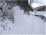 2
2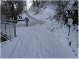 3
3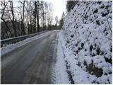 4
4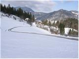 5
5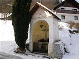 6
6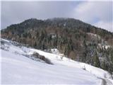 7
7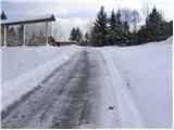 8
8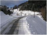 9
9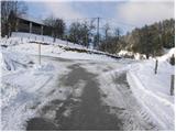 10
10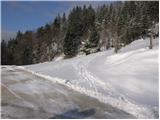 11
11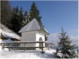 12
12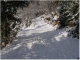 13
13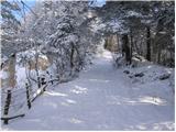 14
14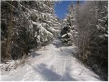 15
15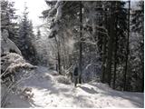 16
16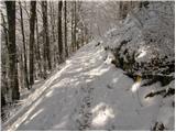 17
17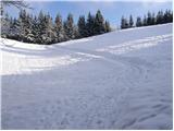 18
18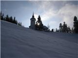 19
19 20
20
Discussion about the trail Selca - Miklavška gora (by road)
|
| grega_p20. 02. 2021 |
Miklavž ga je pihal danes, vendar ni zakril sonca z oblaki, ampak ponudil lepe razglede naokoli, predvsem na zasneženi Ratitovec.
Vzpon po razriti cesti od kapelice je kar strm, 15-20min od kapelice.
|
|
|