Široko - Veliki vrh (above Lom) (direct way)
Starting point: Široko (750 m)
| Lat/Lon: | 46,13207°N 13,75932°E |
| |
Name of path: direct way
Time of walking: 1 h 30 min
Difficulty: easy marked way
Altitude difference: 321 m
Altitude difference po putu: 355 m
Map:
Recommended equipment (summer):
Recommended equipment (winter):
Views: 2.000
 | 1 person likes this post |
Access to the starting point:
The starting point is at the Široko Tourist Farm in Tolmin Lom. Access from Nova Gorica and Idrija is described in more detail, access from Tolmin and across the Banjsko Plateau via Kanalski Lom is also possible.
a) From Nova Gorica, follow the signs for Bovec and Tolmin, drive through Kanal and then look out for the turn-off for Most na Soči (towards Idrija and Ljubljana). Continue driving through the village of Kozaršče, and in the centre of Most na Soči turn right at the crossroads towards Lom (ahead towards Ljubljana, left towards Tolmin). After crossing the bridge over the Idrijca River, continue along the steep local road into a sharp right turn. The road climbs for the next 4 kilometres and leads to a saddle where a steep road branches off to the left towards the Široko Tourist Farm. After about two kilometres of further climbing, you reach the tourist farm, where you find a parking place.
b) From the route of Idrija, follow the signs for Tolmin. In the centre of Most na Soči, at the crossroads, turn sharp left in the direction of Loma (ahead direction Nova Gorica, right direction Tolmin). After crossing the bridge over the Idrijca River, continue along the steep local road in a sharp right turn. The road climbs for the next 4 kilometres and leads to a saddle where a steep road branches off to the left towards the Široko Tourist Farm. After about two kilometres of further climbing, you reach the tourist farm, where you find a parking place.
Path description:
The route is well marked and easy to follow. It is mostly on dirt roads and forest tracks, with a short short narrow track below the summit. There are several marked points of interest and two panoramic viewpoints (Široko and Ledince) along the route, the summit is also visible.
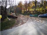
Once parked at the tourist farm, you can continue to the viewpoint above the farm, otherwise find the starting point at the end of the road, where the road descends to the houses and where there are garbage bins. Here you will see signs for Ledince, Grudnica and Veliki vrh, which direct you to a steep macadam forest road. It climbs for a while and then gently descends. Leave the wide macadam road at the top of the next long slope, where signs point to the right towards the Ledince viewpoint and Veliki vrh (signposted shortcut).
From the viewpoint, continue along the forest track logging trail to the next marked crossroads, where you turn slightly left uphill, right downhill towards Močil na Kalu and Kanalski Lom. From here, the route is well signposted with direction signs and blue-yellow markings indicating the circular route "Lom je moj dom". The trail passes the chasm in Špila, slightly higher up the trail, which is open to the public, also with a description on the info board. The path then narrows after a few bends and climbs up to the boundary stone, where the next info board is located.
After the boundary stone, turn right onto the slightly wider path again. In a dried spruce forest, just before a clearing, leave the path and turn right onto a narrower track. This leads to an undistinguished ridge, which rises gently towards Veliki vrh. After a few minutes' walk, a preserved WWI observation post is visible, and then, after a short descent, there is only a short climb to the summit. Just below the summit there is a WWI-themed info board, and at the top there is a miniature Aljaž tower with a signing-in book (opened by lifting the lid).
You can return along the same route or take a detour along the marked "Lom je moj dom" route in the direction of Grudnica (the route takes 30 minutes longer, connecting back at the Ledince lookout point). Alternatively, you can go back to the ridge behind the abyss, turn far left towards Močil na Kalu and follow the "Lom je moj dom" route in the other direction to Kanalski Lom and then climb back up to Široko (the route takes a good 1 hour longer and includes an additional 200 metre climb).

Pictures:
 1
1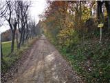 2
2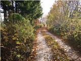 3
3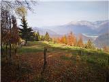 4
4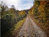 5
5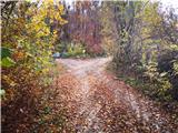 6
6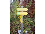 7
7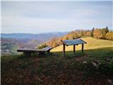 8
8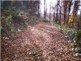 9
9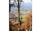 10
10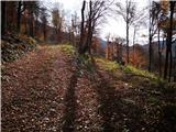 11
11 12
12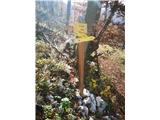 13
13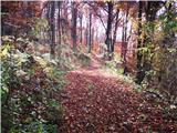 14
14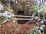 15
15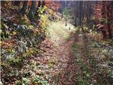 16
16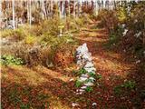 17
17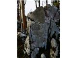 18
18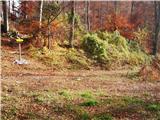 19
19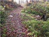 20
20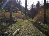 21
21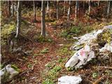 22
22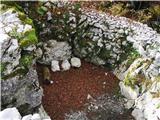 23
23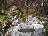 24
24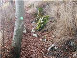 25
25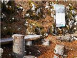 26
26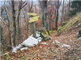 27
27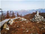 28
28 29
29
Discussion about the trail Široko - Veliki vrh (above Lom) (direct way)