Smrečje - Pečovnik (by road)
Starting point: Smrečje (854 m)
| Lat/Lon: | 46,3993°N 14,469°E |
| |
Name of path: by road
Time of walking: 2 h 35 min
Difficulty: easy unmarked way
Altitude difference: 786 m
Altitude difference po putu: 786 m
Map: Karavanke - osrednji del 1:50.000
Recommended equipment (summer):
Recommended equipment (winter): ice axe, crampons
Views: 5.893
 | 1 person likes this post |
Access to the starting point:
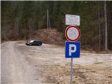
From the motorway Ljubljana - Jesenice take the exit Kranj - East and follow the road towards Jezersko. From the Kanonir Inn, continue for another kilometre to the signposts. Here, turn left towards the signs for Krtina Hospital. Follow the road until you reach a large parking lot with a no further driving sign.
Path description:
From the parking lot, continue along the road along which you parked and after only a few dozen metres you will come across a barrier. Soon after, the road makes a sharp right turn and leads to a crossroads. Take the road to the left towards the Krtina Hospital. The road, which climbs moderately, takes you over a bridge and out of the wods beyond. Here, to, the right-hand path to the hospital branches off, and we continue along the road, which leads us in a few serpentines to the top of a grassy slope. The road, which then goes back into the forest, continues to climb and after an hour and a half's walk leads us to a larger clearing on which stands the Stanič hunting lodge.
From the hut we continue on the road, which soon leads us to a crossroads. Continue on the right road, which is getting worse. After a 30-minute walk from the hunting lodge, it leads us to the ruins (the JNA caravan) at the end of the road.
From here we continue between the two ruins. The path goes into the forest and climbs gently along a beautiful path. After a good ten minutes, this path leads to an unmarked crossroads, where you turn right onto the path above. The path then soon leaves the wods onto steep grassy slopes. The path then crosses these slopes in the lower part and leads us to an unmarked valley. There are two paths ahead. Bear right along the bottom of the valley to a small saddle. At the saddle, turn left and continue along the border ridge. When the path passes out of the forest on the top slope of Mali Pečovnik, a beautiful view opens up. From here it is a short climb to the top of Pečovnika.
Parking - hunting lodge 1:30, hunting lodge - Pečovnik 1:05.

Pictures:
 1
1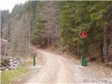 2
2 3
3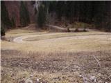 4
4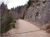 5
5 6
6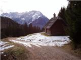 7
7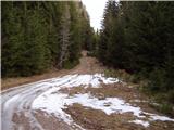 8
8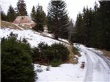 9
9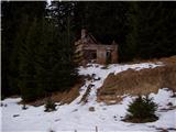 10
10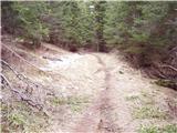 11
11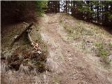 12
12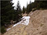 13
13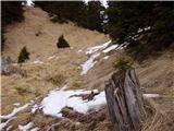 14
14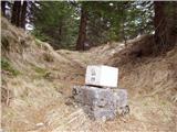 15
15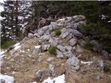 16
16 17
17
Discussion about the trail Smrečje - Pečovnik (by road)
|
| klavdy625. 07. 2009 |
Postanek ob poti na Veliki Pečovnik, ki ni več daleč
|
|
|