Sporthotel Maltatal - Arlhöhe
Starting point: Sporthotel Maltatal (1933 m)
| Lat/Lon: | 47,0789°N 13,3439°E |
| |
Time of walking: 1 h 45 min
Difficulty: easy marked way
Altitude difference: 393 m
Altitude difference po putu: 393 m
Map:
Recommended equipment (summer):
Recommended equipment (winter): ice axe, crampons
Views: 8.261
 | 1 person likes this post |
Access to the starting point:
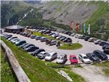
From the motorway Villach-Salzburg take the Gmünd exit and follow the road towards the Malta Valley (Maltatal). After a few kilometres, the well-marked road leads to the village of Malta, and just a little further on to the toll both. The steep and sometimes narrow road, with tunnels and traffic lights, leads to a large parking lot next to an artificial lake (the dam at the end of the lake is 165m high). During the drive, you can observe numerous waterfalls, which, due to the lack of parking spaces, can only be seen from your car.
Path description:
From the large asphalted parking lot, continue along the dirt road towards Osnabrücker Hütte. After 5 minutes of easy walking along the lakeside, you reach the next parking lot at the Kölnbreinstüberl hut. Continue along the road towards the Osnabrücker Hütte. The winding road, which runs alongside the lake the whole way, offers a beautiful view of the surrounding peaks and the waterfalls of the surrounding streams. After a good half hour's walk, you reach a fork in the path, where you turn sharp right in the direction of Arlscharte. From here on the path starts to climb and after a further 5 minutes of climbing leads us to the next crossroads.
Right mountain hut 5 minutes, we continue straight on the increasingly steep and scenic route, which leads us higher to a less well-marked crossroads. Continue slightly left in the direction Arlscharte along the path, which is getting closer and closer to the indistinct peak on our left. When the path is fully approaching the cliffs on our left, it turns slightly right and, after a further ascent, leads us to the Arlscharte pass (2252m). On the pass we see a cross and mountain signs.
Continue left towards the summit of Arlhöhe (straight ahead lake Pfringersee 5 minutes) along a path which climbs steeply for a short time and then leads us to one of the headlands of our destination. There is a good 10 minute walk along the panoramic ridge of the mountain with a few gentle descents. The main peak is only recognisable when you step on it and see the viewing platform.

Pictures:
 1
1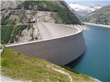 2
2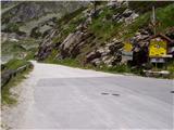 3
3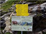 4
4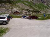 5
5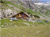 6
6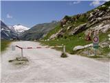 7
7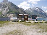 8
8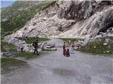 9
9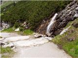 10
10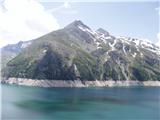 11
11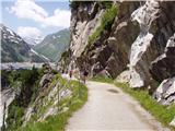 12
12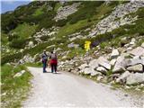 13
13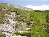 14
14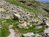 15
15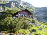 16
16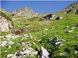 17
17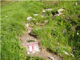 18
18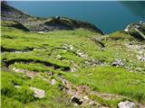 19
19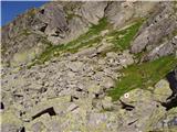 20
20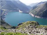 21
21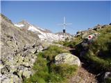 22
22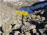 23
23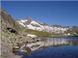 24
24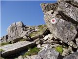 25
25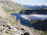 26
26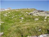 27
27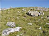 28
28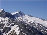 29
29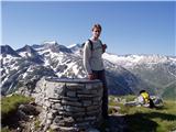 30
30
Discussion about the trail Sporthotel Maltatal - Arlhöhe